Though you won’t become a millionaire panning for gold in Indiana, today’s recreational gold hunters have a lot of fun sloshing around Hoosier creeks in search of the shiny metal that led many a conquistador to his doom. Around 1900, however, Indiana farmers and geologists explored the possibility that the hills of Brown, Monroe, and Morgan counties might become something of a Klondike.
Mining for gold in the Eastern United States might sound far-fetched, but it goes back over two centuries. While Spanish explorers who crisscrossed parts of the South and Southwest were fooled by El Dorado myths, the soils of the Southeastern U.S. do hold significant quantities of the mineral. In fact, until the discovery of California’s huge deposits in the 1840s, most domestic gold came from North Carolina, home of America’s “first gold rush.”
The South’s gold industry began in 1799, when a 17-pound nugget turned up on the farm of John Reed, a former Hessian soldier. An undocumented immigrant, Johannes Ried had deserted from the British Army and settled near Charlotte after the war, anglicizing his name. Reed had apparently never seen gold and didn’t know what the shiny yellow rock his son had found was. For three years, he used it as a door post. Finally asking a jeweler to appraise it, Reed got swindled: he sold the big nugget, actually worth thousands of dollars, for just $3.50.
Image from Samuel Griswold Goodrich’s The First Book of History for Children and Youth (Boston Carter, Hendee, and Co., 1833, p. 75), accessed UNC Libraries.
Fortunately, Reed and other North Carolina farmers soon caught on. By the 1830s, placer mines on farms around Charlotte gave way to heavy-duty mining operations. At their peak, these mines employed about 25,000 people. With deep-vein mines wreaking havoc on the land and destroying good agricultural sites, Southern gold mining may have played a role in the exodus of Southerners to fertile land in the Midwest. Yet the mines were a big boon for the U.S. government, which authorized a new branch of the U.S. Mint in Charlotte in 1837. Although it was still the poorest state in the South, North Carolina produced the first gold coins ever minted in the U.S. These replaced English and Spanish coins legally used by Americans as currency.
Begun by Germans, the Southern gold industry also attracted thousands of immigrants, mostly from places with a long history of mining, like Cornwall, Wales, and Germany. Many joined the rush to California in 1849, around the time the Carolina gold rush peaked. Others came to the Midwest, settling in places like Wisconsin, originally a federal lead mining district.
Gold mining never really took off in Brown County, Indiana. But when Southerners flocked into the uplands in the 1830s, they began finding gold there, too.
The irony is that one of the historically poorest Hoosier counties got an unexpected windfall from the glaciers that stopped on its doorstep and spared most of it from being flattened. That gift was Canadian gold, originally delivered to Earth — so the theory runs — by asteroid collisions four billion years ago.
While artist colonies found a different sort of gold in Brown County’s rustic hills, farmers — most of them with Southern Appalachian roots — found the allure of gold hidden in creek beds worth pursuing. By the 1920s, traditional upland farming practices, heavy logging, and hogs wandering loose through the woods had seriously degraded Brown County’s soil. The situation was so bad that by the time of the Great Depression, much of the county was nearly abandoned. Conservationists were able to snatch up plenty of cheap land for the new park, created in 1929, plus other degraded land later added to the Hoosier National Forest and Yellowwood State Forest. Though considered the crown jewel of the state park system today, Brown County was no wilderness a century ago. And the presence of gold there must have appealed to cash-strapped farmers eking out a basic livelihood.
Locals had been panning gold in streams like Bean Blossom Creek, Lick Creek, and Bear Creek since at least the 1840s, often turning up enough of the mineral to supplement their small income from crops and livestock. In 1897, one prospector told of making as much as $27 a day — over $700 in today’s money — but nobody here was getting filthy rich. Yet in 1903, Indiana State Geologist Willis S. Blatchley came down from Indianapolis to weigh in on an old debate about whether Brown County could sustain a serious gold mining operation.
Blatchley wrote several reports, intended for a popular audience. He described how the glaciers that once covered Indiana in ice five-hundred feet thick lugged gold-bearing rocks down from Hudson Bay, depositing them in “terminal moraines,” piles of rubble left where the ice sheets stopped. Water erosion then washed the gold out of the moraines into streams, dispersing it over several counties south of Indianapolis, where it turned up as tiny flakes in creek beds. Primitive panning and placer mines would help sift the gold out from mud and gravel, but more intensive mining to get all the gold wasn’t traditionally considered worth the effort.
Blatchley was one of Indiana’s great naturalists and took a strong interest in mining. Born in Connecticut, he grew up on farms in Putnam County, whose unusual geology and rich wildlife got him interested in nature, especially rocks, bugs, and butterflies. At Indiana University in the 1880’s, Blatchley studied with the great ichthyologist David Starr Jordan and geologist John Casper Branner. Pioneer Hoosier scientists, Jordan and Branner, later became the first and second presidents of Stanford University in California.
Ironically, Branner, who served as Arkansas State Geologist while still a faculty member at IU, was famously burned in effigy in 1888 after he exposed bogus gold and silver mines in the Ozarks, dashing the hopes of optimistic capitalists and investors there. One of Branner’s assistants on the Arkansas surveys turned out to be future U.S. president Herbert Hoover, who majored in geology at Stanford after Branner left his job in Bloomington to head the new department. (Hoover went on to get his first job after college as a gold-mining engineer in Western Australia and later worked for the Chinese Bureau of Mines and in Russia. Before he went into politics, Hoover was an internationally-recognized mining expert and even published a standard textbook on the subject. In 1912, he and his wife also made the definitive translation from Latin of a 16th-century German mining classic, De re metallica.)
On the heels of a new hunt for Hoosier gold, Branner’s former student W.S. Blatchley’s trip to southern Indiana in early 1902 was covered by the Indianapolis News. The News was excited to announce “great gold discoveries,” and the Chicago Tribune reprinted the story almost verbatim the following winter. The exciting gold finds of 1902, however, were on Highland Creek, between Martinsville and Brooklyn in Morgan County.
Leading the hunt for Highland Creek’s gold was a former California miner, F.F. Taylor, and R.L. Royse, an “Indianapolis gold and diamond prospector.” Taylor ran a hydraulic operation on the creek, called “The Black Eye Flumes,” a name inspired by all the ridicule heaped on Indiana gold mining. Though most experts remained skeptical, the flamboyant Royse announced his confidence that Indiana was soon destined to become the “richest placer gold state” in the Union.
Taylor and Royse tried to disprove what a previous State Geologist, John Collett, had said about Indiana gold. Collett, who died in 1899, quipped that he thought there was enough gold in Brown County to pay off the national debt, but that it would “take the dollar of gold mined and an extra dollar to mine every dollar of it.” The brash prospector R.L. Royse, however, insisted that not only was he going to make a fortune in Morgan County: soon enough, he said, he would come to downtown Indianapolis and “pan some gold out of Washington Street.” (He had already claimed to have found gold in a North Indianapolis street sewer.)
William E. Stafford, known as “Wild Bill,” was one of the colorful prospectors scouring the creeks of Morgan and Brown counties. The reporter for the News gave Stafford a long write-up in 1902. This “Hercules of the gold diggings” would reappear in the Chicago Tribune a year later.
Another man who panned gold on Hoosier streams was “Uncle” John Merriman. Merriman, who lived until 1906, was the son of Hoosier pioneer William Merriman. (William was born in Virginia in 1786, just three years after the end of the Revolutionary War.) Originally from Morgan County, John had lived around Ellettsville and Bloomington, then moved over to Fruitdale in Brown County in the 1870s, where he ran an orchard. Panning gold helped supplement his small income. In spite of a bad kidney ailment, Merriman took enough interest in gold to venture out to the California gold fields in the 1880s.
Like many men who went west, the Hoosier prospector never struck it rich. But in 1903, the 69-year-old helped show State Geologist Blatchley around Brown County’s own “gold fields.”
“Uncle” John Merriman panning gold around 1900. Merriman had been in the papers before. The Fort Wayne Sentinel reported in 1899 that he lived on “1,000 acres of barren land” and subsisted on brown sugar alone while out searching “for the yellow metal,” courtesy of Frank Merriman, accessed Find-A-Grave.W.J. Richards panning gold. Indianapolis News, May 31, 1902. Hoosier State Chronicles.
Blatchley wrote of men like John Merriman that some “do little else than pan gold along the streams.” The geologist did some panning himself on Bean Blossom Creek, where children went out looking for gold after floods and snow melts. Merriman came with him. Blatchley wrote that Merriman averaged about $1.25 a day — approximately $30 in today’s money. Both men thought that modern machinery could increase the yield.
Some panners, like W.W. Young — alias “Old Man” Young — sent their gold off to the U.S. Mint in Philadelphia. “Old Man” Young found fourteen ounces of gold in nine months of panning and got a receipt from the mint for $250.07, equivalent to about $7,000 today. Young was considered “quaint . . . the most peculiar character in any of the Indiana diggings. He will not permit anyone to be near him, and will not pan as long as there is anyone in sight.”
Blatchley’s report states that local Indiana “drift gold” averaged 22 carats, compared to 16-18 for California gold and 14-16 for Alaskan Klondike gold. In other words, Hoosier gold was actually superior to the stuff out West.
Yet he also recognized that shortage of local water sources during the summertime, when many streams ran almost dry, would seriously hamper mining of the mineral. “By constructing permanent dams in several of the valleys enough water could probably be conserved to tide over the dry season.” Taylor proposed sluicing water out of the White River, but the plan never really took on.
For a while, rumor even had it that birds had gotten interested in mining. Gold in duck craws? The tales you’re about to hear sound like an old St. Nicholas story. But for now, we’ll assume these aren’t just tall tales.
Ultimately, however, predictions about great yields of gold in southern Indiana weren’t justified. The slough of excited stories in the Indianapolis press about gold mining going on just “twenty-three miles from the golden dome of the Indiana State House” died out after 1903. But that didn’t stop two men from Ohio from coming to Brown County, panning the stuff, and buying a farm with their profits in 1908.
Today, gold prospecting is said to be the fastest-growing form of outdoor recreation of Indiana and many other states. (In 2010, when the price of gold hit almost $1,500 an ounce, the Wall Street Journalhosted a video about the revival of recreational gold-seeking in Vermont, where it’s a great way to get outdoors, but “more about the experience than the riches.”) Brown, Morgan, and Monroe counties are still the most popular places for gold prospecting in the Hoosier State, but Blatchley reported many other counties where the mineral turned up, including a few in northern Indiana like Cass and Warren.
But watch out, Indiana! Don’t hunt on private property unless you have permission first . . . even if you think you’re as clever as this guy:
For all of human history, natural disasters have plagued the citizens of villages, towns, and nations. One such incident, the volcanic eruptions on Martinique and St. Vincent in 1902, displayed the immense destruction left in the wake of such a tragedy. As one of the few journalists allowed back to the islands after the eruptions, James P. Hornaday, Washington correspondent for the Indianapolis News, witnessed the devastation first-hand and wrote detailed articles about his experiences. In doing so, Hornaday chronicled one of the world’s most violent natural disasters and provided future scholars with a thorough rough draft of what came after.
The islands of Martinique and St. Vincent served as colonial outposts in the Caribbean; the former belonged to the French and the latter belonged to the English. In particular, the Indianapolis News described Martinique as “one of the West Indies, belonging to the chain of the Lesser Antilles. . . . thirty-three miles south of Dominica and twenty-two north of St. Lucia.” St. Vincent, the largest of a chain of islands collectively known as the Grenadines, sits within miles of Martinique. Both islands contained valuable natural resources, agriculture, and industry, especially sugar. Being the creations of tectonic shifts and volcanic activity, Martinique and St. Vincent always faced the potential threat of violent eruptions. However, nearly no one in 1902 expected what carnage awaited them.
On May 8, 1902, after a few days of growing volcanic pressure, Mount Pelée spewed forth ash, rocks, and steam that completely covered the city of St. Pierre, Martinique’s population center. The News reported that St. Pierre was “totally destroyed by earthquakes and volcanic disturbances” and that “almost all the inhabitants—more than 25,000—are said to have been killed.” This left the thousands who survived “without food or shelter.” Across the way, St. Vincent’s Soufrière volcano also gained momentum, with “a big cloud of steam” lingering over the island and startling its inhabitants. The trouble for both of these islands was only beginning.
The eruption of Mont Pelée, Complete Story of the Martinique and St. Vincent Horrors, Internet Archive.
Within days, the news of Martinique’s destruction reached the ears of two prominent Indiana legislators, U.S. Senators Albert J. Beveridge and Charles W. Fairbanks. They started crafting legislation that would send relief supplies to the island, originally calling for an appropriation of $100,000. Upping the ante, President Theodore Roosevelt asked for $500,000 from Congress. They eventually settled on a compromise of $200,000 (over $5.6 million in 2016 dollars) after further negotiations in the appropriations committee led by Indiana Congressman James A. Hemenway. The president also offered his condolences to the French president, Emile Loubet. “I pray your excellency,” President Roosevelt wrote, “to accept the profound sympathy of the American people in the appalling calamity which has come upon the people of Martinique.” Additionally, his message to Congress stressed the importance of a swift relief effort. “I have directed the departments of the Treasury, of the War and of the Navy to take such measures for the relief of those stricken people as lies within the executive discretion,” he declared.
By May 12, the death toll on Martinique grew to 30,000 and the island was engulfed in “almost total darkness.” Among the living, some 50,000 people were without homes, ample food, and supplies. Nearby islands began taking in refugees, but that also came with difficulties. As one Guadeloupe civil servant said, “I do not believe Gaudeloupe [sic] can adequately relieve the stupendous distress.” The next day, the News reported that 1,600 people perished in the eruptions on St. Vincent. James Taylor, an officer on the Quebec shipping liner Roraima, shared his encounter with Mount Pelée:
Suddenly I heard a tremendous explosion. Ashes began to fall thicker upon the deck, and I could see a black cloud sweeping down upon us. I dived below, and, dragging with me Samuel Thomas, a gangway man and fellow-countryman, sprang into a room, shutting the door to keep out the heat that was already unbearable.
The eruption of Mount Pelée, May 8, 1902, The Volcano’s Deadly Work, Internet Archive.
He also shared, in painful detail, the aftermath of the destruction:
All about were lying the dead and the dying. Little children were moaning for water. I did what I could for them. I obtained water, but when it was held to their swollen lips they were unable to swallow, because of the ashes which clogged their throats.
The Reverend William A. Maher, an Indianapolis native who frequently visited Martinique, also expressed his thoughts on the tragedy that fell upon the island. “The horror of this destruction in Martinique is appalling to me,” Maher noted, “It may be that it comes to me more strongly for the reason that some of the persons I have known may have been among the victims.”
Bodies of victims among the wreckage on Martinique, The Volcano’s Deadly Work, Internet Archive.
As soon as the ink was dry on the appropriations, relief ships sailed for Martinique. One such ship was the Dixie, which left from New York City on May 14, 1902. It carried thousands of pounds of food, clothing, shelter materials, and medicines. The stores were desperately needed; nearly 100,000 inhabitants of Martinique were without a steady source of food and supplies. The crew included three army surgeons, thirteen army officers, and 14 civilians, among which were geologists, explorers, volcanologists, and a small handful of press. Among the select journalists included in the crew was Indianapolis’s James P. Hornaday, Washington correspondent for the News. His inclusion came after Senator Beveridge, Senator Fairbanks, and Congressman James Eli Watson sent an appeal to the ship’s captain, Robert Mallory Berry, who allowed Hornaday to join the crew.
Over the next month, Hornaday wrote about his experiences aboard the Dixie and on the islands of Martinique and St. Vincent. The News ran these stories as front page features for over a week. The first article appeared on June 5, 1902, under the title, “With the Relief Boat Dixie: First Story of Uncle Sam’s Work.” Hornaday described his time on the relief vessel, learning from the eminent scientists and military personnel as well as his first glimpses of the Mount Pelée and the island. “In a little while the clouds that surrounded and obscured the volcano on the island shifted, and the crater came into full view,” wrote the newsman, “The island, containing only five square miles, looked like a great heap of volcanic debris piled up—as it really is.”
As he went ashore, Hornaday saw some of the refugees for the first time:
Thousands of refugees, with faces almost expressionless, crowded the sea line in the town of Fort-de-France. Many of them implored the strangers to take them away. To stay, they said, meant certain death.
Two small steamboats, plying the Caribbean waters, were being loaded with such refugees as could raise money enough to get away. Families carried on their heads all their earthly possessions and dumped them into these boats
As for those who stayed on Martinique, he noted their reluctance to use electricity, which resulted in the city of Fort-de-France switching from “electric lights to candles.” “The sensibilities of the natives,” wrote Hornaday, “seemed to be so paralyzed that grief could not manifest itself.”
The front page of Les Colonies, Martinique’s newspaper before the disaster, Century Magazine, Google Books.
In his next article, Hornaday pieced together a rough outline of the events that resulted in the destruction of St. Pierre. Les Colonies, Martinique’s premier newspaper, served as a guide for some of his conclusions. One of the first indications of volcanic activity was reported on April 25, a full 12 days before the eruption. A “picnic guide” named Julian Romain saw what he described as “a boiling mass of what be called ‘bituminous stuff’” around the volcano. “In the cauldron of the crater I saw a boiling, black mixture of bituminous stuff, it rose up, popped, and allowed jets of steam to escape,” Romain said of his encounter with Mount Pelée. Showers of ashes emerged from the sky by May 1, which “did not reach St. Pierre, but guides returning to the summit reported that the ground was well covered high up on the side of the mountain.” May 5 brought on more steam, ash, and eventually boiling water that “formed a good river, and rushed down the mountain side.” The watery onslaught “engulfed several large sugar-cane mills and killed many persons—how many will never be known, for no record had been made up before the great disaster came.”
Two days later, a government commission published a report arguing that “Mont Pelée [sic] offers no more danger to the people of St. Pierre than Vesuvius offer to those of Naples.” The editor and publisher of Les Colonies sided with the government in an attempt to calm the island. “Since the day Jules Romain looked over into the boiling cauldron no one knows what has happened on Pelée,” the editor opined, “We only know we have been getting ashes. What has to-morrow in store for us?” As Hornaday solemnly noted, “the next morning the man who penned those lines was smothered by the escaping gas and buried beneath the ruins of his little printing office.”
Hornaday surveyed the ruins of St. Pierre on May 22, with his reporting appearing in the News on June 7. “In a land area ten miles wide and twelve miles long every living thing was destroyed. . . . the dead were buried by the same force that destroyed the life,” he reported. As he walked around, he would eventually see Pelée and the outline of the former city. Here are some of his details:
Pelée, rising to the northeast of the city, was cloaked in gray ashes from base to summit. Here and there up the side of the mountain could be seen jets of steam issuing forth. The whole scene was one of desolation. Not a sprig of green came within the range of sight. As we drew a little nearer the beach off St. Pierre the details of the ruins stood out before us.
As for those “details,” Hornaday wrote of city buildings ravaged like “children’s blocks tumbled over” and ashes that “buried the dead to a considerable depth.” The island’s governor was reported lost in the wreckage and no attempt was made to recover his body “which, from the general appearance of the place, was buried in ten feet of debris from the building and the ashes from the volcano.” Hornaday stared death in the eyes and he and his crew left the island “happy…to put the picture behind us.”
“Destruction of St. Pierre’s Inhabitants”, Complete Story of the Martinique and St. Vincent Horrors, Internet Archive.
From there, the coverage shifted from the destruction to the relief efforts. Hornaday’s article from June 9 outlined the efforts of relief workers and the response from the natives. “A whole dozen steamers had emptied their cargoes on the island within ten days after the disaster” when the Dixie and its crew arrived to deliver its supplies. During Pelée’s active eruption on May 8, a vast majority of citizens scrambled towards the north end of the island towards the city of St. Pierre. As Hornaday discovered, “practically every life in the north half of the island had been sacrificed.” Despite the seemingly good intentions of those offering help, the thousands who survived apparently saw the relief efforts in a different light. “The population, almost entirely colored, showed no appreciation of the donation of food and clothing by the United States,” Hornaday opined. By contrast, “the government and city officials, of course, did appreciate the act.”
“Members of the First Relief Party Who Visited St. Pierre After its Destruction,” Complete Story of the Martinique and St. Vincent Horrors, Internet Archive.
Now, it is safe to assume that a statement such as this could be seen as prejudiced, as he singled out the natives of color from the government. In that light, Hornaday’s view on the situation is rather myopic. The people who survived had just gone through the worst disaster of their lives, one the government promised just days before would not happen. Perhaps the natives did not feel like trusting the outsiders and the governments who support them as a result. The island also suffered through an additional eruption on May 20 that reached parts of Fort-de-France, although no one died. Additionally, Hornaday reported that many of the natives felt “numb” from the entire experience, so it’s reasonable to suggest that while Martinique’s government appreciated the good intentions of relief effort, the natives had good reasons to be weary of the whole thing.
The attitude of St. Vincent could not have been more different. As Hornaday pointed out in his article from June 10, “the cruiser [Dixie] was received by the governor and the officers of the British cruisers as a friend in need, and arrangements were made at once to receive the stores.” While many died on Martinique, St. Vincent had far more injured survivors and thousands “made penniless and homeless.” While St. Vincent’s government appeared just as grateful as Martinique’s, the natives also appreciated the American relief efforts. “Everywhere one heard expressions of good will toward America for having so promptly come to the relief of the stricken people,” Hornaday highlighted. Again, this is one reporter’s view of the situation, but it is worth noting that the British island (St. Vincent) received the Americans more favorably than the French Island (Martinique). As political scientist Sidney Milkis noted, the Roosevelt administration’s relations with France did not strengthen until the second term.
After four intense days of investigation, James P. Hornaday left the island of St. Vincent on May 25, 1902 aboard the Madiana, while the Dixie stayed behind and unloaded the relief supplies. The Madiana also carried “as many wealthy refugees as she can carry,” which were described by Hornaday as “well-to-do whites.” He further noted that “the opinion was expressed by the refugees brought away that within a year many of the islands would be entirely left to the negroes.” As with his many pontifications, Hornaday comes off as wildly obtuse, if not prejudiced. Regardless, this passage is telling for one clear reason. Martinique and St. Vincent were colonial outposts, which gave their respective French and British transplants easy access off the island while the natives were left to fend for themselves. It is a case study, among many others, that documents the problematic practices of colonialism and imperialism at the turn of the century. While many non-natives perished, like the US consulate and his family, they had the easiest access to food, shelter, medical treatment, and transportation. The natives were not so lucky.
In his final article, dated June 14, 1902, Hornaday makes some tentative conclusions about the entire ordeal. He praised the “promptness with which the United States came to the relief of the needy in Martinique and St. Vincent” and that the “act touched the people of the colonies and they will not soon forget it.” That is, except those who were uneasy about American aid; this is Hornaday slightly reversing his previous conclusions, unless he is talking solely about the islands’ governments. He also praised the work of the scientific community whose initial investigations concluded “that there was ample warning from both Pelée and Soufrière” and “it is nearly always possible to foretell an eruption in time to save life.” Finally, he honored those who died in the destruction, especially American service members:
If the names of the officers and the sailors of the ships who went down could be ascertained and their families sought out wherever they may be there would be undoubtedly be an opportunity to spend wisely the relief fund which the United States holds a reserve. And since the names of most of the ships are known, it ought not to be a task beyond performance.
Once all of his articles were released, the Indianapolis Newspublished Hornaday’s work in a pamphlet, known as the Martinique Letters, on June 19, 1902. It sold for 10 cents a copy and hailed as “a connected and comprehensive account for the great volcanic disasters.”
James Hornaday’s Martinique Letters, Indiana State Library Pamphlet Collection.
Sadly, Martinique suffered another volcanic upset on August 30, 1902, killing several hundred people near the towns of Carbet and Morne Rouge. One of the fatalities was Father Père Marie, who aided the scientific teams and journalists during the initial destruction on Martinique. Hornaday wrote an obituary for Mare that appeared in the News. “If the cable report be true,” he wrote, “his parishioners have perished.” Hornaday praised the priest for his kind assistance on the island during his investigations the previous May.
Martinique and St. Vincent eventually recovered from the tragedies of 1902 and the latter became an independent nation in 1979. Martinique is still a part of France but is no longer a colony; it became an “overseas department” in 1946 that grants its citizens full rights under the French government. Fort-de-France, the major city that survived the eruptions, became the capital. Their towns, villages, and economies all bounced back and both have become viable producers of sugar as well as prime tourist destinations. They have faced volcanic activity since their 1902 disasters but have always found a way to endure.
As for James Hornaday, he worked as the White House Correspondent for the Indianapolis News for another 33 years and became the Dean of White House Correspondents. He died on December 24, 1935 at his desk in Washington, writing up new stories about President Franklin Roosevelt’s New Deal programs. The president released an official statement the next day:
I share with his legion of friends the grief which the passing of James P. Hornaday has brought to all of us at this Christmas time. Dean of White House Correspondents, he had through long years faithfully chronicled national events, not less admired for his talents as a newspaperman than he was beloved because of the beauty and strength of his personal character. There was, there is, among Washington newspapermen no gentler, truer soul than Jim Hornaday. We shall long remember him, and miss him, and mourn him, and be thankful that we were permitted to know him and love him.
The obituary in the Indianapolis Star also lauded the legendary newsman. Reporter Gavin Payne wrote, “I have never known a man who, in my opinion, outranked him in the sterling qualities of manhood. . . . few men have attained a higher reputation in Washington correspondence.” The article also noted his love for Indiana, saying, “He a was a true Hoosier, and though living in Washington for much more than a quarter of a century, never lost his attachment for the folks back home.”
James P. Hornaday’s articles about Martinique and St. Vincent stand among some of the Indianapolis News’ finest reporting from the period. It was also rather unique; a veteran Hoosier reporter traveled across a continent to vividly chronicle the destruction of some of the Caribbean’s most treasured islands. He helped readers then and now understand the immense geographic, political, economic, and personal struggles these islands faced in the wake of such a disaster. While some of his conclusions about the natives are out of touch with our modern sensibilities, which should be acknowledged, he nonetheless created a portrait of the event that resonates even today. He shows us what journalists will often go through to get their story, even when the world is on fire.
The Tower of Pelée, a short lived volcanic cliff, in the fall of 1902. The Tower of Pelée, Internet Archive.
Historians tend to write about the leaders of movements – the “big picture” people espousing new ideologies or courses of action. This focus makes sense. These larger-than-life historical figures had an outsized impact on our past and they lend themselves to more dramatic stories. But what about the lesser-known folks who make change at a local level? Can we make space to honor these quieter voices and their work putting big ideas into action? In this post we’ll look at the late-in-life work of Jane L. (Brooks) Hine to save Indiana’s native bird species. While not one of the major voices of the burgeoning conservation movement, Hine’s ornithological work helped convince Hoosiers that birds were worth protecting as part of delicate ecosystems, from forests to farms.
Jane L. Hine, “Game and Land Birds of an Indiana Farm,” Biennial Report of the Indiana Commissioner of Fisheries and Game (Indianapolis: Wm. B. Burford, State Printer, 1911), 294-470, accessed GoogleBooks.Photograph of Hines courtesy “Charlie Chat” from the Elkhart Public Library, accessed https://eplcharliechat.wordpress.com/2015/04/02/throwback-thursday-jane-brooks-hine/
Jane Levisa Brooks was born in Ohio in 1831 and studied literature at Oberlin College, graduating in the 1850s. She married her sister’s widower, Horatio Hine, adopting children from that union and having three more of her own. The family moved to a farm in Sedan, DeKalb County, Indiana in December 1861. Jane Hine focused on raising her children and helping with the farm work over the following decades. (The family also returned to Ohio for a time before circling back to the Sedan farm permanently). [1] It was not until the mid to late 1880s, when Hine was in her late fifties, that she began to study ornithology (the branch of zoology focused on birds). [2]
Photograph of Hine’s Farm in Jane L. Hine, “Game and Land Birds of an Indiana Farm,” Biennial Report of the Indiana Commissioner of Fisheries and Game (Indianapolis: Wm. B. Burford, State Printer, 1911), 294-470, GoogleBooks.
Women around the world were engaged in scientific work long before they were allowed to study at universities and gain accreditation. Hine joined an informal coterie of women doing physics equations, tinkering with inventions, and categorizing plant species at the kitchen table instead of the university laboratory. Without an avenue open for formal study, Hine simply followed her passion for birds. She became an ornithologist by doing ornithology. That is, she began keeping careful, scientific observations of the birds that populated the farmland and forests around her home in a journal. She also began attending the same meetings and reading the scientific journals of professionally-accredited ornithologists. For example, in 1890, Hine attended a meeting of ornithologists, mainly professors, which was part of a larger meeting of the American Association for the Advancement of Science in Indianapolis. [3]
Pamphlet, Amos W. Butler, Birds of Indiana with Illustrations of Many Species (Indianapolis: Wm. B. Burford, State Printer, First Published 1890), 29, accessed GoogleBooks.
Soon, other scientists came to respect and seek out her data. Amos Butler, a prominent ornithologist and a founder of the Indiana Academy of Science, sought Hine’s data for his Birds of Indiana report for the Indiana Horticultural Society. Amos extensively cited Hine’s observations on bird species around her Sedan home and called her “a faithful observer of nature and a careful recorder of her observations.” [4] Butler’s report was widely circulated by various organizations and the Horticultural Society made Hine a member. [5] After the publication of this report, Hine rocketed to prominence in naturalist circles.
By 1891, Hine was speaking regularly at Farmers’ Institutes, first in the nearby town of Waterloo, and then around the state. [6] Through these talks, she made a significant impact on bird conservation. At this time, many farmers saw birds as pests, nothing more than thieves of seeds and fruits, and shot them on sight. Hine knew she wouldn’t be able to convince everyone to love birds for their own sake as she did, so she found a more practical approach. She painted a larger picture of the ecosystem around farms, with birds as an essential component. Most significantly, Hine told farmers, birds ate the insects that ruined crops. This got their attention. After presenting at the Waterloo Farmers’ Institute in February 1891, the local newspaper reported:
Mrs. Hine is well known not only in this State, but throughout the U.S. among ornithologists, as one [of] the best among them in everything that pertains to the life and habits of the different birds that inhabit the forests and fields on our farms. Her description of different species of birds that were valuable to farmers as insect destroyers was listened to with marked attention by the many farmers present. [7]
Jane L. Hine, “Game and Land Birds of an Indiana Farm,” Biennial Report of the Indiana Commissioner of Fisheries and Game (Indianapolis: Wm. B. Burford, State Printer, 1911), 294-470, accessed GoogleBooks.
In addition to her talents as a reliable collector of scientific data and a convincing speaker for bird preservation, Hine was a colorful and engaging writer. While she continued contributing ornithological data for scientific reports, she also began writing articles for scientific and general audiences. For example, she wrote “Tyrant Flycatchers” for the Waterloo Press in 1891 and contributed an article on thrushes, bluebirds, and robins to the Indiana Board of Agriculture report in 1893. [8] Most popular were the articles she penned for the Farmer’s Guide, which was published in Huntington, Indiana, but had statewide circulation and a large readership. She wrote “Birds That Befriend Our Trees” and “Farmers, Take Care of Your Birds,” both arguing for conservation of bird species. [9] In 1896, she contributed a series of articles under the title “Farm Birds in Northern Indiana,” carefully and colorfully describing bird species. [10] Readers, especially the young ones, couldn’t get enough of these articles from “Aunt Jane” and they clamored for more in their letters to the editor. [11]
The Farmer’s Guide 14, No. 7 (February 15, 1902), 97, accessed GoogleBooks.Jane L. Hine, “Game and Land Birds of an Indiana Farm,” Biennial Report of the Indiana Commissioner of Fisheries and Game (Indianapolis: Wm. B. Burford, State Printer, 1911), 294-470, GoogleBooks.
By the turn of the twentieth century, Hine’s influence continued to grow. Butler again cited her data in a widely-circulated report for the Indiana Academy of Science. [12] She continued to present to Farmers’ Institutes but also to more general audiences, such as literary clubs, around the state. [13] Reporting on the 1899 meeting of the Indiana Audubon Society, the Waterloo Press called for several actions to protect birds. One of these was to have Hine speak widely to the public and especially school children to “awaken an interest in the dear birds by telling of their habits and her own experience watching them.” [14] The article highlights both her expertise and the regard to which her knowledge was held in her community, hinting at how contagious her enthusiasm must have been.
Hine also successfully advocated for the “Indiana Bird Law,” which protected insect-eating birds essential to the ecosystem and especially certain species of trees used in orchards and for timber. She told the Waterloo Press in 1904:
The people of DeKalb county have reason to be proud of our Indiana Bird Law. Only two counties of the state sent petitions, through their Farmer’s Institutes, to the State Legislature for its passage, without which no action could have been taken. Our county, DeKalb, was one of the two counties. The law provides for the protection of our insectivorous birds . . . Our timber and orchards have need of them. Sometimes, both before and since the passage of this law, there has been much slaughter among our woodpeckers . . . but that is in the past; and now boys let us loyally stand by our Indiana Bird Law. [15]
Jane L. Hine, “Game and Land Birds of an Indiana Farm,” Biennial Report of the Indiana Commissioner of Fisheries and Game (Indianapolis: Wm. B. Burford, State Printer, 1911), 294-470, accessed GoogleBooks.
The farmers who attended the institutes where Hine regularly spoke had evolved from shooting the birds on their property to petitioning the Indiana General Assembly for their protection. Hine could have stopped there. She had influenced bird conservation and been accepted by the scientific community as an expert in her field. In fact, in 1906, she presented at the prestigious Twenty-Fourth Annual Congress of the American Ornithologists’ Union. [16] The Indianapolis Daily Sun referred to her as “one of the foremost authorities on native birds in the state.” [17] Fortunately for Hoosier bird lovers, she still had more to contribute.
In 1911, at the age of eighty, Hine made perhaps her most notable contribution to Indiana ornithology in the form of “Game and Land Birds of an Indiana Farm,” published in the Biennial Report of the Indiana Commissioner of Fisheries and Game. [18] In this collection of articles on twenty-nine families of birds, Hine wrote vividly on her personal experiences with the various species and their characteristics and habitats. Her serene and poetic writing painted an idyllic picture of her farm and its feathered residents. She wrote:
I have seen, on a misty morning, an Egret that seemed, as it rose white and beautiful in the mist, more like a spirit than a bird. [19]
Jane L. Hine, “Game and Land Birds of an Indiana Farm,” Biennial Report of the Indiana Commissioner of Fisheries and Game (Indianapolis: Wm. B. Burford, State Printer, 1911), 294-470, accessed GoogleBooks.
Each featured bird was accompanied by a full color photogravure (a type of photographic engraved print) taken by Hines. She also included a poem, “My Birds,” in which she made a passionate argument against the killing of birds for fashion or agriculture. [20] Instead she advocated for their protection, based in part on a religious argument and partly through descriptions of their unique beauty, characteristics, and contributions to the natural environment. The poem begins:
No bird that the Lord has created
Shall come to misfortune through me;
Not one of my jolly old Robins,
Though they take the fruit from my trees [21]
After several more stanzas describing all of “her” birds, she concluded:
Not one of my beautiful Wax-wings,
Though they take my cherries I know;
Not one of the birds God has given me;
Not even my jaunty old Crow.
Shall have from me aught but kind treatment,
When He who created them all,
Would feel both compassion and sorrow
If even a Sparrow should fall. [22]
Newspapers and magazines raved about the collection of articles, reprinted large sections, and included her poem as well. She became known far and wide as “the bird woman of Indiana.” [23] For the next few years she continued speaking to local clubs, but her major work was complete. Jane L. Hine died in Sedan on February 11, 1916. [24] The Waterloo Press praised her as “an authority” on ornithology and the natural sciences. [25] Other newspapers, scientific journals, and the Indiana Audubon Society also paid tribute to her contributions. [26]
Fort Wayne Journal-Gazette, August 6, 1911, 1, accessed Newspapers.com.Jane L. Hine, “Game and Land Birds of an Indiana Farm,” Biennial Report of the Indiana Commissioner of Fisheries and Game (Indianapolis: Wm. B. Burford, State Printer, 1911), 294-470, accessed GoogleBooks.
It would be difficult to quantify Hine’s impact on the conservation movement or summarize her exact place in the history of women in science. But maybe each spring when we hear the birds chatter outside our windows we can just take a minute to thank Hine for protecting our native species at a time when they had few voices to speak for them.
[1] 1850 United States Federal Census, Berlin Township, Erie County, Ohio, August 29, 1850, National Archives, Record Group 29, Series Number: M432, Page 460A, Line 10, AncestryLibrary.com; 1860 United States Federal Census, Berlin Township, Erie County, Ohio, June 14, 1860, National Archives, Record Group 19, Series Number: M653, Page 172, Line 38AncestryLibrary.com; 1870 United States Federal Census, Lawrence / Richland Township, DeKalb County, Indiana, Roll: M593_309, Page 364B, National Archives and Records Administration, Ancestry.com; Seventy-Fifth Anniversary General Catalogue of Oberlin College, 1833—1908, (Cleveland, OH: O. S. Hubbell Printing Co., 1909), 121, HathiTrust; Marriage Record, Lake County Ohio Courthouse Records, p. 160, Various Ohio County Courthouses, 1853-1875, Film Number 000974916, AncestryLibrary.com; History of DeKalb County, Indiana (Indianapolis: B. F. Bowen & Company, 1914), 991-92, GoogleBooks; “Mrs. Jane L. Hine Died Early Saturday Morning,” Waterloo Press, February 16, 1916, 1, 8, Newspapers.com; “Jane L. Hine,” photograph of grave, Waterloo Cemetery, DeKalb County, Indiana, Find A Grave Index, AncestryLibrary.com.
[2] “Noblesville,” Waterloo Press, June 14, 1888, 8, Newspapers.com; Jane L. Hine, “Water Birds and Waders of Our Indiana Farm,” [Hine’s journal], circa 1880s, transcribed in Terri L. Gorney, Jane Brooks Hine: An Indiana Bird Woman (self-published, 2014), Indiana State Library.
[3] “The Men of Science,” Indianapolis News, August 21, 1890, 1, Hoosier State Chronicles.
[4] Amos W. Butler, Birds of Indiana with Illustrations of Many Species, pamphlet (Indianapolis: Wm. B. Burford, State Printer, First Published 1890), 5, 59, 63, 83-84, 92, 100, 102, 104-105, 117, GoogleBooks; Amos W. Butler, “A Catalogue of the Birds of Indiana” in Transactions of the Indiana Horticultural Society for the Year 1890 (Indianapolis: Wm. B. Burford, State Printer, 1891), Appendix C, GoogleBooks.
[5] Transactions of the Indiana Horticultural Society for the Year 1890 (Indianapolis: Wm. B. Burford, State Printer, 1891), 12, GoogleBooks.
[6] “Farmers’ Institute,” Waterloo Press, March 5, 1891, 1, Newspapers.com; “Sedan,” Waterloo Press, January 28, 1892, Newspapers.com.
[7] “Farmers’ Institute,” 1.
[8] Jane L. Hine, “Tyrant Flycatchers,” Waterloo Press, March 19, 1891, 5, Newspapers.com; Jane L. Hine, “ A Family of Feathered Friends,” in Forty-Second Annual Report of the Indiana State Board of Agriculture, 1892-1893 (Indianapolis: Wm. B. Buford, Contractor for State Printing and Binding, 1893), 555-56, GoogleBooks.
[9] Jane L. Hine, “ A Family of Feathered Friends,” in Forty-Second Annual Report of the Indiana State Board of Agriculture, 1892-1893 (Indianapolis: Wm. B. Buford, Contractor for State Printing and Binding, 1893), 555-56, GoogleBooks; W. S. Blatchley, ed., Indiana Department of Geology and Natural Resources Twenty-Second Annual Report (Indianapolis: Wm. B. Buford, Contractor for State Printing and Binding, 1897), 544, GoogleBooks.
[10] W. S. Blatchley, ed., Indiana Department of Geology and Natural Resources Twenty-Second Annual Report (Indianapolis: Wm. B. Buford, Contractor for State Printing and Binding, 1897), 544, GoogleBooks.
[11] Farmer’s Guide, July 3, 1897, 11, GoogleBooks; Farmer’s Guide, July 17, 1897, GoogleBooks; Farmer’s Guide, August 28, 1897, 11, GoogleBooks; Farmer’s Guide, September 4, 1897, 11, GoogleBooks; Farmer’s Guide, September 11, 1897, 11, GoogleBooks; Farmer’s Guide, November 13, 1897, 11, GoogleBooks; Farmer’s Guide, February 22, 1902, 123, GoogleBooks.
[12] A. W. Butler, “Additional Notes on Indiana Birds,” in Proceedings of the Indiana Academy of Science, 1894 (Indianapolis: Wm. B. Burford, State Printer, 1898), 162-166, HathiTrust.
[13] No Title, Waterloo Press, January 20, 1898, 1, NewspaperArchive.com; “Institute Proceedings,” Albion Noble Democrat, February 10, 1898, 1, NewspaperArchive.com; “Sedan Bulleted,” Waterloo Press, October 13, 1904, 8, Newspapers.com; “Sedan,” Waterloo Press, October 12, 1905, 8, NewspaperArchive.com.
[14] “Our Native Birds,” Waterloo Press, March 9, 1899, 5, Newspapers.com.
[15] “Our Indiana Bird Law,” Waterloo Press, November 24, 1903, 1, Newspapers.com.
[16]“The Twenty-Fourth Annual Congress of the American Ornithologists’ Union: Program,” in Bird Lore, edited by Frank M. Chapman (Harrisburg, PA and New York City: D. Appleton & Co., 1906), 212, GoogleBooks.
[17] “Local and General,” Indianapolis Daily Sun reprinted in the Waterloo Press, August 3, 1911, 4, Newspapers.com.
[18] Jane L. Hine, “Game and Land Birds of an Indiana Farm,” in Biennial Report of the Commissioner of Fisheries and Game for Indiana (Indianapolis: Wm. B. Burford, State Printer, 1911), 294-470, GoogleBooks.
[19-22] Ibid.
[23] “Game and Land Birds of an Indiana Farm, Fort Wayne Journal-Gazette, August 6, 1911, 1, NewspaperArchive.com; “Talked on Birds,” Waterloo Press, May 16, 1912, 1, Newspapers.com.
[24] “Personal Mention,” Waterloo Press, April 25, 1912, 5, Newspapers.com; “Local and General,” Waterloo Press, January 28, 1915, 8, NewspaperArchive.com; “All Around Pick Up,” Waterloo Press, May 27, 1915, 4, Newspapers.com; Indiana State Board of Health, “Jane Hine, Certificate of Death, February 11, 1916, Richland Township, DeKalb County, Indiana, p. 127, Indiana State Board of Health Death Certificates, 1900-2017, microfilm, Indiana Archives and Records Administration Roll Number 04, AncestryLibrary.com; “Mrs. Jane L. Hine Died Early Saturday Morning,” Waterloo Press, February 16, 1916, 1, 8, Newspapers.com.
[25] “Mrs. Jane L. Hine Died Early Saturday Morning,” 1.
[26] “Reports of Affiliated State Societies and Bird Clubs: Indiana Audubon Society” in Bird Lore, edited by Frank M. Chapman (Harrisburg, PA and New York City: D. Appleton & Co., 1917), 447, GoogleBooks; John Hall Sage, “Thirty-Fourth Stated Meeting of the American Ornithologists’ Union,” in The Auk: A Quarterly Journal of Ornithology 42, (1917), 76-77, GoogleBooks.
Two old wetlands, sometimes called bogs or sloughs, played a fascinating part in the capitol city’s history.
Fletcher’s Swamp is long gone but used to sit just east of the Old North Side, between Cottage Home and Martindale-Brightwood. A couple of hundred acres in size, the swamp occupied an area more or less centered around the future I-65/I-70 interchange. Pogue’s Run flowed just to the south.
To the boys of twenty-five years ago [circa 1864] this area was known as Fletcher’s swamp, and was a famous place for black and red haws, fox grapes and other wild fruits that only a youngster would think of eating. Fifty years ago [the 1830’s] this place was a verible [sic] dismal swamp, impenetrable even to the hunter except in the coldest winter, for it was a rare thing for the frost to penetrate the thick layer of moss and fallen leaves that covered the accumulated mass of centuries, and which was constantly warmed by the living springs beneath.
In the 1830s, Fletcher’s Swamp became one of the stops on the Underground Railroad. Calvin Fletcher, a Vermont-born lawyer and farmer whose 1,600-acre farm once included most of the Near East Side, was an active abolitionist during the days of the Fugitive Slave Act of 1850. For several decades, many Hoosier opponents of slavery, primarily Quakers, guided hundreds if not thousands of African American freedom seekers toward Westfield in neighboring Hamilton County. (Westfield was a major Quaker settlement before the Civil War, and other “stations” around Indianapolis focused on getting freedom seekers there.) Wetlands, usually hard to penetrate, were an ideal hideout, since the bloodhounds that bounty-hunters used to track freedom seekers lost their scent there. And like the counterfeiters on Bogus Island, refugees from slavery used retractable wooden “steps” across the swamp to help avoid detection.
Although not Quakers themselves, Fletcher and his family helped many African Americans travel north to Michigan and Canada.
Calvin and Sara Fletcher. This daguerreotype was made at Weeks’ Daguerran Gallery at College Hall downtown, January 1856. Joan Hostettler tells the story here. Indiana Album.
Calvin Fletcher, Sr., became the owner of this swamp, or the greater part of it. Spring, summer, and autumn he was in the habit of riding horseback all around it. . . Mr. Fletcher delighted in the study of nature, especially in birds (and in the quiet of this swamp was bird life in sufficient variety for an Audubon or a Wilson), and he knew every flier and nest on its borders.
A tenant of a cabin near this swamp told the story that his attention was often attracted to Mr. Fletcher, for the reason that he rode out that way so early, and usually with a sack thrown over the horse’s neck. The curiosity of the dweller in the cabin was excited to that degree that, one morning, he furtively followed the solitary horseman. It was about sunrise, and he saw Mr. Fletcher hitch his nag to a sapling, take off the sack (which for some reason the narrator supposed to contain corn-bread and bacon), walk a little way into the covert, and then give a call, as if calling cattle. There was, in answer, a waving of elders, flags and swamp-grass, with an occasional plash in the water, and finally appeared the form of a tall, muscular negro, with shirt and breeches of coffee-sacking. He came silently out to the dry land, took the sack from the visitor’s hand, spoke a few words inaudible to the straining ears of the listener and hastily disappeared in the recesses of the swamps. So, after all, Mr. Fletcher’s favorite bird, and a very unpopular one in that day, too, was the blackbird.
The swamp might have had strange bedfellows during the Civil War. The dense thickets and morasses here were an ideal hideout for Confederate POW’s who escaped from the Union Army’s Camp Morton, which sat just west of here, near the future intersection of 19th Street and Central Avenue. Calvin Fletcher’s son, Stephen Keyes Fletcher, claimed in 1892 in the Indianapolis Journal: “During the war the swamp was this great hiding place for escaped prisoners from Camp Morton.”
What happened to Fletcher’s Swamp? Stephen Fletcher, who apparently inherited the property after Calvin’s death in 1866 — he ran a nursery nearby — told some of the story using terminology not employed today:
About this same time the negroes began flocking over from Kentucky and other Southern states. My father, being a great friend of the colored man, was inclined to provide them with homes and work as far as possible. After filling up everything in the shape of a house, I then let them build cabins at the edge of the swamp, on high ground, just north of the Belt railroad, and about where Baltimore Avenue now runs. I soon had quite a settlement, which was named by my brother, Dr. W.B. Fletcher, “Monkey Jungle,” and the location is known to this day [1892] by that name by those familiar with it then.
The clearing of the swamp was an accident of President Lincoln’s emancipation proclamation. Hundreds of colored men, with their families, came from the South to this city. It was a class of labor new to Indianapolis, and for a time there was a disinclination to employ them. Mr. Fletcher, however, gave every man with a family the privilege of taking enough timber to build a cabin, and of having ground for a “truck patch,” besides paying so much a cord for wood delivered on the edge of the swamp. Quite a number of the negroes availed themselves of this offer of work and opportunity for shelter…
Calvin Fletcher, Jr., drained what was left of his father’s swamp in the 1870s by dredging it and connecting it to the “Old State Ditch.” Thus it shared the fate of thousands of acres of Hoosier wetlands sacrificed to agriculture and turned into conventional cropland.
Fern collected in Bacon’s Swamp, August 1922. Friesner Herbarium Collection, Indiana Memory.
An 1891 Journal article on the “State Ditch” calls Fletcher’s Swamp one of two “bayous” that threatened valuable property on the then-outskirts of Indianapolis.
The other “bayou” was the fascinating Bacon’s Swamp. Today, the area that used to be covered by this large Marion County bog is part of Broad Ripple. Although Google Maps still shows a lake there called Bacon’s Swamp, this is really just a pond, re-engineered out of what used to be a genuine freshwater wetland.
Like its neighbor a little to the south, Bacon’s Swamp was created by the melting Wisconsin Glacier. About 20,000 years ago, the ice left an indent on the land that filled with water. As limnologists (freshwater scientists) describe, the process of swamp formation, lakes age and die like living creatures, filling up with sediment and plant matter and gradually losing the oxygen in their depths. Bacon’s Swamp evolved into a peat bog, one of the southernmost in the United States.
Like Fletcher’s Swamp, it took its name from a prominent local farmer active as a stationmaster on the Underground Railroad. A native of Williamstown, Massachusetts, Hiram Bacon moved to this remote spot with his wife Mary Blair in 1821. (Bacon was 21 years old, had studied law at Williams College, but due to poor health joined a government surveying expedition to the Midwest at age 19. He liked Indiana and stayed.) Presbyterians, the Bacons became friends with Henry Ward Beecher, brother of the novelist Harriet Beecher Stowe, when he served as minister of Second Presbyterian Church downtown. Beecher often came out to Bacon’s Swamp in the 1840s, when this was a remote part of Marion County.
This daguerreotype of abolitionist Henry Ward Beecher was probably taken in Indianapolis, where he served as a Presbyterian minister in the early 1840s. Beecher baptized Fanny Vandegrift, Robert Louis Stevenson’s wife, in the White River when she was a child growing up in the Hoosier State. Yale University.
Hiram and Mary Bacon actively helped freedom seekers escape through the area. A 1931 article in the Indianapolis Star claimed that “The Bacon house stands on the east side of the road [now the paved Keystone Avenue], and the large barn was on the west side. In it was a wheat bin, which could be entered only from outside by a ladder. It was usually concealed by piles of hay. Here and in the bin in the cider house, the fugitives were hidden and conveyed after dark to the next depot . . . The matter was never discussed in public.” At night, freedom seekers hid out in the peat bog across from the Bacon dairy farm.
Around 1900, this area, now considered part of Broad Ripple, was called Malott Park. Not to be confused with today’s Marott Park, Malott Park was a small railroad town later annexed by Indianapolis. Barely a century ago, it was one of the last stops on a railroad line that connected northern Marion County with the Circle downtown. Until World War II, Glendale was a far-flung place out in the country.
Walter C. Kiplinger, a chemistry teacher and tree doctor for Indianapolis public schools, wrote a fascinating article about the peat bog for the Indianapolis News in 1916.The part of the bog he described was about a mile north of the State Fairgrounds, near 50th Street and Arsenal Park. Now a major residential neighborhood, a hundred years ago it sounds like GPS coordinates were the only thing we’d recognize about the place:
You can reach it very easily if you have a machine [car] by taking the White River road to Malott Park, but when the spring rambling fever comes it is much more easy to go cross-country. It is just a pleasant afternoon’s hike there and back. . . If common courtesy is observed in closing gates and keeping off fields where the crops might be injured, the owners of the farm lands usually do not enforce their trespass notices. . .
How much peat there is in Bacon’s slough or how thick the bed is, no one seems to know. . . Whatever the average depth, it is as truly a peat bog as any in Ireland.
Serious proposals to harvest peat in Indianapolis were mentioned in the press from 1905 until the 1920’s, when the idea was apparently dropped. Other parts of Indiana, especially up north, also explored the possibility of using peat as a substitute for coal. During World War I, the U.S. and Canada exported sphagnum moss from North American peat bogs to Europe, where a cotton shortage had led army doctors to experiment with peat bandages on the Western Front. The moss served as a kind of natural antibiotic and was a success when used to dress wounds. (The story made it into the South Bend News-Times in 1918.)
Use of peat has always been widespread in Europe. Not a fossil fuel, it emits an odorless, smokeless heat and an “incredible ambiance.” For millennia, it has served as a cheap heat source in rural Ireland and Britain (where it also gives the “smoky” flavor to Scotch whisky.) The Indianapolis News ran an article about “inexhaustible” Irish peat in 1916, informing Hoosiers that “Mixed with crude molasses from sugar mills it is also used as a forage for cattle, while semi-successful efforts have been made to convert the vegetable fibers into a cheap grade of paper.” In 1929, a massive 40% of the Soviet Union’s energy came from peat, but today, large-scale industrial harvesting is only common in Ireland and Finland.
Peat stacks and cutting, Yorkshire, England, 1905. Alexander Eric Hasse, photographer. Wikimedia Commons.Indianapolis News, August 19, 1905. Newspapers.com.
As an alternative fuel source, peat nearly became a reality in central Indiana in the early 1900s. E.H. Collins, a “scientific” farmer from Hamilton County, touted that the “earth that would burn” in the summer of 1905.
Collins owned a farm a mile north of the State Fairgrounds, in the vicinity of Bacon’s Swamp. An article on August 19 in the Indianapolis News refers to the 30-acre peat bog he “discovered” as the “Collins Bog.” The farmer estimated that it held about 400,000 tons of the fuzzy stuff.
The announcement that a good fuel deposit has been found at the city limits and can be drawn on in case Indianapolis gets into a fuel pinch is of great importance to a city that, thus far, has been left out of practically every fuel belt in Indiana in recent years — in fact, since she was the very center of the stove wood belt. Too far west to be in the gas belt, too far east to be in the coal fields and outside of the oil territory, Indianapolis, since the old cordwood days, has been a negative quantity in the state’s fuel supply. . .
The discovery of good peat deposits around Indianapolis calls attention to the fact that Indiana sooner or later is to come to the front as a peat-producing state.
Obviously, this never happened. Peat was briefly harvested in Bacon’s Swamp in the mid-20th century, as it was in a few other spots throughout northern Indiana, but the resource was mostly used for gardening, not as a rival to coal.
As Indianapolis’ economic downturn and “white flight” led to the explosion of Broad Ripple as a suburb in the 1950s, the swamp was more and more threatened. Conservationists were mostly ignored when they argued that the swamp protected creatures who keep insect populations in check and therefore help farmers and gardeners. In February 1956, three children drowned trying to save a puppy who had fallen through the ice in one of the lakes here, prompting residents in the area to push for “condemning” and obliterating the “deadly swamp.”
While the squishy, “bottomless” ground was a constant problem for developers — devouring roads in 1914 and 1937 — gradually only a tiny remnant pond was left, just west of Keystone Ave and a block south of Bishop Chatard High School. Yet the tree doctor Walter Kiplinger did remember one man who kept himself warm with a satisfying peat fire in Indianapolis back in the day.
His name was Michael O’Something-or-other, I’m not certain what, but he was a gentleman in the highest sense of the word. There was nothing hyphenated about his Americanism, but is a man any the worse American for having a bit of sentimental feeling for the old country in his makeup? Surely when one has a bit of Ireland’s own bog land in his own back yard, you might say, he has a perfect right to dig and use the peat for fuel. . .
Bacon’s Slough will probably go the way of similar places; but one should not be too pessimistic. The Irish may mobilize some St. Patrick’s Day, and go out and save it just for the sake of that peat bog. You can never tell.
Today, we drive over rivers and creeks in a few seconds and barely know their names. But before modern transportation severed so much of our connection to waterways, human contact with rivers practically defined life in water-rich Indiana.
One lost industry that had a brief “boom and bust” over most of the eastern U.S. a century ago was closely tied to the life of the rivers. If you’re keeping a list of industries (like steel and auto manufacturing) that have declined and even vanished from the Midwest, add one more: pearl button making.
Consumers today rarely give a thought to where buttons come from. How synthetic goods are made (i.e., the zippers, plastic buttons, and Velcro that partly replaced shell around 1950) may seem less “romantic” than the work of pearl fishermen hauling shiny treasures out of Midwestern streams in johnboats. Yet in spite of its nostalgic appeal, the pearl button industry also wreaked havoc on the environment and on workers in factories.
(This photo taken on the Wabash River at Vincennes, Indiana, around 1905 shows a pearl fisherman in his boathouse. He kept a “cooker” on hand to steam the mussel shells open. “The meat was fed to hogs or used as bait.” Shells were sent off to button factories.)(Man on a johnboat on the Rock River outside Beloit, Wisconsin, circa 1911. Mussels would clamp down on hooks and not let go until they were cooked off. The rods were often made out of cast-off gas pipes. Photo by Lloyd Ballard. Beloit College Archives.)
At the time of European settlement, midwestern rivers abounded in mussels. As many as 400 species probably lived in the Ohio Valley in 1800. The Mound Builder cultures that once occupied the American heartland found many ways to use mussels and left behind enormous refuse piles — what archaeologists call “middens” — in their towns, which almost always sat beside creeks and rivers. They were large towns, too. In the year 1200, Cahokia, across the Mississippi River from the future site of St. Louis, was bigger than medieval London.
Among Indiana’s early settlers, “diving” for pearls hidden in freshwater mussels dates back to at least 1846, when farmers at Winamac founded a small stockholders association to try to market shells taken from the Tippecanoe River. They sent a man to St. Louis and Cincinnati to ask about the value of freshwater pearls. Prices were low at the time and the “Pulaski County Pearl Diver Association” went bust.
Though a few button factories existed in Indiana before the Civil War — relying on shell, horn, and bone — the American freshwater pearl boom didn’t really gain momentum until 1900. In that year, a pearl frenzy erupted along the Black and White Rivers near Newport, Arkansas. Arkansas’ pearl boom had all the hallmarks of an old-time gold rush. A writer for the Indianapolis Journal reported in 1903:
Within the past three years more than $3,000,000 worth of pearls have been taken from the Mississippi Valley. . . The excitement spread from the land to the river steamboats. Their crews deserted them, and sometimes their captains, and the Black River was the scene of the wildest excitement. New towns were built and old ones were increased to the size of cities. Streets were laid out, banks and mercantile establishments were started, mortgages were lifted, money was plenty and times were prosperous. . . New York pearl dealers flocked there in great numbers.
The writer tells a story, perhaps exaggerated like much of his account, that an African American family who had lived in poverty made enough money pearling to build a large house and hire white servants. He also mentions that New York dealers were often ripped off by sellers masquerading Arkansas pearls as Asian.
Arkansas’ rivers were quickly “pearled out,” but the pearl boom spread and reached its peak around 1905-1910. Southwestern Indiana is almost as close to Arkansas as it is to Cincinnati. When the Southern boom died down, the hunt for pearls came north. The Jasper Weekly Courier reported in October 1903 that pearls had been found in the Wabash River at Maunie, Illinois, just south of New Harmony. “The river is a veritable bee hive and scores are at work securing mussel shells. The price of shells has risen from $4 to $15 a ton and an experienced man can secure a ton in a day. Farmers find it difficult to get farm hands.”
“Musselers” found an estimated $7000 worth of pearls in the Wabash in the first week of June 1909. Charles Williams, a “poor musseler,” found a “perfect specimen of the lustrous black pearl and has sold it for $1250. Black pearls are seldom found in freshwater shells.”
(The steamboat City of Idaho docked at Vincennes, Indiana, around 1907. For a few years, a small button factory on Willow Street produced as many as 3,000 buttons a week from mussel shells harvested along the Wabash. When the factory closed, mussel fishermen sent shells by steamboat and train to the large button manufacturers in Muscatine, Iowa.)
Vincennes experienced an explosion of musseling in 1905, as pearl hunters converged on the Wabash River’s shell banks. Eastern buyers came out to Indiana and frequently offered $500-$1000 for a pearl, which they polished into jewelry in cities like New York. A thousand dollars was a lot amount of money at a time when factory workers typically made about $8.00 a week. But with several hundred people eagerly scouring the riverbanks, the best pearls were quickly snatched up. For about a decade afterwards, “mussel men” and their families focused on providing shells for button manufacturers.
Interestingly, the shell craze caused a squatters’ village to spring up in Vincennes. A shanty town called Pearl City, made up of shacks and houseboats, sat along the river from 1907 to 1936, when as part of a WPA deal, its residents were resettled in Sunset Court, Vincennes’ first public housing.
At Logansport on the Wabash, patients from the Northern Indiana Insane Hospital spent part of the summer of 1908 hunting for pearl-bearing mussels. “One old man has been lucky, finding several pearls valued at $200 each. Local jewelers have tried to buy them but the old man hoards them like a miser does his gold. He keeps them in a bottle, and his chief delight is to hold the bottle so that he can see his prizes as the sun strikes the gems.” In and around Indianapolis, hunters discovered pearls in Fall Creek and the White River, especially around Waverly, southwest of the city.
Though every fisherman sought to find a high-value pearl and make a tiny fortune, the boom’s more prosaic side — button-making — eventually won out. From the 1890s to the 1940s, hundreds of small factories across the Midwest turned out glossy “mother-of-pearl” buttons. The industry especially flourished along a stretch of the Mississippi near Muscatine, Iowa, called the “button capital of the world.” Muscatine’s button industry was founded by John Boepple, a master craftsman from Hamburg, Germany, who immigrated to Iowa around 1887. Muscatine’s factories turned out a staggering 1.5 billion buttons in 1905 alone. About 10,000 workers were employed by button factories in the Midwestern states.
John Boepple lived to see the industry’s impact on rivers like the Mississippi. In 1910, the industrialist turned conservationist began work at a biological station established by Congress at Fairport, Iowa, to help repopulate mussels by reseeding riverbeds. Congress’ role was simply to preserve the industry, not to save decimated species. In 1912, the embattled mussels had their revenge: Boepple cut his foot on a shell and died of a resulting infection.
Although Iowa dominated the American button industry, numerous tiny factories popped up in small Indiana towns, including Mishawaka, Lawrenceburg, Leavenworth, Madison, and Shoals. (Shoals was named for its founder, Frederick Shulz, not for the mussel shoals on the White River.) Taylor Z. Richey, writing from Cannelton, Indiana, described how the work was done along the Ohio River in 1904. Many factories did not create the actual buttons, merely the “blanks” that were shipped out to Iowa.
Created by Robert Ervin Coker, 1921, courtesy of University of Washington, accessed Wikipedia.(In 1910, three buttonworks in Leavenworth, Indiana, employed twenty-four families — most of the population of the town. This two-story Greek Revival building had once been City Hall. Long chutes connected upper windows to wheelbarrows below. Discarded shells were burned to produce lime. “Old” Leavenworth was permanently wiped out by the 1937 Ohio River Flood. Image courtesy of Crawford County Historical & Genealogical Society.)(Workers at a button factory along the Ohio River at St. Mary’s, West Virginia, circa 1910. The man on the far left, second row, in the black apron is Andrew Jackson Wigner, the great-grandfather of Trisha Johns who submitted the photo, accessed https://www.wvgenweb.org/pleasants/workmen.htm)
Working in the button industry was far from quaint and actually proved a hazardous job. Exposure to hydrochloric acid and poor ventilation took a big toll on workers. Author Jeffrey Copeland notes that. there were more cases of pneumonia, typhus and gangrene among button factory laborers than in any other industry. Children as young as eight worked sixty-hour weeks carrying buckets of shells and acid to soften the material up. Eye injuries and loss of fingers often occurred as workers “stamped” the buttons out of shells or operated lathes. Even before the industry reached its turn-of-the-century heyday, gory accidents (such as this one, reported in the Jasper Weekly Courier in 1874) made it into the newspapers:
A French girl, sixteen years old, was caught by her long hair in a revolving shaft at a button factory in Kankakee, Ill., the other day, and the left side of her head was completely scalped. A severe concussion of the brain was also sustained. Her condition was considered critical.
Partly under the leadership of a young activist named Pearl McGill, labor unions in Iowa battled it out with factory owners, culminating in Muscatine’s “Button War” of 1911, a fight that involved arson and the killing of police. In Vincennes in 1903, however, the usual pattern of Progressive-era labor politics seemed to go the other way around. The Indianapolis Journal reported that Eugene Aubrey, owner of a pearl-button factory at Vincennes and allegedly a member of the Socialist Party, fired worker Charles Higginbottom for serving in the militia during Evansville’s bloody July 1903 race riot, when many African Americans were gunned down. The Journal went on to accuse Aubrey of being a secret anarchist.
In his semi-fictional Tales of Leavenworth, Rush Warren Carter described a small-town Indiana button factory in those years. A boy named Palmer Dotson quits school at 16 and gets a job working under superintendent “Badeye” Williams. (Factory workers often lost eyes.) “Cutting buttons was not a business that developed one’s mind or elevated his thoughts,” Carter wrote. “The cutting process was a dull routine to a background of everything but enlightened conversation. Talk about your ladies’ sewing circles. When it came to gossip, [women] were not in the same league with the men in the button factory, who chewed and rechewed every real or imagined bit of gossip until it had been ground to a fine pulp.” Dotson died of tuberculosis at 21. A co-worker decided that opening a saloon would be preferable to stamping buttons.
In 1917, a silent movie based on Virginia Brooks‘ popular novel “Little Lost Sister” was playing at The Auditorium in South Bend. The plot begins in a sordid rural button factory in “Millville” (probably in Iowa), where the heroine, Elsie Welcome, has big dreams about getting out and going to Chicago. A classic stand-off with the foreman ensues:
Although Iowa’s factories were still running in 1946 (the year actor Ronald Reagan chose Muscatine’s Pearl Queen), exhaustion of shell banks all over the Midwest was killing the industry fast. Japanese innovations increased competition after World War II. Synthetic plastics — which were cheap and could withstand washing machines better than shell — were pioneered in the 1920s and eventually took over the industry in the mid-1950s. Instead of smelly buckets of shells, workers handled tubs of polyester syrup. Then, two snazzy new inventions, zippers and Velcro, even cut into the demand for buttons outright.
Indiana’s factories, which had been shipping blanks to Iowa for years, had all gone out of business by the end of World War II. The last independent buttonworks in the U.S., the Wilbur E. Boyd Factory at Meredosia on the Illinois River, closed in 1948. Iowa’s button industry hung on until the mid-1990s, when Chinese innovations in pearl cultivation finally caused it to collapse.
During the late nineteenth and early twentieth centuries, expeditions from multiple nations took on one of the most dangerous, treacherous parts of the globe: the north and south poles. The most well-known example is Irish explorer Sir Ernest Shackleton. His expedition to Antarctica in 1915 became world-famous for his actions to save all 22 men of his crew from extreme cold for 105 days. Biographies of this journey became best-sellers, inspiring many on-screen adaptations, most notably 2002’s Shackleton, starring Kenneth Branagh. However, Shackleton wasn’t the only artic explorer to receive accolades for his endurance and bravery. Julius Frederick, Indiana resident and survivor of the Lady Franklin Bay expedition, also endured harsh temperatures, food shortages, and crew disruptions while stranded in the arctic.
The crew of the Lady Franklin Bay expedition. Frederick is fifth from the left in the back row. Courtesy of NARA/Glenn Stein.
According to the Indianapolis News, Frederick was born in Dayton, Ohio on July 21, 1852. He spent most of his early years in St. Mary’s, Ohio before his mother died when he was thirteen. Without much keeping him in Ohio, Frederick moved to Chicago, taking odd jobs as a messenger boy and railroad worker before he enlisted in the US army in 1876. For many years, Frederick was a soldier in military campaigns against Native Americans, fighting the Sioux and Nez Pierce. Specifically, he fought in the battle of Muddy Creek against the Sioux on May 7, 1877.
Adolphus Greely, leader of the Lady Franklin Bay Expedition. Courtesy of Google Books.
By 1879, Frederick was interested in a different course and signed up to join the Howgate expedition to the North Pole. However, the unstable condition of the ship stranded Frederick in Montana for another two years. Finally, in 1881, Frederick joined the Lady Franklin Bay expedition led by Adolphus Greely, a then-First Lieutenant of the Army’s 5th Cavalry Regiment. Lady Franklin Bay is by Ellesmere Island, Nanavut, Canada, making it one of the most northern spots on the globe to be explored. The expedition’s task, in Frederick’s words, was to “take scientific observations within the Arctic Circle.” This came in the form of weather recording devices and other techniques used to understand the intense climate of the arctic region. In August of 1881, the 21 person crew set course on the ship Proteus, a “steam whaler” that carried them from St. John’s, Newfoundland to Lady Franklin Bay. As historian Glenn Stein noted, Frederick’s “nickname among his Arctic comrades was “Shorty” because of his five-foot, two-inch stature” and he “did little hunting during the LFBE, but performed the various duties of a cook, steam-launch engineer, and shoemaker.”
Map of Fort Conger and Lady Franklin Bay. Courtesy of Wikipedia Commons.
Once they arrived at Lady Franklin Bay, Greely and his team began their months-long investigation of the region, complete with recordings of the climate and natives. This was all in accordance with a multinational project called the International Polar Year that, according to historian C. J. Taylor, sought to establish “14 research stations” to “study the geophysics and geodesy of the polar region.” Among these stations, they resided at Fort Conger, an outpost a few miles inland from the bay. During these investigations, Sergeants David Brainard and James Lockwood confirmed the “farthest north” record up to that time. Things were going well until the supply ship Neptune failed to reach Lady Franklin Bay and returned to the United States. With its failure went the expedition’s resupply of food and other necessities. Subsequently, the expedition went from a mission of knowledge to one of survival.
Fort Conger, the headquarters of the Greely Expedition. Courtesy of Wikipedia.Another image of their headquarters, Indianapolis Journal, January 7, 1904, Hoosier State Chronicles.
Greely and his men began to face intense supply shortages which ravaged the crew, leading many to die from the lack of food and the harsh temperatures. A first rescue attempt in 1883 had failed, when the ship Proteus had been sunk by ice collisions, permanently shifting the crew southward from Fort Conger. It was in this dire situation that Julius Frederick endured his most painful experience of the expedition. In April of 1884, only a few months before the party was rescued, Frederick and Sergeant George W. Rice trekked to Cape Isabella, Baird Inlet, “to attempt the recovery of the hundred pounds of English beef which had been abandoned in November, 1883.” As a profile in Scribner’s magazine wrote, Frederick and Rice risked “their lives at almost every step of the way . . . only to find, after hours of searching among the floes, that their triumph was a barren one. . . .” The meat “had drifted from the shore” and was not salvageable. Rice’s condition worsened dramatically and he asked Frederick to leave him to die. Frederick refused and stayed with Rice until the very end, wrapping Rice’s “frozen feet with the temiak, or fur-lined jacket taken from his [Frederick’s] own back for this purpose, and then sat and held his unfortunate comrade till the latter’s pain was relieved by death.” Frederick initially yearned to die but, dedicated to his mission, saved Rice’s food ration, laid Rice’s body to rest, gathered up their supplies, and returned to camp so his colleagues wouldn’t suffer during a search attempt. As Scribner’s wrote, “He would use what was his own, but would not rob the living or the dead.”
Sergeant George W. Rice. Frederick comforted him during his final minutes while there were on a supply run. Courtesy of Internet Archive.Julius Frederick (right) helping comrade George Rice (left) stay comfortable before he died in April, 1884. Courtesy of Internet Archive.
While many died from malnutrition, immense cold, and sheer exhaustion during the Greely expedition, only one was executed for insubordination. Private Charles B. Henry was caught stealing food in excess of his ration and summarily punished for his crimes. As the Fort Wayne Sunday Gazette noted, Frederick recalled that Private Henry was shot in the back with “two balls taking effect and producing instant death.” The Gazette shared more details from Frederick about the grisly conditions:
He said further there may have been cannibalism, but of this he has no personal knowledge. Henry had been warned several times about stealing food, but he repeated the offense and finally Greely issued the order for his execution.
Private Charles B. Henry. He was executed for stealing food and supplies. Courtesy of NARA/Daily Mail.
Frederick’s account was also published in the New York Times. However, the Indianapolis News reported that survivor Maurice Connell claimed Henry had been falsely accused and that Greely had actually stolen food. “To these charges,” the News wrote, “Sergeant Frederichs [sic], of this city, gives an emphatic denial, claiming that he himself saw Henry commit the theft. . . .” Greely also defended his decision to the New York Times, exclaiming that “it was discovered that, with other articles [food], Henry had stolen and secreted the sealskin boots of the hunter of the expedition.” The execution of Private Henry was one of the more inhumane moments of the Greely expedition, an acknowledgement of the harsh environment encompassing the men.
The six survivors of the LFB expedition. Frederick is the first on the left, back row. Courtesy of Corbis/Getty Images.
On June 23, 1884, after three long and suffering years, the survivors of the Greely expedition were rescued by a slew of ships led by Commander Winfield Schley. When all was said and done, there were only six survivors: Frederick, Brainard, Biederbick, Connell, Long, and Greely himself. Frederick was promoted to Second Lieutenant for his service during the expedition. The rest had perished during the years-long process to resupply and then rescue the expedition party. Greely, as quoted in the Indianapolis Journal, lamented that “six out of twenty-five were brought home. Nineteen brave men remain in that land of desolation.” When the crew docked at Portsmouth, New Hampshire on August 4, 1884, the New York Times wrote:
Never before in the history of Portsmouth has there been so grand and imposing an event as the celebration of the return of Lieut. Greely and the survivors of the expedition. . . . They were enthusiastically greeted as they landed, and the crowd pressed forward to shake their hands.
The hero’s welcome they received from their fellow citizens underscored the almost unthinkable hardships these men faced while in the arctic.
After a few other postings, Frederick moved to Indianapolis in February 1885, on assignment for the federal Signal and Weather Bureau Services. His move back to the US required some adjustment, especially in regards to the climate. “Sergeant Frederick[s],” the Indianapolis Journal wrote on January 13, 1887, “was about, yesterday, in his shirtsleeves complaining that the weather was much too warm.” The article further quoted him:
“I suppose an Esquimau [sic],” said the Sergeant, “couldn’t be made to understand that heat, no matter how strong it might be, could under any circumstances, occasion suffering. A hereafter of unquenchable fire would have no terrors for him, and when missionaries are sent to the ever-frozen north, they will have to preach a future for the wicked of even more intense cold.”
Despite his acclimation to the cold, Frederick never fully recovered from his expedition. In an interview with the Indianapolis News, when asked of why he chose to live more inland in Indiana, he cited “rheumatism” as a motivator.
In 1902, after many years of lobbying by the state legislature, Julius Frederick received a final promotion, first-class Sergeant of the signal corps of the army, as well as a retirement with pension. Biederbick, Long, and Connell also received the same commendation. The measure was passed by the Congress and signed by President Theodore Roosevelt on June 12, 1902. This final tribute, explained by Indiana Congressman Jesse W. Overstreet in an article in the Indianapolis News, was to “give to these men the only recognition which it remains for a grateful nation to bestow upon those who have imperiled their lives in war or in pursuit of science. This expedition carried the American flag to the northernmost point it has ever been planted by any scientific expedition.” Frederick’s contributions to exploration were finally recognized by the United States and he could finally retire to focus on his health.
Unfortunately, by the fall of 1903, Frederick’s health steadily declined. As the Indianapolis Journal reported, Frederick was “lying in a critical condition at his home on Center Drive, Woodruff place. Acute gastritis, brought on by exposure while with the General A. W. Greely expedition to the North Pole nineteen years ago, is the cause of Sergeant Frederick’s illness.” Frederick died on January 6, 1904 from complications from stomach cancer. He was only 51 years old. Upon his death, the Monthly Weather Review applauded his work in meteorology and noted that he died “enjoying the respect and esteem of all who knew him.” His friend and fellow Greely expedition survivor, Henry Biederbick, traveled all the way from New Jersey to attend his funeral. Frederick was buried in Crown Hill Cemetery in Indianapolis.
Reflecting on the expedition, Frederick said to the Indianapolis News that:
The Greely expedition was most unfortunate. I am not going to criticise [sic]. It was a horrible experience. I think, however that the success of polar expeditions is largely a question of equipping well. My expedition for the most part had only the rigors of the climate to contend against.
Frederick’s humility and perseverance, in the face of unparalleled challenges, speaks to the importance of exploration. As astronomer Carl Sagan once wrote, “We have always been explorers. It is part of our nature. Since we first evolved a million years or so ago in Africa, we have wandered and explored our way across the planet.” Frederick was one of those explorers, a brave soul who dared to face the elements and survived. In his success the world grew more connected, more understood. Upon Frederick’s death, a friend recalled a motto that he had “made a precept throughout his life: ‘Nothing is impossible to him that does.” If that is the case, then Frederick thoroughly achieved the impossible.
LFB expedition memorial plaque, Pim Island, 2005. Courtesy of Wikipedia.
In Part One we presented the text for a new marker at Sycamore Row in Carroll County, Indiana which will replace a 1963 marker that was recently damaged. This new text focuses less on unverifiable legends about sycamore trees sprouting along the Old Michigan Road told by the original marker text, in order to make room for the history of the Potawatomi that is intertwined with the creation of the road. The new marker still tells the story of the trees and their preservation—history that the local community values—but it now also hints at the complex history of the injustices the U.S. perpetuated against the Potawatomi. The marker’s limited space doesn’t allow IHB to tell the larger story, so we are expanding on that here. This story of injustice, genocide, and survivance* is often lost by historians presenting a version of Indiana history as a march towards progress. To truly understand our state’s history and the atrocities perpetuated in the name of that “progress,” we must re-center the Potawatomi and other indigenous People in that story.
“Me-Te-A, A Pottawatimie Chief,” n.d., lithograph, Allen County – Fort Wayne Historical Society Collection, Purdue University Fort Wayne, accessed Indiana Memory.
Potawatomi Removal, Genocide, Resistance, and Survivance
The Potawatomi lived in the land now called the United States for centuries before European people settled here. By the 13th century, but likely earlier, the Potawatomi (then the Bodewadmi) were living in what is now Eastern Canada and the Northeastern United States. They were one of a group of Algonquin-speaking tribes united with the Odawa (Ottawa) and Ojibwe (Chippewa) into a collective called Nishnabe, which still exists to this day. (Learn more about the history of the Potawatomi through the Citizen Potawatomi Cultural Heritage Center). [1]
Over the centuries, the Potawatomi migrated inland as their prophets had predicted, settling around the Great Lakes Region. Potawatomi men fished and hunted deer, elk, and beaver. Potawatomi women maintained areas of cultivated crops, which have usually been referred to as gardens, but according to historian and professor Jeffrey Ostler, these plots should be recognized as farms. Some of them were as large as 100 acres or more, surrounded by fences and producing bounties of corn, beans, pumpkins, and wheat. According to the Milwaukee Public Museum, in the winter, the Potawatomi lived in small groups coordinated with specific hunting territories. In the spring, they gathered in large villages for communal hunting and food production. Required to marry outside of one’s own community, Potawatomi people created a network of social bonds through these marriages. Trade also strengthened these relationships between communities. The Potawatomi did not have a chief that spoke for the entire tribe, but instead, village heads who met in council with the leaders of other Potawatomi communities to make decisions through intricate diplomatic negotiations. Recognizing this decentralized system of government is important in understanding the duplicitous treatymaking explained later in this post.[2]
After clashes with the Iroquois in the 17th century, the Potawatomi lived peacefully, and for a time, enjoyed a mutually beneficial partnership with French trappers in the 18th century, according to John Boursaw, a member of the Citizen Potawatomi Nation and former director of the Citizen Potawatomi Cultural Heritage Center (CPCHC). However, when hundreds of Potawatomi men joined the French to fight in the Seven Year’s War starting in 1757, some returned carrying smallpox. The Great Lakes Potawatomi were devastated by the epidemic. They were also impacted by the defeat of the French by the British in 1763, with different indigenous communities supporting the French, the British, and the fledgling United States. [3]
After the American Revolutionary War, the new United States government began pushing West, surveying and selling land. The U.S. government worked towards this end through military action, economic pressure, treaty negotiations, and sanctioned genocide in order to make space for white male settlers to farm the land. White squatters and militias also murdered indigenous peoples for their land. (Learn more about 18th and early 19th-century removal and persecution of indigenous peoples in the Midwest). [4]
The Potawatomi resisted U.S. expansion in multiple ways. For example, they fought against the U.S. in the Ohio Indian Wars, they joined Tenskwatawa and Tecumseh’s resistance after 1805, and allied with the British during the War of 1812. Many of the gains the Potawatomi made were lost after the British defeat when the crown ceded its midwestern lands to the U.S. [5]
George Winter, “Pottawattamie Indians,” 1837, watercolor, Tippecanoe County Historical Association Collection, Purdue University, accessed Indiana Memory.
By 1825, the state and federal governments were applying severe pressure on the Potawatomi to leave Indiana. The government systematically worked to extinguish Indian-held land titles negotiated through previous treaties. And there was always the threat of violence, both from encroaching white settlers and the U.S. military. The state government viewed the Miami lands as blocking the development of the Wabash, and Erie Canal and Potawatomi lands as blocking the creation of the Michigan Road. Indiana legislators pushed for removal of both peoples. [6]
U. S. Government Strategies for Indigenous Land Theft
The U.S. government had several strategies for forcing Native Peoples to cede land. According to Blake Norton, curator of the Citizen Potawatomi Nation Cultural Heritage Center,
U.S. leaders exploited tribal autonomy by making treaties with individual villages, rather than large regional bands. This tactic helped divide communities, as gifts and annuities were leveraged against those unwilling to go. [7]
The loss of land in areas where Native Peoples were removed impacted those who remained. They could no longer self-sufficiently live off the land and they became reliant on annuities while being pushed into debt. This was intentional. As Thomas Jefferson explained to William Henry Harrison in an 1803 letter:
We shall push our trading houses, and be glad to see the good and influential individuals among [Great Lakes Indians] run in debt, because we observe that when these debts get beyond what the individuals can pay, they become willing to lop them off by a cession of lands. [8]
Nellie Armstrong Robertson and Dorothy Riker, eds., John Tipton Papers Volume I: 1809-1827 (Indianapolis: Indiana Historical Bureau, 1942, Indiana State Library Digital Collections.
By 1826, the United States government tasked three commissioners, including General John Tipton, an Indian agent working out of Fort Wayne, with securing land cessions from the Potawatomi. The proposed treaty would make way for what would become the Michigan Road. John Tipton would benefit professionally and financially from this suppression and disenfranchisement of the Potawatomi—a microcosm of the larger story about the United States building its empire on the stolen lands of Indigenous People. [9]
The U.S. commissioners tasked with treatymaking presented these land cessions to the bands as a way for the Potawatomi to pay off debts claimed against them. Again, the Potawatomi only owed these debts to traders and Indian agents because they had been forced from their traditional livelihoods—an intentional part of the larger government plan to remove them. In addition to clearing accrued debt, the U.S. commissioners also promised the Potawatomi a group of eighty-six land reserves where they would hold title. [10]
According to educator and historian Juanita Hunter, other techniques used by government officials to take the Potawatomi ancestral land included: negotiating with members not authorized to speak on behalf of a tribe while referring to them in treaties as “chiefs;” making treaties with rival tribes with no claims to the land; introducing alcohol into negotiations; and encouraging encroachment of settlers onto Indian land. The threat of military intervention was also ever present. [11]
“Deceitful Lips”: The 1826 Treaty with the Potawatomi
James Otto Lewis, “Me-No-Quet, A Distinguish’d Pottowatomie Chief,” 1827, lithograph, Allen County – Fort Wayne Historical Society Collections, Purdue University Fort Wayne Digital Collection, accessed Indiana Memory.
Under these conditions, twenty-four bands of Potawatomi gathered near the Mississinewa River in Wabash County, Indiana, on October 5, 1826. Bands of Miami were also present for similar negotiations. The commissioners began the proceedings by pushing for complete removal. They painted a bright picture of life beyond the Mississippi River and promised white settlement would never touch them there. Commissioner Lewis Cass, also governor of Michigan Territory, claimed:
We are authorized to offer you a residence there, equal in extent to your land here, and to pay you an annuity, which will make you comfortable, and to provide the means of your removal . . . You will then have a country abounding in game . . . Your Great Father will never suffer any of his white children to reside there, for it is reserved for the red poeple [sic]. It will be yours, as long as the sun shines, and the rain falls. [12]
These were empty promises, and the indigenous leaders knew it. They responded that the white men had caused the problems that the indigenous bands were now facing. They explained that they could not go West because there were already people living there—other native groups with their own claims to the land. Speaking for himself and Potawatomi leader Aubanaubee, Miami leader Legro stated:
You speak to us with deceitful lips, and not from your hearts. You say the game is going away and we must follow it; who drove it away? . . . Before you came, the game was plenty . . . We own there is game there, but the Great Spirit has made and put men there, who have a right to that game, and it is not ours. [13]
James Otto Lewis, “Pe-Che-Co, A Pottowattomie Chief, Painted at the Treaty of Mississinewa,” 1827, Allen County Fort Wayne Historical Society Collection, Purdue University Fort Wayne Digital Collection, accessed Indiana Memory.
The secretary documenting the details of the treaty negotiations recorded no more of the proceedings, which continued for several days. It is clear from Legro’s words that they did not want to cede more land, and yet they ultimately did. The terms of the 1826 Treaty with the Potawatomi can give us some clues to what happened. [14]
Article I provided over $30,000 in goods to the Potawatomi. With this provision, white stakeholders profited twice. The traders providing the goods received payment from the government, while the government would turn around and sell the land to settlers for profit. These annuities also furthered Potawatomi dependence on the U.S. government, which would ultimately push them further into debt. [15]
Article I also provided $9,573 in payments for debts that traders claimed the Potawatomi owed them. In a blatant conflict of interest, it was Tipton, a commissioner who regularly befitted from suppressing and removing the Potawatomi through his speculative land dealings, who decided (in his role as Indian agent) just how much debt the Potawatomi owed. [16]
The Potawatomi pushed back for larger payments and succeeded to some extent. They were able to negotiate for an annual payment of $2,000 over a period of twenty-two years with additional money provided for education and for a mill built at government expense. But Legro’s prediction was correct. The government spoke with “deceitful lips,” and the Indigenous Peoples would not receive twenty-two years of payments. Instead, the government would force them off their ancestral land within only twelve years. [17]
Article II of the treaty was even more disastrous for the Potawatomi. In this section, which included the provisions for the future Michigan Road, the treaty makers were careful not to define the route of the road. The Potawatomi thought they were ceding a mile-wide strip of land in a straight, contiguous line for the route. Even Tipton, in private correspondence, admitted that this was also his understanding of the provision. He told the land office commissioner Elijah Hayward:
I feel bound to state to you, and through you to the President, that, at the time of negotiating this treaty, these Indians did not understand that their land, not embraced within the bounds of the tract then ceded, would be required to construct this road, except where the road passed through the country retained by them . . . This was also my understanding of this treaty at the time it was made. [18]
Instead, when the State of Indiana began surveying the route, they chose a circuitous route around swamps and other undesirable land. The Potawatomi resisted this change, stopping and confronting surveyors, and delaying the road-building operation. Other councils were held between commissioners and some Potawatomi members while settlers and government officials continued to press for complete removal. In September 1831, Potawatomi members of dubious authority ceded the land for the circuitous route. Without information from the indigenous perspective it is hard to know exactly how this happened. Reports of U.S. officials claim that through an interpreter “of mixed blood,” who was educated in white schools and worked for a fur trading company, they were able to get “a few young chiefs” intoxicated and convince them to cede more land. Looking at the history of U.S. negotiation tactics, it is likely that these young men were not authorized to make such a deal. [19]
The new route for the Michigan Road cut through the remaining Potawatomi lands, further isolating and cordoning off the indigenous bands. According to Hunter, ” The commissioners, in fact, saw this fractionalization as one reason for the ratification of the treaty.” John Tipton wrote:
It was then important that the Indians be separated into bands, by the intervention of our settlements . . . We could not purchase any particular district near the centre of the Pattawatamie [sic] country; but that tribe freely consented to give us land for the road described in the treaty, and for the settlement along it. Such a road . . . will sever their possessions, and lead them at no distant day to place their dependence upon agricultural pursuits, or to abandon the country. [20]
The Potawatomi refused to sell the bulk of their lands. However, the commissioners planned the road so that it cut through the middle of indigenous lands. This purposeful intercession combined with white settlement along the road, cut Potawatomi territory into unconnected pieces, weakening their holdings. State and government officials then turned their attention to removal.
Map, “Potowatomie Reserves by Treaty of 27th October 1832,” March 27, 1832, Indiana State Archives, accessed Indiana Memory.
Trail of Death
In May 1830, President Andrew Jackson signed the Indian Removal Act, authorizing “an exchange of lands with the Indians residing in any of the states or territories, and for their removal west of the river Mississippi.” [21] The state and federal government, along with white settlers and squatters, continued to apply pressure for Potawatomi removal. In the 1832 Treaty of Tippecanoe, Potawatomi “chiefs” supposedly sold much of the remaining land. Menominee, an important Potawatomi leader, denied the validity of this treaty and resisted removal. [22] He wrote to a federal Indian agent, referring optimistically to President Van Buren:
The President does not know the truth . . . He does not know that you made my young chiefs drunk and got their consent and pretended to get mine. He would not drive me from my home and the graves of my tribe, and my children, who have gone to the Great Spirit, nor allow you to tell me that your braves will take me, tied like a dog. [23]
Menominee stood his ground and gathered followers. In response, Indiana Governor David Wallace had him arrested and ordered the forced removal at gunpoint of most of the remaining Potawatomi. The CPCHC explained:
On the morning of September 4, 1838, a band of 859 Potawatomi, with their leaders shackled and restrained in the back of a wagon, set out on a forced march from their homeland in northern Indiana for a small reserve in present-day Kansas. To minimize the temptation for the Potawatomi to try to escape and return home, militia members burned both fields and houses as the dejected members of the wagon train departed. [24]
George Winter, “Pottawattamie Emigration,” 1838, Tippecanoe County Historical Association Collection, accessed Citizen Potawatomi Nation Cultural Heritage Center, https://www.potawatomiheritage.com/encyclopedia/trail-of-death/
The whitemen were gathering thick around them, which was but a sad necessity for their departure. Still they clung to their homes. But the flames of the torch were applied—their villages and wigwams were annihilated. [25]
It was John Tipton who led the militia group that forced the Potawatomi on this Trail of Death. In a horrific twist of irony, the route they took followed part of the Michigan Road. According to the CPCHC:
The journey was a 660-mile trek for which the Potawatomi were not prepared and through terrain to which they were not accustomed. The heat was oppressive and water was often scarce. They had only a few hundred horses to carry people and supplies, and promised additional wagons did not arrive before their departure; so, even the weak and elderly were forced to walk. The pace and conditions of the march debilitated the health of travelers. A day rarely passed that a member of the party did not die, usually a child, forcing their bereft and exhausted families to leave the bodies behind in hastily dug graves. In the end, more than forty people died during what the Potawatomi came to call the Trail of Death. [26]
This tragedy was not some unintended consequence of settlement. Removal was the plan from the beginning. The U.S. government, state governments, and white settlers chose the systematic genocide of Indigenous Peoples in order to take their native lands for their own use. Methods for the perpetuation of this crime included the tactics seen here: making treaties with people not authorized to speak on behalf of indigenous bands, pushing Indigenous Peoples into debt and dependence through encroachment and over hunting, flagrantly violating treaties, and finally, violence and murder. White people benefited directly from this genocide, taking the fertile land and prospering while continuing the persecution of Native Peoples. [27]
For example, Tipton, who helped negotiate the 1826 Treaty and led the forced removal of the Potawatomi, bought several sections of land along the Michigan Road. He later benefited financially from the sales of these lands as businesses and residences sprung up along the road. In 1831, John Tipton purchased the land surrounding the section of the Old Michigan Road called Sycamore Row, where IHB and local partners will install a new historical marker. We can only hope that the phrases on that marker about the 1826 Treaty and the pressure put on the Potawatomi will spur interest in learning more about this enduring people. [28]
George Winter, “Sinisqua,” 1842, watercolor, Tippecanoe County Historical Association, Purdue University, accessed Indiana Memory.
Survivance
And they did endure. Even in the face of persecution and genocide, the Potawatomi continue today as sovereign nations, including the Prairie Band Potawatomi Nation located in Kansas and the Pokégnek Bodéwadmik, or Pokagon Band of Potawatomi, located in Michigan and Indiana. These tribal governments maintain their own educational and health systems, infrastructure, housing developments, law enforcement, and more. The Potawatomi people also continue to teach future generations traditional culture, arts, history, and language. In 1994, the U.S. government finally recognized the sovereignty of the Pokagon Band through an act of Congress signed by President Bill Clinton. [29]
“Pokagon Band of Potawatomi commemorate 25th anniversary of Reaffirmation of Sovereignty,” (Winnipeg, Canada) Indian Life, November 4, 2019, https://www.newspaper.indianlife.org/.
According to the Pokagon Band:
The Pokagon people have endured thanks in part to their values of Wisdom, Love, Respect, Truth, Honesty, Humility, and Bravery. Adapting these deeply-rooted ideals to contemporary circumstances has made the Band an engine for economic development and a model for sustainable living in the region. [30]
* “Survivance” is a term coined by White Earth Ojibwe scholar Gerald Vizenor to explain that Indigenous People survived and resisted white colonization and genocide and continue as a people to this day. Theirs is not a history of decline. Their work preserving and forwarding their culture, traditions, language, religions, and struggle for rights and land continues.
[3] Boursaw, 29-30; Jeffrey Ostler, Surviving Genocide: Native Nations and the United States from the American Revolution to Bleeding Kansas (New Haven and London: Yale University Press, 2019), 34-35.
[4] Jill Weiss Simins, “Democracy for Some: Defining the Indiana Landscape through the Rectangular Survey System,” Untold Indiana, December 2017, https://blog.history.in.gov/democracy-for-some-defining-the-indiana-landscape-through-the-rectangular-survey-system/. For a more thorough study of the genocidal policies and actions of the United States government, area militias, and squatter-settlers, see Roxanne Dunbar-Ortiz, An Indigenous Peoples’ History of the United States (Boston: Beacon Press, 2014).
[5]”Potawatomi,” Milwaukee Public Museum.
[6] Juanita Hunter, “Indians and the Michigan Road,” Indiana Magazine of History 83, No. 3 (September 1987): 244-266.
[9] John Tipton, Land Deed, State Volume Patent, Indiana, Issued January 3, 1831, Document Number: 11836, Accession Number: IN1110_.054, U.S. Department of Land Management, U.S. Department of the Interior, accessed glorecords.blm.gov/; John Tipton, Land Deed, State Volume Patent, Indiana, Issued January 3, 1831, Document Number: 11837, Accession Number: IN1110_.055, U.S. Department of Land Management, U.S. Department of the Interior, accessed glorecords.blm.gov/; Nellie Armstrong Robertson and Dorothy Riker, eds., John Tipton Papers, Volume I: 1809-1827 (Indianapolis: Indiana Historical Bureau, 1942), accessed Indiana State Library Digital Collections; “Trail of Death,” Citizen Potawatomi Nation Cultural Heritage Center, https://www.potawatomiheritage.com/encyclopedia/trail-of-death/.
[10] Armstrong Robertson and Riker, Tipton Papers: Vol. I, 537; Ratified Indian Treaty 146: Potawatomi – Near Mouth of Mississinewa Upon the Wabash, October 16, 1826, National Archives Catalogue No. 121651643, Record Group 11, National Archives, https://catalog.archives.gov/id/121651643; Hunter 244-45.
[11] Hunter, 246.
[12] Armstrong Robertson and Riker, Tipton Papers: Vol. I, 578-80; Hunter, 252.
[13] Ibid.
[14] Ibid.; Ratified Indian Treaty 146: Potawatomi.
[15] Ibid.; Hunter, 254; Tipton Land Deed 11836; Tipton Land Deed 11837.
[16] Ibid.
[17] Ratified Indian Treaty 146: Potawatomi; Hunter 254-56.
[18] Armstrong Robertson and Riker, Tipton Papers: Vol. II, 419; Hunter, 256.
[19] Hunter, 256-57.
[20] Armstrong Robertson and Riker, Tipton Papers: Vol. I, 602; Hunter, 266.
[21] “An Act to Provide for an Exchange of Lands with the Indians Residing in Any of the States or Territories, and for Their Removal West of the River Mississippi,” May 28, 1830, Twenty-First Congress, Session I, Chapter 148, 411, A Century of Lawmaking for a New Nation: U.S. Congressional Documents and Debates, American Memory, Library of Congress.
[22] “Articles of a Treaty Made and Concluded on Tippecanoe River, in the State of Indiana, between Jonathan Jennings, John W. Davis and Marks Crume, Commissioners on the Part of the United States, and the Chiefs, Headmen and Warriors, of the Pottawatimie Indians” (Treaty with the Potawatomi, 1832), The Avalon Project: Documents in Law, History and Diplomacy, Yale Law School, Lillian Goldman Law Library, https://avalon.law.yale.edu/19th_century/pot1832.asp.
[25] “Potawatomi Trail of Death,” Kansas Historical Society.
[26] “Trail of Death,” Citizen Potawatomi Cultural Heritage Center.
[27] See footnote 4.
[28] Tipton Land Deed 11836; Tipton Land Deed 11837. See also footnote 9.
[29] Prairie Band Potawatomi Nation, The Official Website of the Prairie Band Potawatomi Nation, https://www.pbpindiantribe.com/; Pokégnek Bodéwadmik, Pokagon Band of Potawatomi, https://www.pokagonband-nsn.gov/; “Pokagon Band of Potawatomi Commemorate 25th Anniversary of Reaffirmation of Sovereignty,” (Winnipeg, Canada) Indian Life, November 4, 2019, https://www.newspaper.indianlife.org/.
This is Part One of a two-part post. Part One examines why IHB and local partners chose to refocus the text of a new historical marker to Sycamore Row in Carroll County that replaces a damaged 1963 marker. Instead of focusing on the unverifiable legends surrounding the row of sycamores lining the Old Michigan Road, this new marker centers the persecution and removal of the Potawatomi to make way for that road and further white settlement. Part Two will look in depth at the persecution of the this indigenous group by the U.S. government as well as the resistance and continued “survivance” of the Potawatomi people.*
What’s in a Legend?
The sycamore trees lining the Old Michigan Road have long been the subject of much curiosity and folklore in Carroll County. But there is a story here of even greater historical significance – the removal and resistance of the Potawatomi. While the trees will likely continue to be the subject that brings people to this marker, IHB hopes to recenter the Potawatomi in the story. (To skip right to the story of the Potawatomi, go to Part Two of this post, available April 2021).
Folklore is a tricky area for historians. The sources for these stories are often lost, making it difficult to determine the historical accuracy of the tale. But historians shouldn’t ignore folklore either. Local stories of unknown origin can point to greater truths about a community. It becomes less important to know exactly if something really happened and more significant to know why the community remembers that it did.
Folklore is both a mirror and a tool. It can reflect the values of the community and serve to effect change. Folklore surrounding “Sycamore Row” in Carroll County does both of these things. Continuing local investment in this row of trees reflects a community that values its early history. At the same time, these trees have served as a preservation tool bringing this community together time and time again for the sake of saving a small piece of Indiana’s story.
These are the big ideas around folklore, but what about searching for the facts behind the stories? In the case of Sycamore Row, digging into the events that we can document only makes the story more interesting and inclusive. And it gives us the opportunity to reexamine the central role of the Potawatomi in this history and return it to the landscape in a small way.
In 1963, the Indiana Historical Bureau placed a marker for “Sycamore Row” on State Road 29, formerly the Old Michigan Road. The 1963 marker read:
This row of sycamores sprouted from freshly cut logs used in the 1830’s to corduroy a swampy section of the historic Michigan Road, the first state road in Indiana, running from Madison to Michigan City.
IHB historians of the 1960s presented this theory on the origin of the sycamores as fact. Today, IHB requires primary documentation for all marker statements. While there are secondary sources (sources created after the event in question), there are no reliable primary sources for this statement. In fact, we don’t know where the trees came from. Local legend purports that saplings sprang from the logs used to lay the “corduroy” base when the dirt road was planked in the 1850s. There is evidence that sycamores were used on this section of the road. During road construction in the 1930s, the Logansport Press reported that workers discovered sycamore logs under the road near the famous Fouts farm. And it is possible that some saplings could have grown on their own, though it’s unlikely they sprouted from the logs. Local historian Bonnie Maxwell asked several experts for their take. One Indiana forester wrote that it was more likely that the trees sprouted from seeds that took root in the freshly dug furrows next to the road. Others noted that even if the trees sprouted as the legend claims, they would not be the same trees we see today, as they are not large enough have sprouted in the early 19th century. Other theories have been posited as well, including one from a 1921 Logansport-Pharos article claiming that the trees were planted to protect the creek bank during road construction in the 1870s. Regardless, we know from Carroll County residents that there have been sycamores along that stretch of road for as long as anyone can remember. It matters less to know where the trees came from and more to know why they have been preserved in memory and in the landscape. [1]
Preservation and Community Building
The ongoing preservation and stewardship of Sycamore Row tells us that local residents care about the history of their community. The trees provide a tangible way of caring for that history. To that end, Carroll County residents have joined together many times over the years to protect the sycamores.
In the 1920s, the Michigan Road section at Sycamore Row became State Road 29 and some of the trees were removed during paving. Starting in the 1930s, road improvements planned by the state highway department threatened the sycamores again, but this time local residents acted quickly. In November 1939, the Logansport Pharos-Tribune reported that Second District American Legion commander Louis Kern organized opposition to a state highway department plan to remove 19 sycamores in order to widen the road. Local residents joined the protest and the state highway commission agreed to spare all but five of the 127 sycamore trees during the highway expansion. [2]
By the 1940s, newspapers reported on the dangerous and narrow stretch of road between the sycamores where several accidents had occurred. By the 1960s, local school officials worried about school busses safely passing other cars and trucks on the stretch and proposed cutting down the trees to widen the road. In 1963, Governor Matthew Walsh issued an order to halt the planned removal of sixty-six of the sycamores and the state highway department planted twenty new trees. Many still called for a safer, wider road and the local controversy continued. [3]
In 1969, officials from the school board and the Carroll County Historical Society (CCHS) met to discuss options for improving driving conditions, weighing this need against the historical significance of the sycamores. Meanwhile, the state highway department continued planning to widen the road, a plan that would have required cutting down the trees. The CCHS staunchly opposed removing the sycamores and organized support for its efforts. The organization worked for over a decade to save Sycamore Row, petitioning lawmakers and gaining the support of Governor Edgar Whitcomb. Carroll County residents signed petitions and spoke out at public meetings with the state highways commission. Ultimately, in 1983, the state highway department announced its plan to reroute SR 29 around the sycamores. This grass roots effort, focused on preserving local history, had prevailed even over the needs of modernization. Construction on the new route began in 1987. The Logansport Pharos-Tribune reported that residents then began using the section of the Old Michigan Road to go down to the bank of the creek and fish. [4]
“Friends of CC Parks Plant Sycamore Trees,” Carroll County Comet, January 4, 2021, accessed Carroll County Comet.
In 2012 the Friends of Carroll County Parks took over stewardship of Sycamore Row and began planting new sycamore saplings the following year. In 2020 they planted even larger sycamores to preserve the legacy for future generations. They also took over the care of the 1963 historical marker, repainting it for the bicentennial. In late 2020, the marker was damaged beyond repair and had to be removed. This opened up an opportunity for IHB, the Friends, and the CCHS to place a new two-sided historical marker. The marker process is driven by applicants, either individuals or community organizations, and then IHB works with those partners, providing primary research to help tell their stories. We work together, sharing authority. These Carroll County organizations still want to tell the story of the sycamores, but recognize that there is complex history beyond the legends.
Re-centering the Potawatomi
IHB and local partners are using the extra space on the double-sided marker to include the Potawatomi in the story of Sycamore Row. While there is no way we can give the history of these indigenous peoples in all its complexity in the short space provided on a marker, we can make sure it is more central. After all, the story of the genocide, removal, and resistance of the Potawatomi to settler colonialism is part of the story of Indiana.
Some people have a negative view of this kind of reevaluation of sources and apply the label “revisionist” to historians updating the interpretation of an old story. However, “historians view the constant search for new perspectives as the lifeblood of historical understanding,” according to author, historian, and Columbia professor Eric Foner. [5] As we find new sources and include more diverse views, our interpretation changes. It becomes more complex, but also more accurate. And while there is a temptation to view history as a set of facts, or just as “what happened,” it is always interpretive. For instance, the act of deciding what story does or does not make it onto a historical marker is an act of interpretation. When IHB omits the Native American perspective from a historical marker we present a version of history that begins with white settlement. It might be simpler but its not accurate. There were already people on this land, people with a deep and impactful history. When historians and communities include indigenous stories, they present a version of Indiana history that is more complex and has a darker side. This inclusion reminds us that Indiana was settled not only through the efforts and perseverance of the Black and white settlers who cleared the forests, established farms, and cut roads through the landscape. It was also settled through the removal and genocide of native peoples. Both things are true. Both are Indiana history.
With this in mind, the new two-sided marker at Sycamore Row will read:
The sycamores here line the sides of the Michigan Road, which connected the Ohio River with Lake Michigan and further opened Indiana for white settlement and trade. Under intense military and economic pressure, Potawatomi leaders ceded the land for the road in 1826. John Tipton, one of the U.S. agents who negotiated this treaty, purchased the land here in 1831.
The state began work on the road in the 1830s. While there are several theories on how the trees came to be here, their origin is uncertain. By the 1930s, road improvements threatened the trees, but residents organized to preserve them over the following decades. In 1983, the Carroll County Historical Society petitioned to reroute the highway and saved Sycamore Row.
Of course, this does little more than hint at the complex history of the Potawatomi. Markers can only serve as the starting point for any story, and so, IHB uses our website, blog, and podcast to explore further. In Part Two of this post, we will take an in-depth look at the persecution of the Potawatomi to make way for the Michigan Road, their resistance to unjust treaty-making, their removal and genocide as perpetuated by the U.S. government, and the continued “survivance” of the Potawatomi people today in the face of all of this injustice.
*”Survivance” is a term coined by White Earth Ojibwe scholar Gerald Vizenor to explain that indigenous people survived and resisted white colonization and genocide and continue as a people to this day. Theirs is not a history of decline. Their work preserving and forwarding their culture, traditions, language, religions, and struggle for rights and land continues.
Notes
Special thanks to Bonnie Maxwell of the Friends of Carroll County Parks for sharing her newspaper research. Newspaper articles cited here are courtesy of Maxwell unless otherwise noted. Copies are available in the IHB marker file.
[1] “Trees Half Century Old Still Stand,” Logansport Pharos-Tribune, May 14, 1921.; “Lane of Trees at Deer Creek To Be Spared,” Logansport Pharos-Tribune, December 8, 1939.; “Deer Creek Road Corduroy Found at Taylor Fouts Place,” Logansport Pharos-Tribune, September 1, 1939.; Correspondence between Bonnie Maxwell, Joe O’Donnell, Tim Eizinger, and Lenny Farlee, submitted to IHB December 28, 2020, copy in IHB file.
[2] “Second State Road to Come in for Paving,” Logansport Pharos-Tribune, November 13, 1924, 1, accessed Newspapers.com.; “Lane of Trees at Deer Creek To Be Spared,” Logansport Pharos-Tribune, December 8, 1939.
[3] “Lane of Trees at Deer Creek To Be Spared,” Logansport Pharos-Tribune, December 8, 1939.; “Lane of Trees at Deer Creek To Be Spared by State,” Logansport Pharos-Tribune, December 16, 1939.; “Halt Cutting of Sycamores Along Route 29,” Logansport Pharos-Tribune, March 18, 1963.; “Governor Save 66 Sycamores,” Logansport Pharos-Tribune, March 19, 1963.; “Sycamores to Get Historical Marker,” Logansport Pharos-Tribune, April 4, 1963.; “Plant More Sycamores on Road 29,” Logansport Pharos-Tribune, April 4, 1963.
[4] “Historical Society Hears Research Report,” Hoosier Democrat, December 3, 1970.; Letter to the Editor, Hoosier Democrat, November 25, 1971.; Carroll County Comet, November 7, 1979.; Dennis McCouch, “Save the Sycamores” Carroll County Comet, November 7, 1979.; “Sycamore Row Petitions,” Carroll County Comet, January 16, 1980.; Von Roebuck, “Carroll County Landmarks to Remain Intact,” Logansport Pharos-Tribune, December 1, 1983.; “Bridge Work to Cause Deer Creek Detour,” Logansport Pharos-Tribune, June 7, 1987.
[5] Eric Foner, Who Owns History?: Rethinking the Past in a Changing World (New York: Hill and Wang, 2002), xvi.
The Times (Munster), August 13, 1970, accessed Newspapers.com.
* See Part I to learn about the origins of Federated Metals’ Indiana plant and community protest to its pollutants.
Carl Weigand, acting chief of air pollution control, reported in 1969 that Federated Metals’s Hammond-Whiting smelting plant “has a hell of [a] stink problem” (Munster Times). He worked untiringly to combat air pollution generated by “The Region‘s” industries. Weigand’s description of his professional obstacles mirrored the conflicting financial and environmental interests enmeshed in the plant: “Sometimes all a company has to do is call up a councilman or city hall to mention, ‘we could move this operation'” and pollution policies would go unenforced. “But,” Weigand countered, “‘I’m a stubborn German.'”
That year, the Munster Times noted that the Calumet Region was 11th in air pollution in the U.S. When including the Chicago area, it was the second or third highest. Nationally, Americans turned their attention to the impact of industry on the environment, especially following the Santa Barbara oil spill. In 1970, Senator Gaylord Nelson created the first Earth Day, and throughout Indiana Hoosiers acted to raise awareness about the imminent pollution crisis. In addition to general clean up campaigns, panel discussions, and seminars, students built monuments made of trash and participated in marches. The constituent support for Earth Day encouraged Congress to enact a swell of landmark environmental legislation, including the creation of the Environmental Protection Agency in December 1970, the Clean Air Act amendments of 1970, and the Clean Water Act in 1972.
Christy Miller, a student at Northwestern High School in Kokomo, stands among trash picked up around the school and asks other students to sign a petition against pollution, Kokomo Tribune, April 23, 1970, accessed newspapers.com.
In this framework, Federated Metals found itself on the periphery of a heated public debate about the fate of Lake George in the late 1970s. The Times reported in 1979 that silt containing toxic metals, like arsenic and mercury, was found at the bottom of the “‘decaying lake,'” potentially making fish dangerous to eat. This complicated Calumet College‘s proposal to deepen the lake, and resulted in a “turbulent hearing involving debates over private vs. public rights, hazardous waste and legislative intent.” The college owned the title to the lake, except for the section belonging to Federated Metals. College president Rev. James F. McCabe petitioned to drain the lake and remove sand, which would then be sold, generating approximately $1.5 million for the struggling school.
Rev. McCabe contended “If you force us to preserve a decaying lake, it will be an infringement on the rights of private ownership.” But the U.S. Corps of Engineers advised against dredging because it could stir up pollutants. The Indiana Department of Natural Resources, however, thought the petition should be approved, with conditions, because “The proposed project would increase the recreational potential and desirability of the lake, and would preserve the existing wildlife habitat.”
In 1981, “emotional tension” arose when senators debated a bill allowing Calumet College to sandmine Lake George, despite the city having an ordinance against sand-mining. The Times reported on a skirmish on the Senate floor between bill sponsor Senator Ralph Potesta (R) and opponent Senator Frank Mrvan (D). The legislators argued over ownership of the lake, control of which would be taken from the DNR with passage of the bill. Senator Mrvan opposed this, as well as the potential for property damage caused by sand-mining. He was accompanied by women from the Robertsdale neighborhood, who protested “the most lobbyed [sic] bill to be considered this session” in the Senate chambers. State policemen manned the chambers after one woman reportedly threatened to shoot Senator Potesta if the bill passed. When it did, the Times noted “tiny pieces of a printed copy of the bill flurried to the floor of the Senate from where the women were seated. One began to cry.” The project was expected to generate $38 million ($2-$3 million allocated to the college) and some of the sand would be used to fill the Cline Avenue extension. The debate about dredging the lake was for naught. Calumet College scrapped the idea in 1989, stating “Calumet College has no interest—long-term—in being in the lake business, the park business, the sand business, the real estate business or any related business” (Times).
Senator Mrvan had earlier opposed Federated Metal’s 1977 expansion, which involved building a “sludge treatment plant designed to extract nickel compounds used for nickel-plating steel.” He exclaimed, in response to the City Council’s approval of municipal-rate bonding for the plant, “‘I don’t believe this. Here are nine councilmen just coming in and we’re expected to pass this thing in one night when we’ve never seen it before.'” Mrvan also took issue with the unannounced caucuses that took place prior to the vote and influenced councilmen.
Although it had closed its Indiana plant in 1983, Federated Metals found itself in hot water in 1985, when it had to pay civil penalties to the Indiana Environmental Management Special Fund for permit violations. The Times stated that the company “failed to provide groundwater monitoring equipment on its property where hazardous waste was treated and stored.” In December of that year, HBR Partners, Inc. purchased the former plant.
“Appeal Goes Out to Study Dumps, The Times (Munster), February 21, 1988, 1, accessed Newspapers.com.
Federated’s troubles deepened in 1986, when Councilman Gerald Bobos requested an investigation into possible contamination of Lake George by dump sites owned by Federated and the former Amoco facility. Preliminary studies conducted in 1984 indicated that “‘at one time there were 50,000 cubic yards of persistent toxic substances—picking liquors, degreasers and fine heavy metal powders—on the site that could be filtered into the lake'” (Times, March 1986). The study also noted that a child sustained third-degree burns while playing at the dump in 1978.
“Innuendos” and “allegations” is how Councilman Edward Repay described Bobos’s presentation of the surveys, which he used to convince the council of the need for an official investigation. Repay, who sponsored the lake dredging, contended that “we’ve got studies from last year from the Robertsdale Foundation that show the sand is clean. I’ll go along with those studies.” Ultimately, Repay voted to investigate the dump sites, but not before accusing opponents of the dredging as guilty of “‘rotten, no-good, uncitizenlike behavior'” for presenting the studies.
Feeling the need to explain himself, Repay wrote to the Munster Times that his anger towards a Hammond councilman, presumably Bobos, was deserved. Repay leveled that his ire was not because the councilman and United Citizens Association (UCA) brought up the alleged toxic state of the Federated site, but “that they waited to use it as a ‘trump card’ against possible improvements to George Lake.” (Bobos had earlier mentioned that he requested the 1984 studies months prior, but the state board’s delay meant he was unable to use them in the decision to issue a dredging permit). Repay maintained “This is ‘one-upsmanship,’ not statesmanship or an act of a responsible civic organization.” Repay agreed that action should have been taken when the child was exposed in 1978, but the “inaction of a councilman and the leaders of the UCA is reprehensible and deserving of angry criticism.”
The Times (Munster), April 30, 1991, 12, accessed Newspapers.com.
Ultimately, the EPA planned to investigate, which site inspection official Harry Atkinson considered crucial because there were over 800 alleged dump sites in the state, but Lake County has “‘tons’ of such alleged sites.” The Times reported that federal inspectors tried to examine the former site of Federated Metals in 1985, but the property owners denied access.
In 1990, the U.S. Justice Department sued Federated Metals, Inland Steel, and Bethlehem Steel, jewels in The Region’s industrial crown. According to the Logansport Pharos-Tribune, the Justice Department sued for violation of pollution laws, which threatened Lake Michigan by “‘creating fish too contaminated to eat, forcing frequent beach closings, harming wildlife living along the shore, and depositing toxins in lake bottom sediment.'” The Northwest Indiana Times reported that at the time Indiana was one of seven U.S. states without air pollution control laws and relied on federal regulations that only limited small amount of emissions. Increased enforcement of pollution laws through heavy fines, a Justice Department official contended, “would teach industrial polluters that befouling the air and waterways can cost more than spending to control hazardous wastes.” The director of the Grand Cal Task Force, a citizens environmental group, approved of the “aggressive plan,” stating “In the past, smoke has meant jobs. . . . People were afraid to put pressure on the companies. Now there aren’t as many jobs and pollution is just as bad.”
The Tribune (Seymour), October 17, 1990, accessed Newspapers.com.
The following year, Federated Metals and the Indiana Department of Environmental Management (IDEM) came to an agreement to make the site safer. The Munster Times reported that within a year the smelting company would place a “sophisticated clay cap” over nineteen acres of contaminated slag in Lake George and install monitoring wells. Federated’s residual heavy metals had been linked with “mental retardation in children and high blood pressure in adults.” Preventing these health effects, an IDEM official said, “has been a thorn in our side for quite a long period of time.”
The Times credited citizens living in the Robertsdale neighborhood for the remediation. The paper stated that the group had worked for years to “get the site cleaned up and fenced off from unsuspecting children who enjoyed riding their bikes on the lead, zinc and copper dust piles because they were soft to land in.” Kids also scavenged for metal to sell at the former site. By 1991, Federated Metals, a subsidiary of Asarco Inc., installed a security guard and fence to prevent this from reoccurring.
The Times (Munster), November 11, 2003, 9, accessed Newspapers.com.
But hazards posed by the former Federated Metals site endured into 21st century. The Times reported in 2003 that the “hazardous waste dump” had “never been closed or capped, allowing the release of toxins into the air and the contamination of water that runs into the lake [George].” That year, environmental consulting and remediation company ENACT began a “long-awaited cleanup” of the former Federated site.
To David Dabertin, a now retired EPA official and Hammond resident, history repeated itself in 2017. IDEM renewed Whiting Metals’s permit (which operates at the former Federated site), despite the EPA investigating off-site soil contamination in residential areas. This area included the St. Adalbert Catholic Church, which complained in 1939 that Federated’s noxious fumes kept students home. According to the Northwest Indiana Times, IDEM renewed the permit without a public hearing or meeting. Dabertin, one of the local children that had ridden his bike through the piles of metal dust, railed that issuing the permit in
an area where lead may be an issue without obtaining the test results is foolish and bordering on the negligent . . . The refusal to hold a public hearing is plain cowardice. And IDEM’s attempt to address my concerns about the prior ownership of the facility by relying on the unintelligible correspondence of its prior director is so nonresponsive it is insulting.
In April 2018, Dabertin introduced himself to Governor Eric Holcomb near the former Federated site and calmly informed him, “You are telling these people there is lead in their backyard, but [the state environmental agency] just permitted that facility to produce lead . . . That’s a disconnect.” Former U.S. EPA Administrator Scott Pruitt quietly accompanied Governor Holcomb on his visit to the EPA Superfund site and the following day authorized $1.7 million to remove contaminated soil. According to the Northwest Indiana Times, soil sampling detected the presence of lead above the EPA’s designated level. Removal of contaminated soil was slated to start the following week, beginning with properties inhabited by “sensitive populations,” such as pregnant women and children under the age of seven. But remediation costs at $50,000 per property, and the bankruptcy of Federated Metals, left no “responsible party” to replace the homeowner’s soil. It remains to be seen who will bear the financial burden of restoring the yards.
Will these efforts satisfy the community’s concerns about Federated Metal’s impact on their health? Or will they fall short, like Federated’s attempt to quell citizen protest in 1939 by replacing a problematic smokestack? That history is yet to be written.
On April 19, 2018, over a chain link fence Hammond resident and former EPA attorney David Dabertin voiced his concerns about the former site of Federated Metals to Governor Eric Holcomb. East Chicago environmental activist Thomas Frank told Mother Jones weeks after the visit “’We’d known for quite some time that there was some contamination there,’” but the Indiana Department of Environmental Management allowed plants at the site to keep polluting. For decades, industry was the region’s bread and butter and often the corporation’s and community’s financial well-being was prioritized over health or environmental concerns. Frank noted that older generations viewed the plants with “a sense of pride as it provided jobs and stability” and do not “‘want to look at what they’re so proud of and see that it’s harming them.'”
The EPA’s 2018 investigation of Hammond’s soil lead levels, a response to the “national criticism of its slow reaction to polluted water in Flint, Mich., and lead-contaminated housing in East Chicago,” (Chicago Tribune) inspired us to take a look at Federated Metal’s origins. In 1937, the Chicago-based company announced it would establish a plant in the Whiting-Hammond area. By 1939, hundreds of workers produced non-ferrous metals used in automobile, housing, and oil drilling industries. Almost immediately after production began, the community voiced complaints about the effects on their health.
In the spring, a citizens committee decried the fumes and smoke being expelled by the new smelting and refining plant—so noxious that students at St. Adalbert Catholic parochial school had to miss class due to illness—and pressed city officials to intervene. That year, resident Frank Rydzewski wrote to the Munster Times that Federated Metals foisted upon the Hammond community a “generous sample of sickening odors which emit from its midget—partially concealed smoke stacks and which have already showed its ill-effects on pupils of a school situated not a block distant.”
Rydzewski’s next sentiment encompassed the conflicting priorities related to Federated Metals from the 1930s until its closing in 1983: “Certainly, the value of health impairment to residents in the vicinity far surpasses any questionable tax-able asset this company can create.” Although he bemoaned the fumes plaguing the city’s residents, he also noted that the plant could “boast of its colored personnel; its predominating out-of-state and outside employe[e]s; its labor policies.” Since the 1930s, Federated Metals has served as both the bane and pride of Hammond and Whiting residents. The plant experienced labor strikes, symbolized livelihood and industrial progress, helped the Allies win World War II, and was the site of accidental loss of life.
“Hammond Plant Makes Various Metal Alloys,” The Times (Munster), June 13, 1949, accessed Newspapers.com.
In April, the Munster Times reported that hundreds of residents in the area “revolted” against the plant’s operations at the city council meeting. They charged that “harmful gas discharges from the plant damaged roofs of residences, caused coughing and sneezing that punctuated school studies and prayers in the Whiting church and school and made it virtually impossible to open doors or windows of homes in the neighborhood.”
The paper noted that Mrs. Feliz Niziolkeiwicz wept as she addressed plant manager Max Robbins. She told him “You can live in my home for free rent if you think you can stand the smoke nuisance. The home I built for $10,000 is almost wasted because of the acid from the plant.” Her concerns were shared by Hammond Mayor Frank R. Martin, the city council, the city board of public works and safety, and the health department, whose secretary ordered Federated Metals one month prior to “abate the nuisance” within sixty days. In October, the company was tried in a Hammond city court hearing and found not guilty of criminal liability for the fumes, despite city health inspector Robert Prior testifying that Federated Metals “continued to operate and discharge gasses on the Whiting-Robertsdale community after repeated warnings to abate the alleged nuisance.”
By November, Federated Metals had constructed a $50,000 smoke stack much taller than the previous, offending one, so as to diffuse smoke farther above the Robertsdale neighborhood. In March 1940, Prior stated that citizen protests had ceased with the improvement. Following this remediation, the Munster Times published a smattering of articles throughout the 1940s about health complaints related to plant output. In October 1941, the Times published a short, but eyebrow-raising article regarding allegations that Federated Metals tried to pay Whiting residents in the area as a settlement for property damaged by fumes. Councilman Stanley Shebish shouted “When the people of this community suffer bad health and many can’t go to sleep at night because of this smoke and particles of waste, it is time to stop an underhanded thing like this!” Health officials maintained that the sulphur dioxide fumes were “not a menace to health,” but may be “detrimental to flowers and shrubs.” Whiting’s St. Adalbert’s Church filed a similar complaint about the health of students, teachers, and parishioners in 1944.
Cpl. Glen Kirkman transporting war material from Federated Metals Whiting location on Indianapolis Blvd. to the company’s Chicago headquarters, The Times (Munster), June 19, 1945, accessed Newspapers.com.
While citizens lamented pollutants, the plant churned out “vital war materials” for World War II operations. (The Air Force also awarded the company contracts in the 1950s.) In accordance with the national post-war trend, 1946 ushered in labor strikes at the Hammond-Whiting plant. The Times reported that in January CIO United Steelworkers of America closed down the “Calumet Region’s steel and metal plants,” like Inland Steel Co., Pullman-Stan. Car & Mfg. Co., and Federated Metals. On February 17, Federated Metals agreed to increase the wages of its 350 employees to $32 per month. Labor strikes, such as that which “deprived workers of a living and dampened Calumet Region business,” took place at Federated Metals until at least 1978. This last strike lasted nearly five months and required the service of a federal mediator.
On January 5, 1949, one of the grimmest events in the plant’s history took place at the receiving department. While unloading a shipment from National Lead Co., Federated workers were suddenly overcome by arsenic seeping from rain-sodden drums. The gas, which can also cause paralysis, memory loss, and kidney damage, took the lives of four men and hospitalized eleven. The Times noted that “only the caprice of weather saved scores of Hammond and Whiting residents” from dying while the open freight cars transported the drums from Granite City, Illinois to the Federated Metals plant. The cities’ residents narrowly avoided catastrophe, since rain causes metal dross to generate deadly arsine gas.
Drums at Federated Metals’s Whiting-Hammond plant, The Times (Munster), January 9, 1949, accessed Newspapers.com.
Dr. Richard H. Callahan, East Chicago deputy coroner, probed the deaths and placed the blame primarily on the state board of health. He lamented “‘It is inconceivable that the chemists in the state board did not know that dross used by Federated Metals would poison workmen with arsine. Federated Metals was in the possession of a dangerous toy.” He noted that safeguards against arsenic poisoning had existed for thirty years, ranging from gas masks to the use of caged birds, who fell ill at lower concentrations of gas than humans. The Times noted that Dr. Callahan’s investigation was expected to “foster national and international safeguards against arsine poisoning.”
Deputy Coroner Dr. Richard H. Callahan, The Times (Munster), January 20, 1949, accessed Newspapers.com.
A.J. Kott wrote in the paper that Federated workers’ lives could have been saved had British Anti-Lewisite (BAL) been on hand, “a miracle drug, discovered during World War I in University of Chicago laboratories.” Instead, the drug had to be rushed to St. Catherine Hospital to treat affected workers. While Dr. Callahan identified the state board as the responsible party, questions regarding Federated’s culpability lingered, such as if they violated the state act requiring employees wear gas masks and if they should have had BAL on hand. Following the accident, the company promised to strengthen safety procedures, like employing gas detecting devices when material arrived.
Nearly twenty years later, Federated Metals found itself in the cross-hairs of the environmental movement, which had produced the first Earth Day and the Environmental Protection Agency. Learn about the U.S. Justice Department’s suit against Federated and the politics of pollution in Part II.


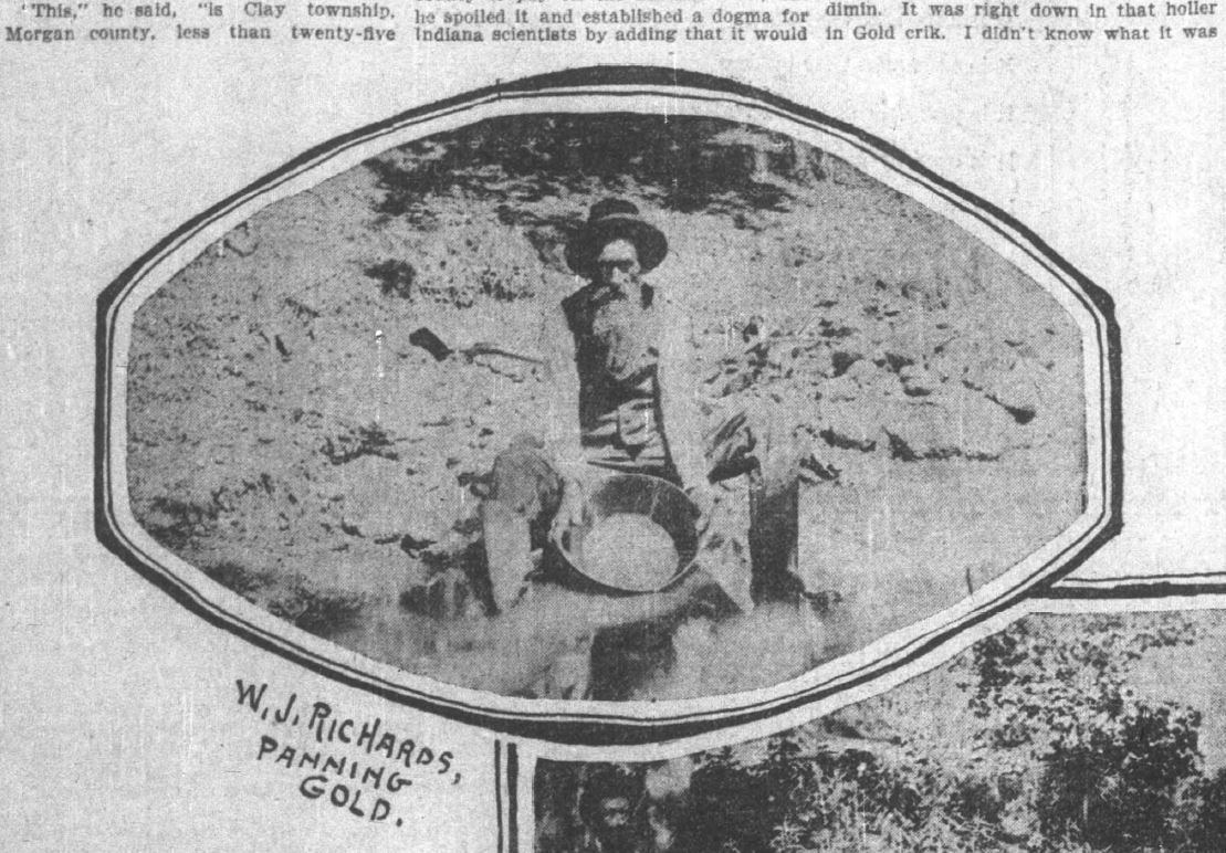


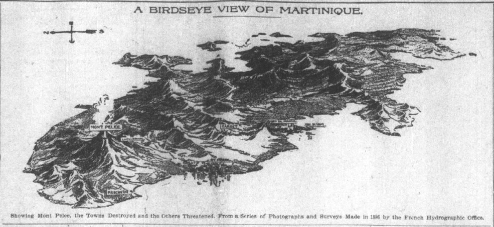
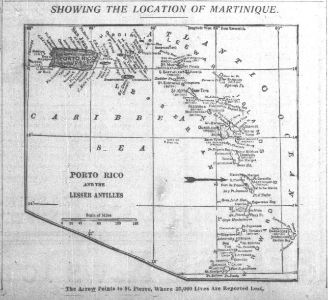
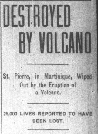
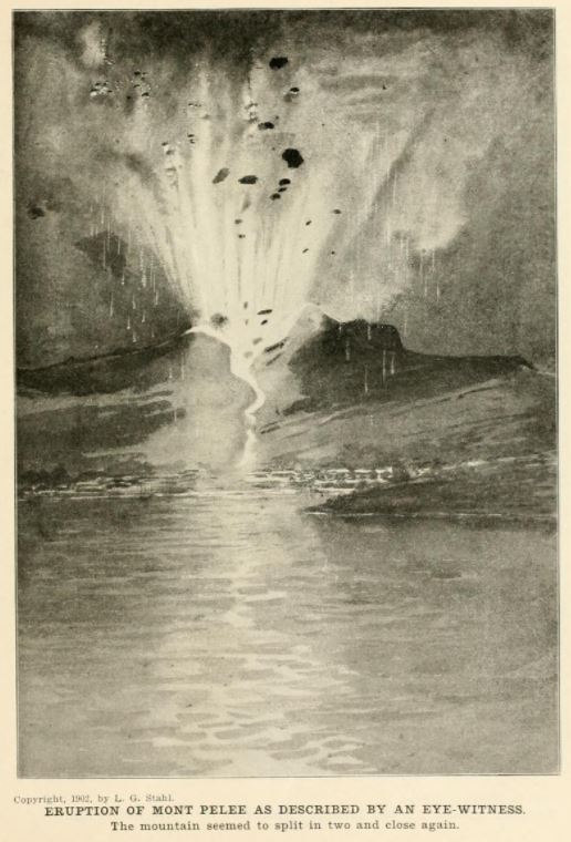
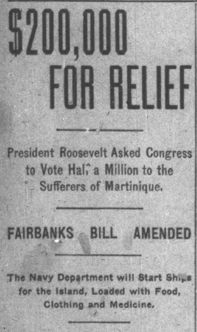
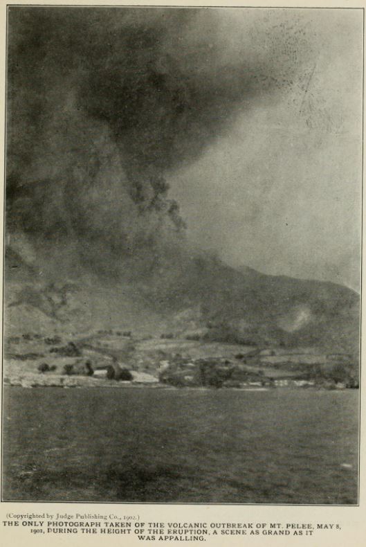
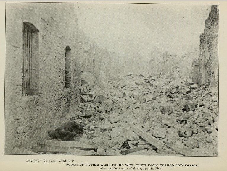
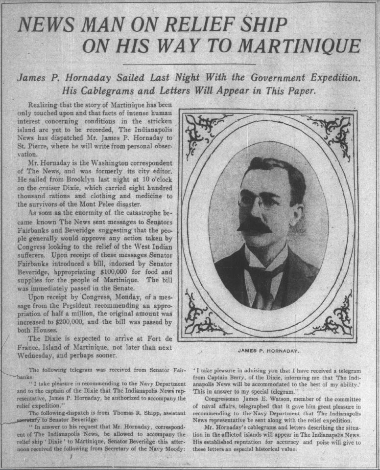
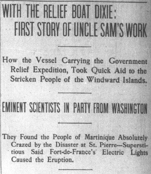
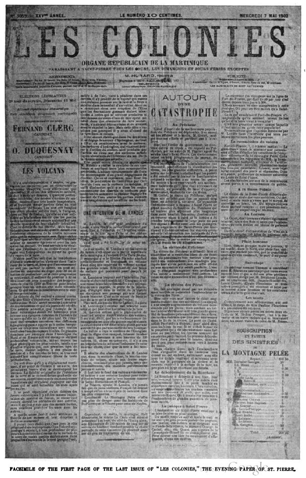
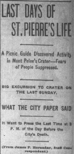
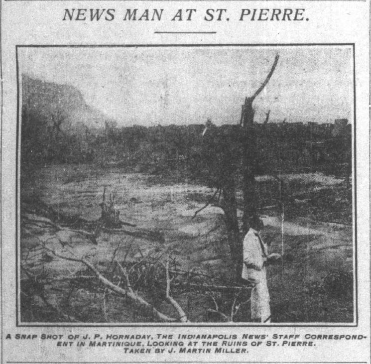
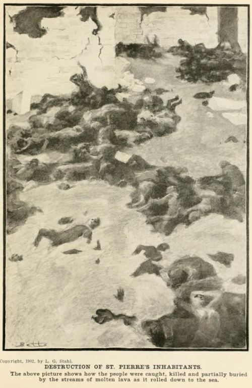
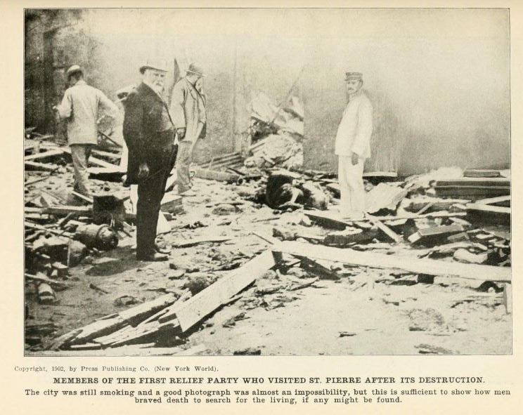
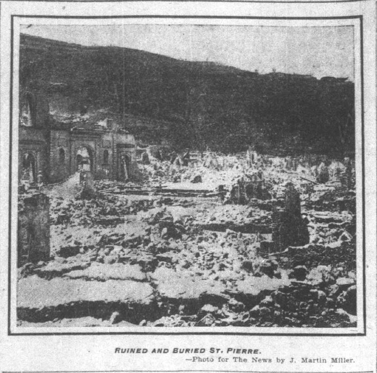

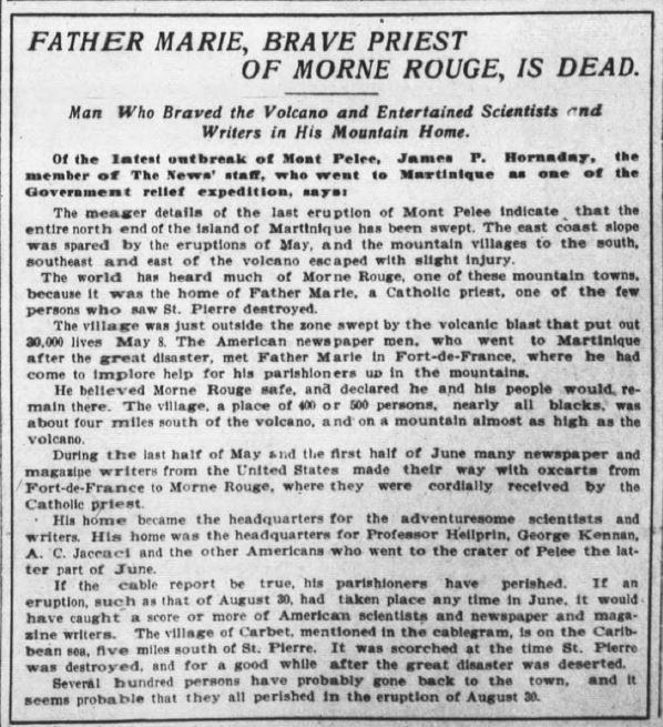
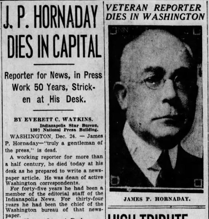


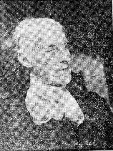
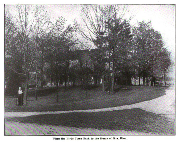


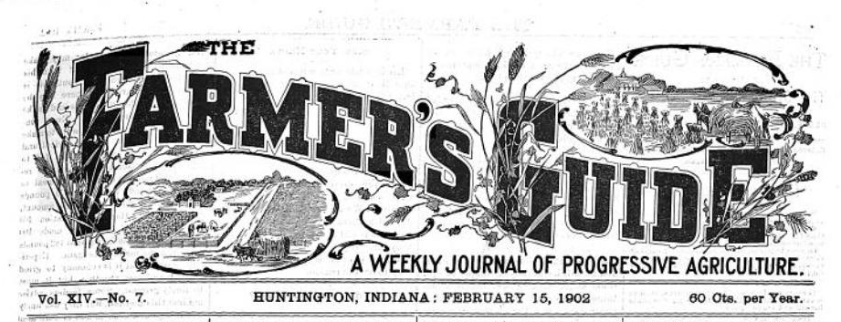


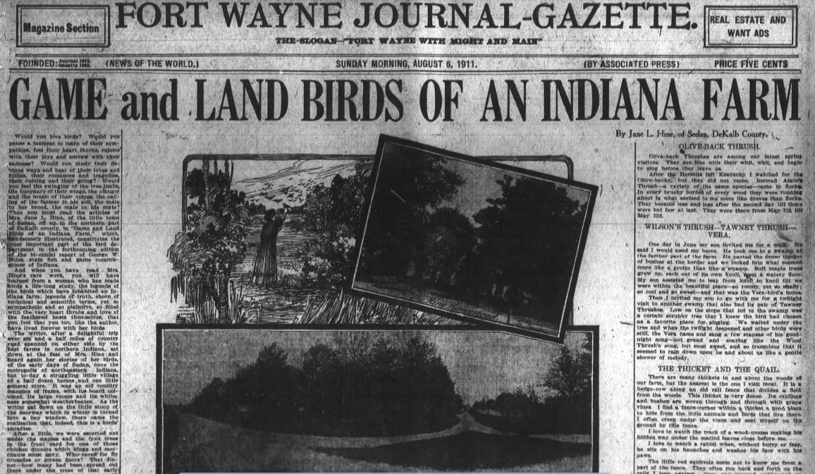

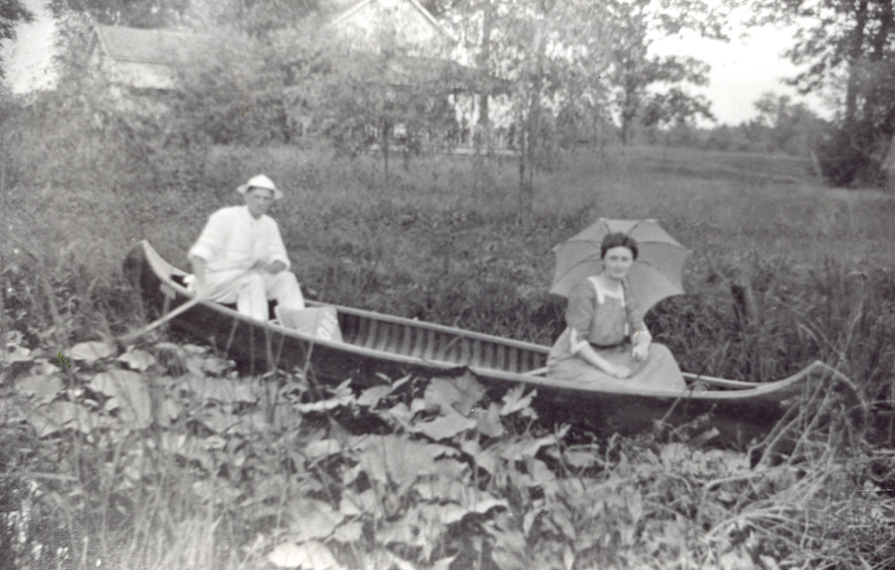
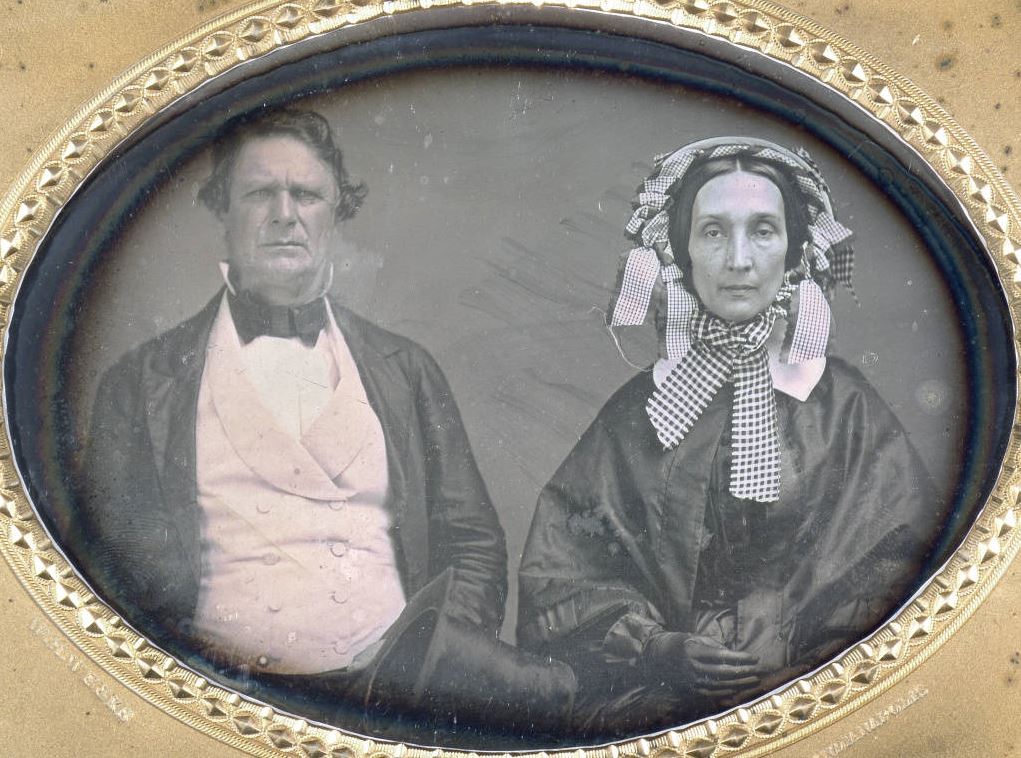
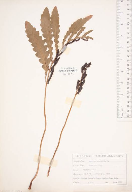
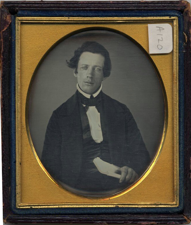
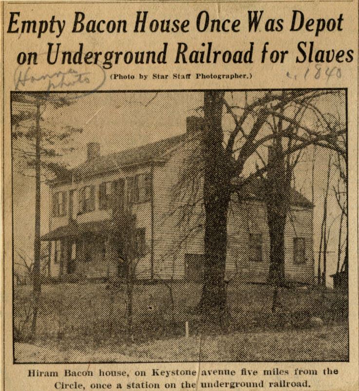

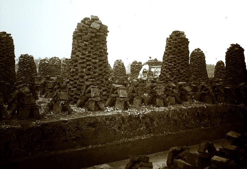
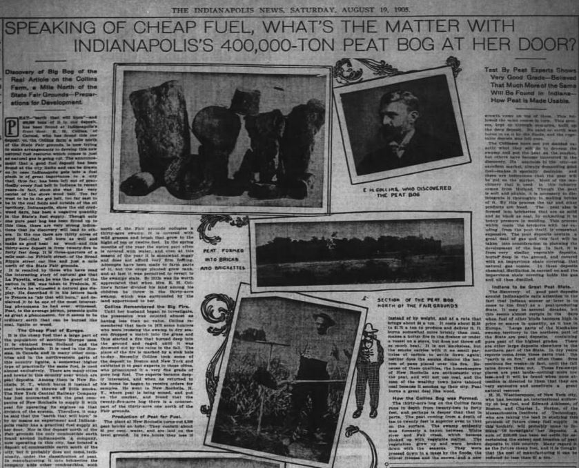


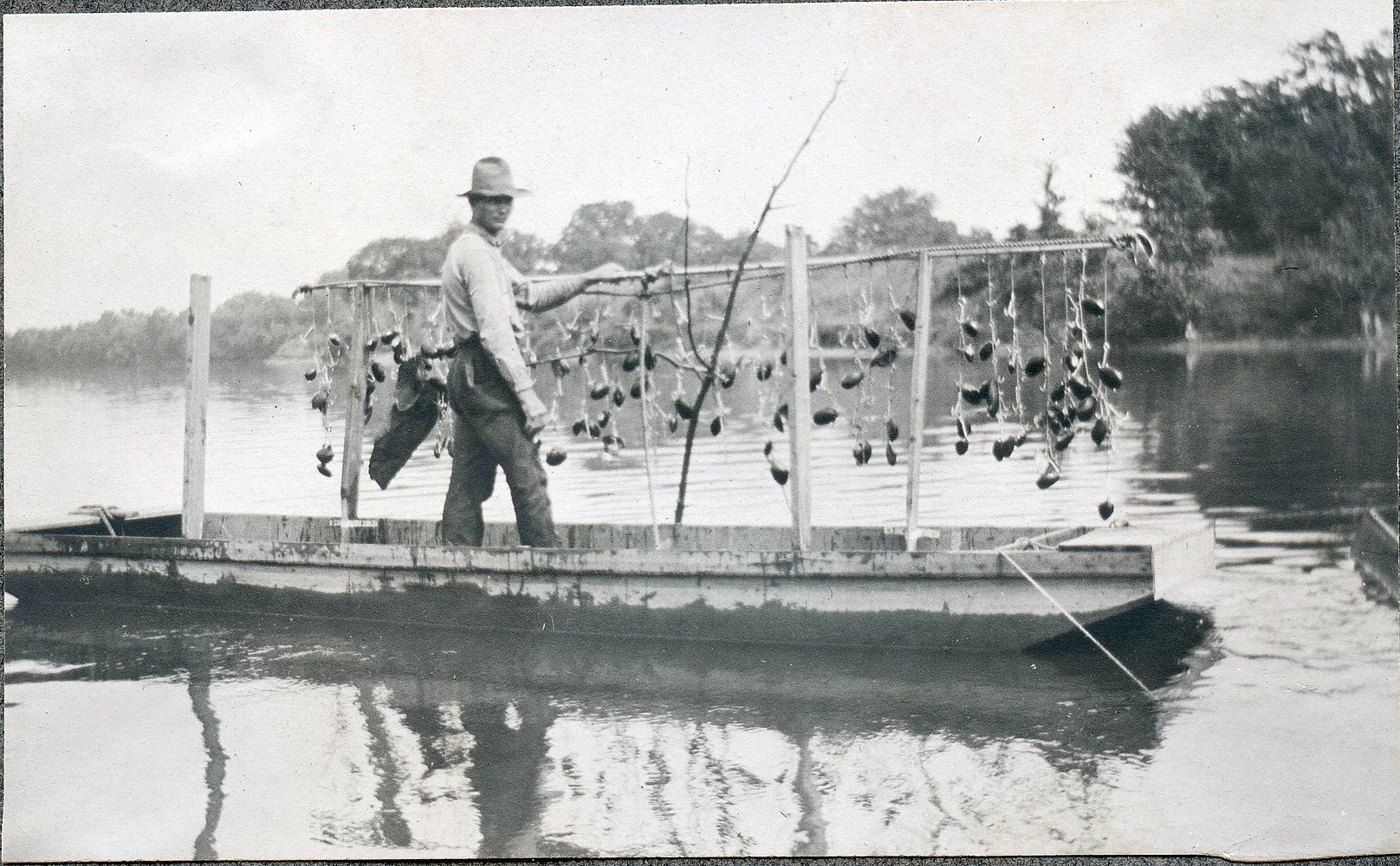


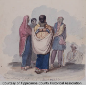
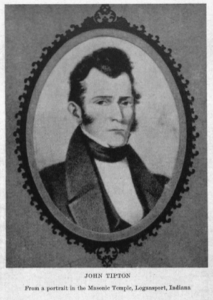
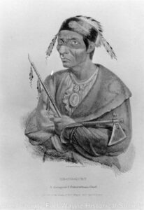
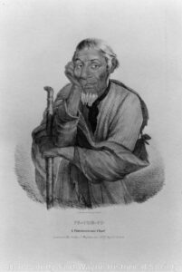


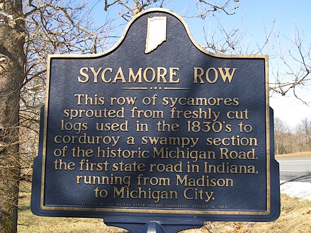
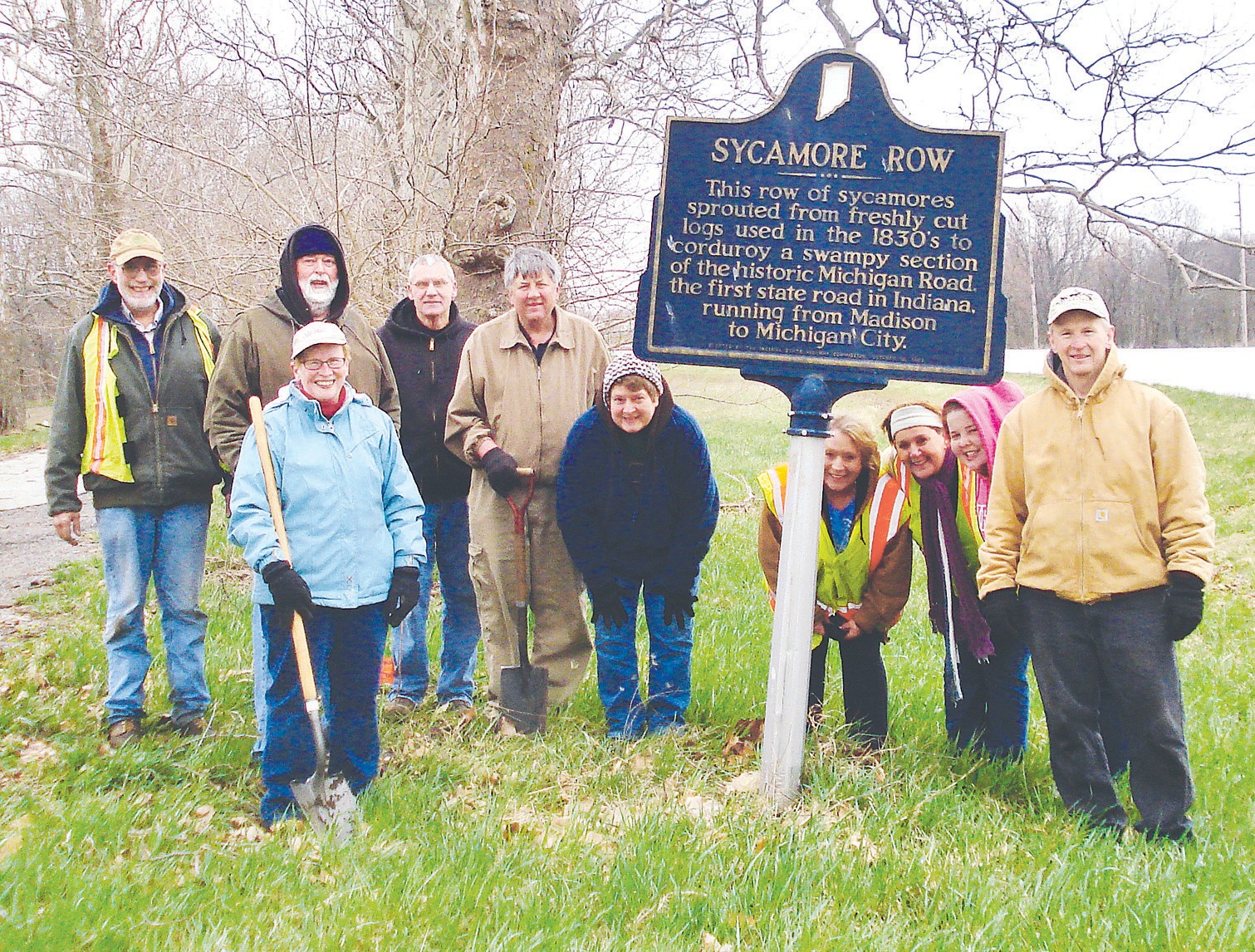
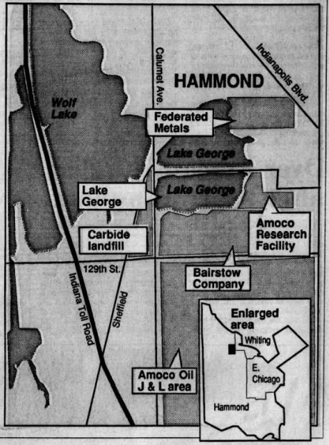

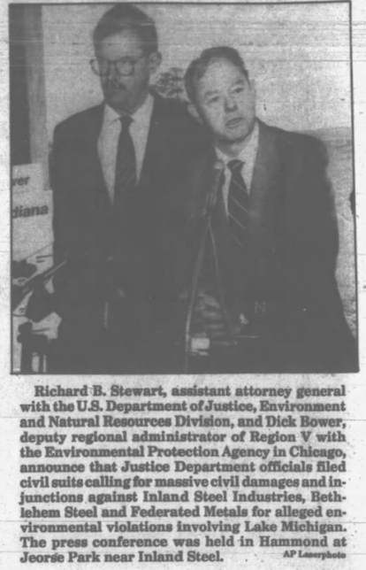
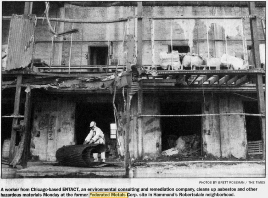
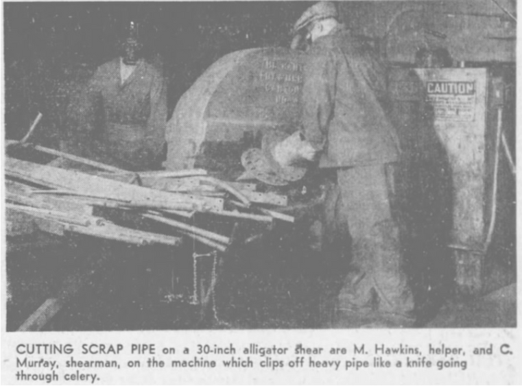
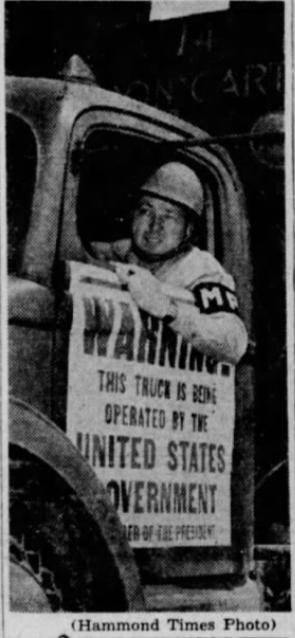