Injustice, Genocide, and “Survivance”: Re-centering the Potawatomi at Sycamore Row, Part Two

This is Part Two of a two-part post.

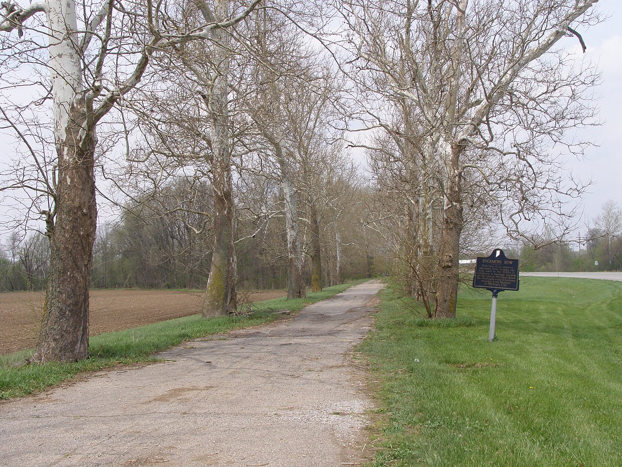
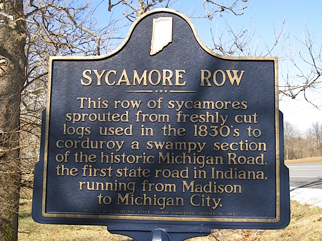
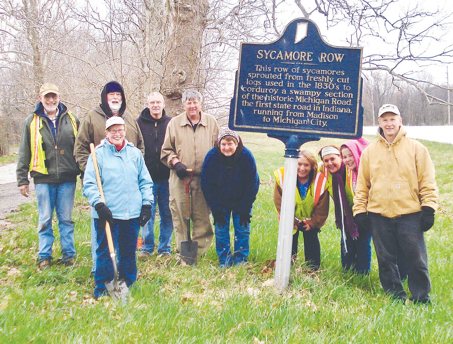
In Part One we presented the text for a new marker at Sycamore Row in Carroll County, Indiana which will replace a 1963 marker that was recently damaged. This new text focuses less on unverifiable legends about sycamore trees sprouting along the Old Michigan Road told by the original marker text, in order to make room for the history of the Potawatomi that is intertwined with the creation of the road. The new marker still tells the story of the trees and their preservation—history that the local community values—but it now also hints at the complex history of the injustices the U.S. perpetuated against the Potawatomi. The marker’s limited space doesn’t allow IHB to tell the larger story, so we are expanding on that here. This story of injustice, genocide, and survivance* is often lost by historians presenting a version of Indiana history as a march towards progress. To truly understand our state’s history and the atrocities perpetuated in the name of that “progress,” we must re-center the Potawatomi and other indigenous People in that story.

“Me-Te-A, A Pottawatimie Chief,” n.d., lithograph, Allen County – Fort Wayne Historical Society Collection, Purdue University Fort Wayne, accessed Indiana Memory.

Potawatomi Removal, Genocide, Resistance, and Survivance

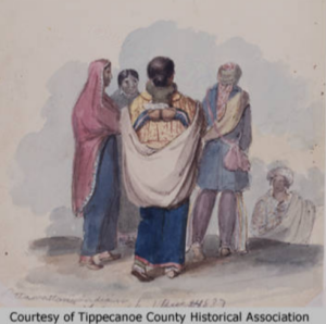
The Potawatomi lived in the land now called the United States for centuries before European people settled here. By the 13th century, but likely earlier, the Potawatomi (then the Bodewadmi) were living in what is now Eastern Canada and the Northeastern United States. They were one of a group of Algonquin-speaking tribes united with the Odawa (Ottawa) and Ojibwe (Chippewa) into a collective called Nishnabe, which still exists to this day. (Learn more about the history of the Potawatomi through the Citizen Potawatomi Cultural Heritage Center). [1]

Over the centuries, the Potawatomi migrated inland as their prophets had predicted, settling around the Great Lakes Region.  Potawatomi men fished and hunted deer, elk, and beaver. Potawatomi women maintained areas of cultivated crops, which have usually been referred to as gardens, but according to historian and professor Jeffrey Ostler, these plots should be recognized as farms. Some of them were as large as 100 acres or more, surrounded by fences and producing bounties of corn, beans, pumpkins, and wheat. According to the Milwaukee Public Museum, in the winter, the Potawatomi lived in small groups coordinated with specific hunting territories. In the spring, they gathered in large villages for communal hunting and food production. Required to marry outside of one’s own community, Potawatomi people created a network of social bonds through these marriages. Trade also strengthened these relationships between communities. The Potawatomi did not have a chief that spoke for the entire tribe, but instead, village heads who met in council with the leaders of other Potawatomi communities to make decisions through intricate diplomatic negotiations. Recognizing this decentralized system of government is important in understanding the duplicitous treatymaking explained later in this post.[2]

After clashes with the Iroquois in the 17th century, the Potawatomi lived peacefully, and for a time, enjoyed a mutually beneficial partnership with French trappers in the 18th century, according to John Boursaw, a member of the Citizen Potawatomi Nation and former director of the Citizen Potawatomi Cultural Heritage Center (CPCHC). However, when hundreds of Potawatomi men joined the French to fight in the Seven Year’s War starting in 1757, some returned carrying smallpox. The Great Lakes Potawatomi were devastated by the epidemic. They were also impacted by the defeat of the French by the British in 1763, with different indigenous communities supporting the French, the British, and the fledgling United States. [3]

After the American Revolutionary War, the new United States government began pushing West, surveying and selling land.  The U.S. government worked towards this end through military action, economic pressure, treaty negotiations, and sanctioned genocide in order to make space for white male settlers to farm the land. White squatters and militias also murdered indigenous peoples for their land. (Learn more about 18th and early 19th-century removal and persecution of indigenous peoples in the Midwest). [4]

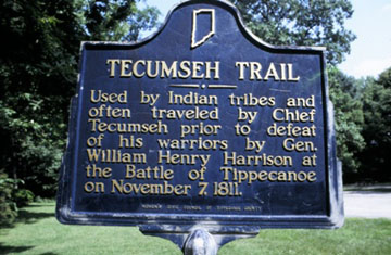
The Potawatomi resisted U.S. expansion in multiple ways. For example, they fought against the U.S. in the Ohio Indian Wars, they joined Tenskwatawa and Tecumseh’s resistance after 1805, and allied with the British during the War of 1812. Many of the gains the Potawatomi made were lost after the British defeat when the crown ceded its midwestern lands to the U.S. [5]

George Winter, “Pottawattamie Indians,” 1837, watercolor, Tippecanoe County Historical Association Collection, Purdue University, accessed Indiana Memory.

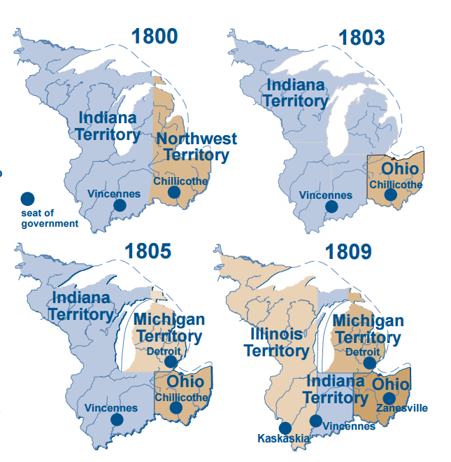
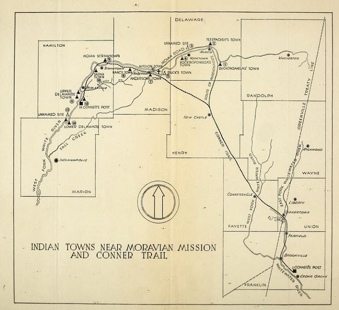
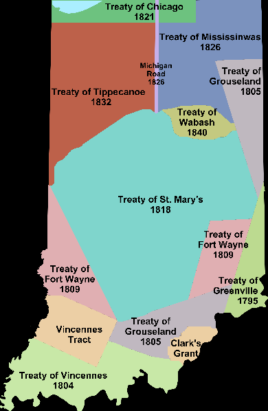
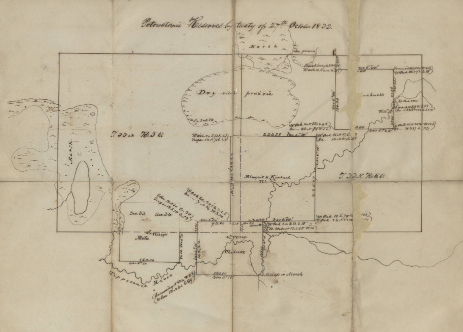
By 1825, the state and federal governments were applying severe pressure on the Potawatomi to leave Indiana. The government systematically worked to extinguish Indian-held land titles negotiated through previous treaties. And there was always the threat of violence, both from encroaching white settlers and the U.S. military. The state government viewed the Miami lands as blocking the development of the Wabash, and Erie Canal and Potawatomi lands as blocking the creation of the Michigan Road. Indiana legislators pushed for removal of both peoples. [6]

U. S. Government Strategies for Indigenous Land Theft

The U.S. government had several strategies for forcing Native Peoples to cede land. According to Blake Norton, curator of the Citizen Potawatomi Nation Cultural Heritage Center,

U.S. leaders exploited tribal autonomy by making treaties with individual villages, rather than large regional bands. This tactic helped divide communities, as gifts and annuities were leveraged against those unwilling to go. [7]

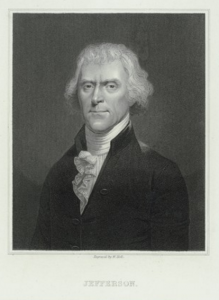
The loss of land in areas where Native Peoples were removed impacted those who remained. They could no longer self-sufficiently live off the land and they became reliant on annuities while being pushed into debt. This was intentional. As Thomas Jefferson explained to William Henry Harrison in an 1803 letter:

We shall push our trading houses, and be glad to see the good and influential individuals among [Great Lakes Indians] run in debt, because we observe that when these debts get beyond what the individuals can pay, they become willing to lop them off by a cession of lands. [8]

Nellie Armstrong Robertson and Dorothy Riker, eds., John Tipton Papers Volume I: 1809-1827 (Indianapolis: Indiana Historical Bureau, 1942, Indiana State Library Digital Collections.

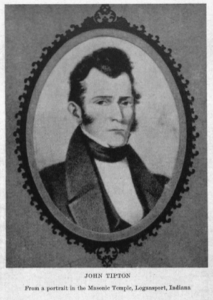
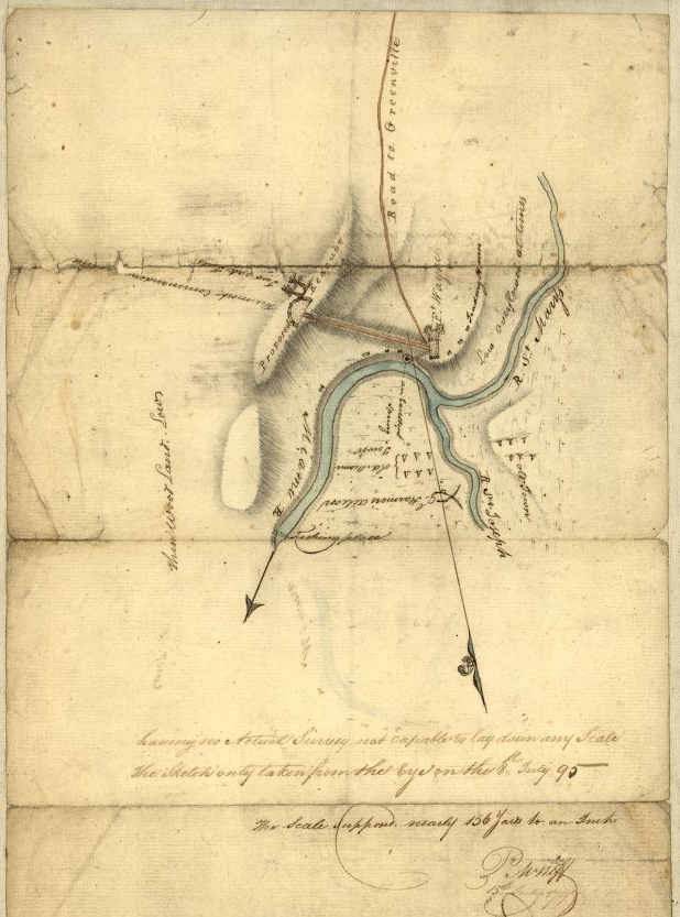
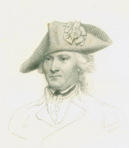
By 1826, the United States government tasked three commissioners, including General John Tipton, an Indian agent working out of Fort Wayne, with securing land cessions from the Potawatomi. The proposed treaty would make way for what would become the Michigan Road. John Tipton would benefit professionally and financially from this suppression and disenfranchisement of the Potawatomi—a microcosm of the larger story about the United States building its empire on the stolen lands of Indigenous People. [9]

The U.S. commissioners tasked with treatymaking presented these land cessions to the bands as a way for the Potawatomi to pay off debts claimed against them. Again, the Potawatomi only owed these debts to traders and Indian agents because they had been forced from their traditional livelihoods—an intentional part of the larger government plan to remove them. In addition to clearing accrued debt, the U.S. commissioners also promised the Potawatomi a group of eighty-six land reserves where they would hold title. [10]

According to educator and historian Juanita Hunter, other techniques used by government officials to take the Potawatomi ancestral land included: negotiating with members not authorized to speak on behalf of a tribe while referring to them in treaties as “chiefs;” making treaties with rival tribes with no claims to the land; introducing alcohol into negotiations; and encouraging encroachment of settlers onto Indian land. The threat of military intervention was also ever present. [11]

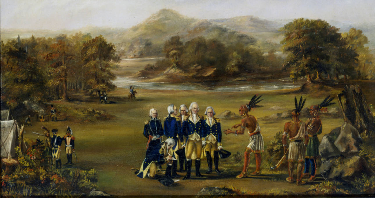
“Deceitful Lips”: The 1826 Treaty with the Potawatomi

James Otto Lewis, “Me-No-Quet, A Distinguish’d Pottowatomie Chief,” 1827, lithograph, Allen County – Fort Wayne Historical Society Collections, Purdue University Fort Wayne Digital Collection, accessed Indiana Memory.

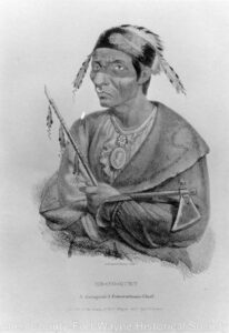
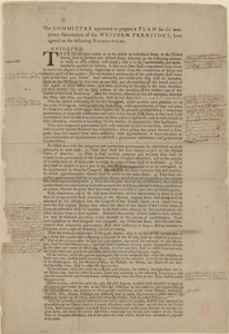
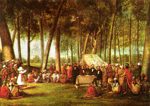
Under these conditions, twenty-four bands of Potawatomi gathered near the Mississinewa River in Wabash County, Indiana, on October 5, 1826. Bands of Miami were also present for similar negotiations. The commissioners began the proceedings by pushing for complete removal. They painted a bright picture of life beyond the Mississippi River and promised white settlement would never touch them there. Commissioner Lewis Cass, also governor of Michigan Territory, claimed:

We are authorized to offer you a residence there, equal in extent to your land here, and to pay you an annuity, which will make you comfortable, and to provide the means of your removal . . . You will then have a country abounding in game . . . Your Great Father will never suffer any of his white children to reside there, for it is reserved for the red poeple [sic]. It will be yours, as long as the sun shines, and the rain falls. [12]

These were empty promises, and the indigenous leaders knew it. They responded that the white men had caused the problems that the indigenous bands were now facing. They explained that they could not go West because there were already people living there—other native groups with their own claims to the land. Speaking for himself and Potawatomi leader Aubanaubee, Miami leader Legro stated:

You speak to us with deceitful lips, and not from your hearts. You say the game is going away and we must follow it; who drove it away?  . . . Before you came, the game was plenty . . . We own there is game there, but the Great Spirit has made and put men there, who have a right to that game, and it is not ours. [13]

James Otto Lewis, “Pe-Che-Co, A Pottowattomie Chief, Painted at the Treaty of Mississinewa,” 1827, Allen County Fort Wayne Historical Society Collection, Purdue University Fort Wayne Digital Collection, accessed Indiana Memory.

The secretary documenting the details of the treaty negotiations recorded no more of the proceedings, which continued for several days. It is clear from Legro’s words that they did not want to cede more land, and yet they ultimately did. The terms of the 1826 Treaty with the Potawatomi can give us some clues to what happened. [14]

Article I provided over $30,000 in goods to the Potawatomi. With this provision, white stakeholders profited twice. The traders providing the goods received payment from the government, while the government would turn around and sell the land to settlers for profit. These annuities also furthered Potawatomi dependence on the U.S. government, which would ultimately push them further into debt. [15]

Article I also provided $9,573 in payments for debts that traders claimed the Potawatomi owed them. In a blatant conflict of interest, it was Tipton, a commissioner who regularly befitted from suppressing and removing the Potawatomi through his speculative land dealings, who decided (in his role as Indian agent) just how much debt the Potawatomi owed. [16]

The Potawatomi pushed back for larger payments and succeeded to some extent. They were able to negotiate for an annual payment of $2,000 over a period of twenty-two years with additional money provided for education and for a mill built at government expense. But Legro’s prediction was correct. The government spoke with “deceitful lips,” and the Indigenous Peoples would not receive twenty-two years of payments. Instead, the government would force them off their ancestral land within only twelve years. [17]

Article II of the treaty was even more disastrous for the Potawatomi. In this section, which included the provisions for the future Michigan Road, the treaty makers were careful not to define the route of the road. The Potawatomi thought they were ceding a mile-wide strip of land in a straight, contiguous line for the route. Even Tipton, in private correspondence, admitted that this was also his understanding of the provision. He told the land office commissioner Elijah Hayward:

I feel bound to state to you, and through you to the President, that, at the time of negotiating this treaty, these Indians did not understand that their land, not embraced within the bounds of the tract then ceded, would be required to construct this road, except where the road passed through the country retained by them . . . This was also my understanding of this treaty at the time it was made. [18]

Instead, when the State of Indiana began surveying the route, they chose a circuitous route around swamps and other undesirable land. The Potawatomi resisted this change, stopping and confronting surveyors, and delaying the road-building operation. Other councils were held between commissioners and some Potawatomi members while settlers and government officials continued to press for complete removal. In September 1831, Potawatomi members of dubious authority ceded the land for the circuitous route. Without information from the indigenous perspective it is hard to know exactly how this happened. Reports of U.S. officials claim that through an interpreter “of mixed blood,” who was educated in white schools and worked for a fur trading company, they were able to get “a few young chiefs” intoxicated and convince them to cede more land. Looking at the history of U.S. negotiation tactics, it is likely that these young men were not authorized to make such a deal. [19]

The new route for the Michigan Road cut through the remaining Potawatomi lands, further isolating and cordoning off the indigenous bands. According to Hunter, ” The commissioners, in fact, saw this fractionalization as one reason for the ratification of the treaty.” John Tipton wrote:

It was then important that the Indians be separated into bands, by the intervention of our settlements . . . We could not purchase any particular district near the centre of the Pattawatamie [sic] country; but that tribe freely consented to give us land for the road described in the treaty, and for the settlement along it. Such a road . . . will sever their possessions, and lead them at no distant day to place their dependence upon agricultural pursuits, or to abandon the country. [20]

The Potawatomi refused to sell the bulk of their lands. However, the commissioners planned the road so that it cut through the middle of indigenous lands. This purposeful intercession combined with white settlement along the road, cut Potawatomi territory into unconnected pieces, weakening their holdings. State and government officials then turned their attention to removal.
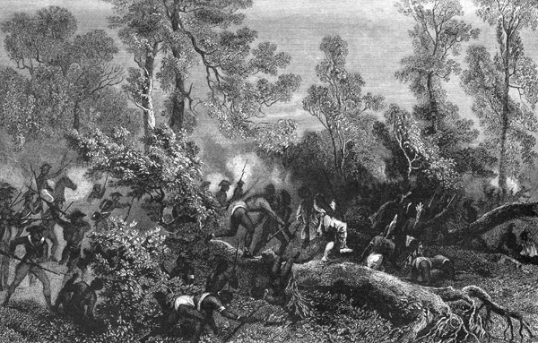
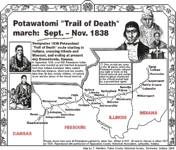
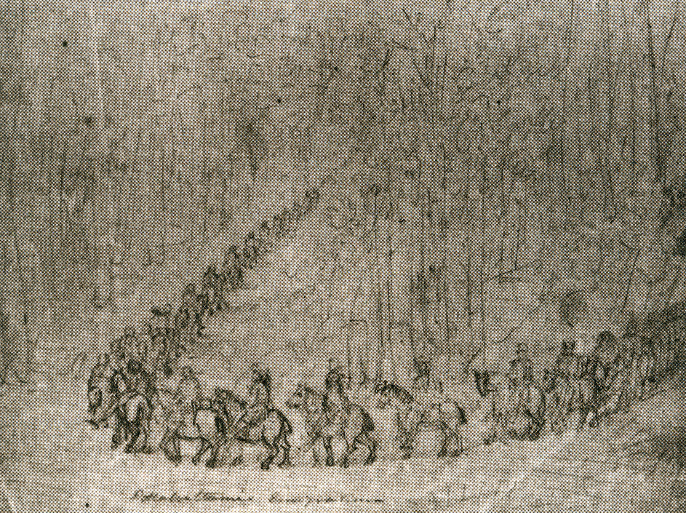
Map, “Potowatomie Reserves by Treaty of 27th October 1832,” March 27, 1832, Indiana State Archives, accessed Indiana Memory.

Trail of Death

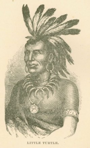
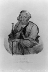
In May 1830, President Andrew Jackson signed the Indian Removal Act, authorizing “an exchange of lands with the Indians residing in any of the states or territories, and for their removal west of the river Mississippi.” [21] The state and federal government, along with white settlers and squatters, continued to apply pressure for Potawatomi removal. In the 1832 Treaty of Tippecanoe, Potawatomi “chiefs” supposedly sold much of the remaining land. Menominee, an important Potawatomi leader, denied the validity of this treaty and resisted removal. [22] He wrote to a federal Indian agent, referring optimistically to President Van Buren:

The President does not know the truth . . . He does not know that you made my young chiefs drunk and got their consent and pretended to get mine. He would not drive me from my home and the graves of my tribe, and my children, who have gone to the Great Spirit, nor allow you to tell me that your braves will take me, tied like a dog. [23]

Menominee stood his ground and gathered followers. In response, Indiana Governor David Wallace had him arrested and ordered the forced removal at gunpoint of most of the remaining Potawatomi. The CPCHC explained:

On the morning of September 4, 1838, a band of 859 Potawatomi, with their leaders shackled and restrained in the back of a wagon, set out on a forced march from their homeland in northern Indiana for a small reserve in present-day Kansas. To minimize the temptation for the Potawatomi to try to escape and return home, militia members burned both fields and houses as the dejected members of the wagon train departed. [24]

George Winter, “Pottawattamie Emigration,” 1838, Tippecanoe County Historical Association Collection, accessed Citizen Potawatomi Nation Cultural Heritage Center, https://www.potawatomiheritage.com/encyclopedia/trail-of-death/

A white witness described the scene:

The whitemen were gathering thick around them, which was but a sad necessity for their departure. Still they clung to their homes. But the flames of the torch were applied—their villages and wigwams were annihilated. [25]

It was John Tipton who led the militia group that forced the Potawatomi on this Trail of Death. In a horrific twist of irony, the route they took followed part of the Michigan Road. According to the CPCHC:

The journey was a 660-mile trek for which the Potawatomi were not prepared and through terrain to which they were not accustomed. The heat was oppressive and water was often scarce. They had only a few hundred horses to carry people and supplies, and promised additional wagons did not arrive before their departure; so, even the weak and elderly were forced to walk. The pace and conditions of the march debilitated the health of travelers. A day rarely passed that a member of the party did not die, usually a child, forcing their bereft and exhausted families to leave the bodies behind in hastily dug graves. In the end, more than forty people died during what the Potawatomi came to call the Trail of Death. [26]

This tragedy was not some unintended consequence of settlement. Removal was the plan from the beginning. The U.S. government, state governments, and white settlers chose the systematic genocide of Indigenous Peoples in order to take their native lands for their own use. Methods for the perpetuation of this crime included the tactics seen here: making treaties with people not authorized to speak on behalf of indigenous bands, pushing Indigenous Peoples into debt and dependence through encroachment and over hunting, flagrantly violating treaties, and finally, violence and murder. White people benefited directly from this genocide, taking the fertile land and prospering while continuing the persecution of Native Peoples. [27]

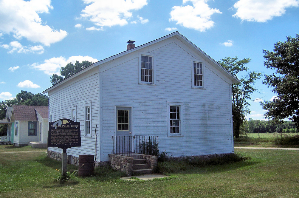
For example, Tipton, who helped negotiate the 1826 Treaty and led the forced removal of the Potawatomi, bought several sections of land along the Michigan Road. He later benefited financially from the sales of these lands as businesses and residences sprung up along the road. In 1831, John Tipton purchased the land surrounding the section of the Old Michigan Road called Sycamore Row, where IHB and local partners will install a new historical marker. We can only hope that the phrases on that marker about the 1826 Treaty and the pressure put on the Potawatomi will spur interest in learning more about this enduring people. [28]

George Winter, “Sinisqua,” 1842, watercolor, Tippecanoe County Historical Association, Purdue University, accessed Indiana Memory.

Survivance

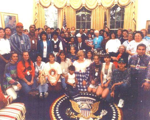
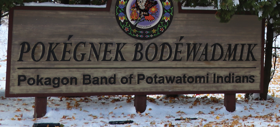
And they did endure. Even in the face of persecution and genocide, the Potawatomi continue today as sovereign nations, including the Prairie Band Potawatomi Nation located in Kansas and the Pokégnek Bodéwadmik, or Pokagon Band of Potawatomi, located in Michigan and Indiana. These tribal governments maintain their own educational and health systems, infrastructure, housing developments, law enforcement, and more. The Potawatomi people also continue to teach future generations traditional culture, arts, history, and language. In 1994, the U.S. government finally recognized the sovereignty of the Pokagon Band through an act of Congress signed by President Bill Clinton. [29]

“Pokagon Band of Potawatomi commemorate 25th anniversary of Reaffirmation of Sovereignty,” (Winnipeg, Canada) Indian Life, November 4, 2019, https://www.newspaper.indianlife.org/.

According to the Pokagon Band:

The Pokagon people have endured thanks in part to their values of Wisdom, Love, Respect, Truth, Honesty, Humility, and Bravery. Adapting these deeply-rooted ideals to contemporary circumstances has made the Band an engine for economic development and a model for sustainable living in the region. [30]

Learn more about the Potawatomi culture through the Pokagon Band Potawatomi website and the Citizen Potawatomi Cultural Heritage Center.

http://www.pokagonband-nsn.gov/

* “Survivance” is a term coined by White Earth Ojibwe scholar Gerald Vizenor to explain that Indigenous People survived and resisted white colonization and genocide and continue as a people to this day. Theirs is not a history of decline. Their work preserving and forwarding their culture, traditions, language, religions, and struggle for rights and land continues.

Sources:

[1] Citizen Potawatomi Cultural Heritage Center, “History,” https://www.potawatomiheritage.com/history/; Jon Boursaw, “The Flint Hills: A Major Chapter in Potawatomi Migration,” Symphony in the Flint Hills Field Journal (2011): 28-37, Kansas State University Library, newprairiepress.org/sfh/2011/flinthills/3/.

[2] Citizen Potawatomi Cultural Heritage Center, “History,” https://www.potawatomiheritage.com/history/; “Potawatomi,” Milwaukee Public Museum, http://www.mpm.edu/content/wirp/ICW-56.

[3] Boursaw, 29-30; Jeffrey Ostler, Surviving Genocide: Native Nations and the United States from the American Revolution to Bleeding Kansas (New Haven and London: Yale University Press, 2019), 34-35.

[4] Jill Weiss Simins, “Democracy for Some: Defining the Indiana Landscape through the Rectangular Survey System,” Untold Indiana, December 2017, https://blog.history.in.gov/democracy-for-some-defining-the-indiana-landscape-through-the-rectangular-survey-system/. For a more thorough study of the genocidal policies and actions of the United States government, area militias, and squatter-settlers, see Roxanne Dunbar-Ortiz, An Indigenous Peoples’ History of the United States (Boston: Beacon Press, 2014).

[5]”Potawatomi,” Milwaukee Public Museum.

[6] Juanita Hunter, “Indians and the Michigan Road,” Indiana Magazine of History 83, No. 3 (September 1987): 244-266.

[7] “The United States’ Handling of the ‘Indian Problem’,” Citizen Potawatomi Nation, September 7, 2018, https://www.potawatomi.org/the-united-states-handling-of-the-indian-problem/.

[8] Thomas Jefferson to William Henry Harrison, February 27, 1803, Founders Online, National Archives, https://founders.archives.gov/documents/Jefferson/01-39-02-0500.

[9] John Tipton, Land Deed, State Volume Patent, Indiana, Issued January 3, 1831, Document Number: 11836, Accession Number: IN1110_.054, U.S. Department of Land Management, U.S. Department of the Interior, accessed glorecords.blm.gov/; John Tipton, Land Deed, State Volume Patent, Indiana, Issued January 3, 1831, Document Number: 11837, Accession Number: IN1110_.055, U.S. Department of Land Management, U.S. Department of the Interior, accessed glorecords.blm.gov/; Nellie Armstrong Robertson and Dorothy Riker, eds., John Tipton Papers, Volume I: 1809-1827 (Indianapolis: Indiana Historical Bureau, 1942), accessed Indiana State Library Digital Collections; “Trail of Death,” Citizen Potawatomi Nation Cultural Heritage Center, https://www.potawatomiheritage.com/encyclopedia/trail-of-death/.

[10] Armstrong Robertson and Riker, Tipton Papers: Vol. I, 537; Ratified Indian Treaty 146: Potawatomi – Near Mouth of Mississinewa Upon the Wabash, October 16, 1826, National Archives Catalogue No. 121651643, Record Group 11, National Archives, https://catalog.archives.gov/id/121651643; Hunter 244-45.

[11] Hunter, 246.

[12] Armstrong Robertson and Riker, Tipton Papers: Vol. I, 578-80; Hunter, 252.

[13] Ibid.

[14] Ibid.; Ratified Indian Treaty 146: Potawatomi.

[15] Ibid.; Hunter, 254; Tipton Land Deed 11836; Tipton Land Deed 11837.

[16] Ibid.

[17] Ratified Indian Treaty 146: Potawatomi; Hunter 254-56.

[18] Armstrong Robertson and Riker, Tipton Papers: Vol. II, 419; Hunter, 256.

[19] Hunter, 256-57.

[20] Armstrong Robertson and Riker, Tipton Papers: Vol. I, 602; Hunter, 266.

[21] “An Act to Provide for an Exchange of Lands with the Indians Residing in Any of the States or Territories, and for Their Removal West of the River Mississippi,” May 28, 1830, Twenty-First Congress, Session I, Chapter 148, 411, A Century of Lawmaking for a New Nation: U.S. Congressional Documents and Debates, American Memory, Library of Congress.

[22] “Articles of a Treaty Made and Concluded on Tippecanoe River, in the State of Indiana, between Jonathan Jennings, John W. Davis and Marks Crume, Commissioners on the Part of the United States, and the Chiefs, Headmen and Warriors, of the Pottawatimie Indians” (Treaty with the Potawatomi, 1832), The Avalon Project: Documents in Law, History and Diplomacy, Yale Law School, Lillian Goldman Law Library, https://avalon.law.yale.edu/19th_century/pot1832.asp.

[23] “Potawatomi Trail of Death,” Kansapedia, 2012, Kansas Historical Society, https://www.kshs.org/kansapedia/potawatomi-trail-of-death/17944.

[24] “Trail of Death,” Citizen Potawatomi Cultural Heritage Center, https://www.potawatomiheritage.com/encyclopedia/trail-of-death/.

[25] “Potawatomi Trail of Death,” Kansas Historical Society.

[26] “Trail of Death,” Citizen Potawatomi Cultural Heritage Center.

[27] See footnote 4.

[28] Tipton Land Deed 11836; Tipton Land Deed 11837. See also footnote 9.

[29] Prairie Band Potawatomi Nation, The Official Website of the Prairie Band Potawatomi Nation, https://www.pbpindiantribe.com/; Pokégnek Bodéwadmik, Pokagon Band of Potawatomi, https://www.pokagonband-nsn.gov/; “Pokagon Band of Potawatomi Commemorate 25th Anniversary of Reaffirmation of Sovereignty,” (Winnipeg, Canada) Indian Life, November 4, 2019, https://www.newspaper.indianlife.org/.

[30]“Our Culture,” Pokégnek Bodéwadmik, Pokagon Band of Potawatomi, https://www.pokagonband-nsn.gov/our-culture.

Re-centering the Potawatomi at Sycamore Row Part One

Photograph by Chris Light, accessed Wikipedia.

This is Part One of a two-part post. Part One examines why IHB and local partners chose to refocus the text of a new historical marker to Sycamore Row in Carroll County that replaces a damaged 1963 marker. Instead of focusing on the unverifiable legends surrounding the row of sycamores lining the Old Michigan Road, this new marker centers the persecution and removal of the Potawatomi to make way for that road and further white settlement. Part Two will look in depth at the persecution of the this indigenous group by the U.S. government as well as the resistance and continued “survivance” of the Potawatomi people.*

What’s in a Legend?

The sycamore trees lining the Old Michigan Road have long been the subject of much curiosity and folklore in Carroll County. But there is a story here of even greater historical significance – the removal and resistance of the Potawatomi. While the trees will likely continue to be the subject that brings people to this marker, IHB hopes to recenter the Potawatomi in the story. (To skip right to the story of the Potawatomi, go to Part Two of this post, available April 2021).

Folklore is a tricky area for historians. The sources for these stories are often lost, making it difficult to determine the historical accuracy of the tale. But historians shouldn’t ignore folklore either. Local stories of unknown origin can point to greater truths about a community. It becomes less important to know exactly if something really happened and more significant to know why the community remembers that it did.

Folklore is both a mirror and a tool. It can reflect the values of the community and serve to effect change. Folklore surrounding “Sycamore Row” in Carroll County does both of these things. Continuing local investment in this row of trees reflects a community that values its early history. At the same time, these trees have served as a preservation tool bringing this community together time and time again for the sake of saving a small piece of Indiana’s story.

These are the big ideas around folklore, but what about searching for the facts behind the stories? In the case of Sycamore Row, digging into the events that we can document only makes the story more interesting and inclusive. And it gives us the opportunity to reexamine the central role of the Potawatomi in this history and return it to the landscape in a small way.

Sycamore Row

Sycamore Row Historical Marker, Indiana Historical Bureau, accessed Carroll County Indiana.

In 1963, the Indiana Historical Bureau placed a marker for “Sycamore Row” on State Road 29, formerly the Old Michigan Road. The 1963 marker read:

This row of sycamores sprouted from freshly cut logs used in the 1830’s to corduroy a swampy section of the historic Michigan Road, the first state road in Indiana, running from Madison to Michigan City.

IHB historians of the 1960s presented this theory on the origin of the sycamores as fact. Today, IHB requires primary documentation for all marker statements. While there are secondary sources (sources created after the event in question), there are no reliable primary sources for this statement. In fact, we don’t know where the trees came from. Local legend purports that saplings sprang from the logs used to lay the “corduroy” base when the dirt road was planked in the 1850s. There is evidence that sycamores were used on this section of the road. During road construction in the 1930s, the Logansport Press reported that workers discovered sycamore logs under the road near the famous Fouts farm. And it is possible that some saplings could have grown on their own, though it’s unlikely they sprouted from the logs. Local historian Bonnie Maxwell asked several experts for their take. One Indiana forester wrote that it was more likely that the trees sprouted from seeds that took root in the freshly dug furrows next to the road. Others noted that even if the trees sprouted as the legend claims, they would not be the same trees we see today, as they are not large enough have sprouted in the early 19th century. Other theories have been posited as well, including one from a 1921 Logansport-Pharos article claiming that the trees were planted to protect the creek bank during road construction in the 1870s. Regardless, we know from Carroll County residents that there have been sycamores along that stretch of road for as long as anyone can remember. It matters less to know where the trees came from and more to know why they have been preserved in memory and in the landscape. [1]

Preservation and Community Building

The ongoing preservation and stewardship of Sycamore Row tells us that local residents care about the history of their community. The trees provide a tangible way of caring for that history. To that end, Carroll County residents have joined together many times over the years to protect the sycamores.

In the 1920s, the Michigan Road section at Sycamore Row became State Road 29 and some of the trees were removed during paving. Starting in the 1930s, road improvements planned by the state highway department threatened the sycamores again, but this time local residents acted quickly. In November 1939, the Logansport Pharos-Tribune reported that Second District American Legion commander Louis Kern organized opposition to a state highway department plan to remove 19 sycamores in order to widen the road. Local residents joined the protest and the state highway commission agreed to spare all but five of the 127 sycamore trees during the highway expansion. [2]

By the 1940s, newspapers reported on the dangerous and narrow stretch of road between the sycamores where several accidents had occurred. By the 1960s, local school officials worried about school busses safely passing other cars and trucks on the stretch and proposed cutting down the trees to widen the road. In 1963, Governor Matthew Walsh issued an order to halt the planned removal of sixty-six of the sycamores and the state highway department planted twenty new trees. Many still called for a safer, wider road and the local controversy continued. [3]

In 1969, officials from the school board and the Carroll County Historical Society (CCHS) met to discuss options for improving driving conditions, weighing this need against the historical significance of the sycamores. Meanwhile, the state highway department continued planning to widen the road, a plan that would have required cutting down the trees. The CCHS staunchly opposed removing the sycamores and organized support for its efforts. The organization worked for over a decade to save Sycamore Row, petitioning lawmakers and gaining the support of Governor Edgar Whitcomb. Carroll County residents signed petitions and spoke out at public meetings with the state highways commission. Ultimately, in 1983, the state highway department announced its plan to reroute SR 29 around the sycamores. This grass roots effort, focused on preserving local history, had prevailed even over the needs of modernization. Construction on the new route began in 1987. The Logansport Pharos-Tribune reported that residents then began using the section of the Old Michigan Road to go down to the bank of the creek and fish. [4]

“Friends of CC Parks Plant Sycamore Trees,” Carroll County Comet, January 4, 2021, accessed Carroll County Comet.

In 2012 the Friends of Carroll County Parks took over stewardship of Sycamore Row and began planting new sycamore saplings the following year. In 2020 they planted even larger sycamores to preserve the legacy for future generations. They also took over the care of the 1963 historical marker, repainting it for the bicentennial. In late 2020, the marker was damaged beyond repair and had to be removed. This opened up an opportunity for IHB, the Friends, and the CCHS to place a new two-sided historical marker. The marker process  is driven by applicants, either individuals or community organizations, and then IHB works with those partners, providing primary research to help tell their stories. We work together, sharing authority. These Carroll County organizations still want to tell the story of the sycamores, but recognize that there is complex history beyond the legends.

Re-centering the Potawatomi

IHB and local partners are using the extra space on the double-sided marker to include the Potawatomi in the story of Sycamore Row. While there is no way we can give the history of these indigenous peoples in all its complexity in the short space provided on a marker, we can make sure it is more central. After all, the story of the genocide, removal, and resistance of the Potawatomi to settler colonialism is part of the story of Indiana.

Some people have a negative view of this kind of reevaluation of sources and apply the label “revisionist” to historians updating the interpretation of an old story. However, “historians view the constant search for new perspectives as the lifeblood of historical understanding,” according to author, historian, and Columbia professor Eric Foner. [5] As we find new sources and include more diverse views, our interpretation changes. It becomes more complex, but also more accurate. And while there is a temptation to view history as a set of facts, or just as “what happened,” it is always interpretive. For instance, the act of deciding what story does or does not make it onto a historical marker is an act of interpretation. When IHB omits the Native American perspective from a historical marker we present a version of history that begins with white settlement. It might be simpler but its not accurate. There were already people on this land, people with a deep and impactful history. When historians and communities include indigenous stories, they present a version of Indiana history that is more complex and has a darker side. This inclusion reminds us that Indiana was settled not only through the efforts and perseverance of the Black and white settlers who cleared the forests, established farms, and cut roads through the landscape. It was also settled through the removal and genocide of native peoples. Both things are true. Both are Indiana history.

With this in mind, the new two-sided marker at Sycamore Row will read:

The sycamores here line the sides of the Michigan Road, which connected the Ohio River with Lake Michigan and further opened Indiana for white settlement and trade. Under intense military and economic pressure, Potawatomi leaders ceded the land for the road in 1826. John Tipton, one of the U.S. agents who negotiated this treaty, purchased the land here in 1831. 

The state began work on the road in the 1830s. While there are several theories on how the trees came to be here, their origin is uncertain. By the 1930s, road improvements threatened the trees, but residents organized to preserve them over the following decades. In 1983, the Carroll County Historical Society petitioned to reroute the highway and saved Sycamore Row. 

Of course, this does little more than hint at the complex history of the Potawatomi. Markers can only serve as the starting point for any story, and so, IHB uses our website, blog, and podcast to explore further. In Part Two of this post, we will take an in-depth look at the persecution of the Potawatomi to make way for the Michigan Road, their resistance to unjust treaty-making, their removal and genocide as perpetuated by the U.S. government, and the continued “survivance” of the Potawatomi people today in the face of all of this injustice.

*”Survivance” is a term coined by White Earth Ojibwe scholar Gerald Vizenor to explain that indigenous people survived and resisted white colonization and genocide and continue as a people to this day. Theirs is not a history of decline. Their work preserving and forwarding their culture, traditions, language, religions, and struggle for rights and land continues.

Notes

Special thanks to Bonnie Maxwell of the Friends of Carroll County Parks for sharing her newspaper research. Newspaper articles cited here are courtesy of Maxwell unless otherwise noted. Copies are available in the IHB marker file.

[1] “Trees Half Century Old Still Stand,” Logansport Pharos-Tribune, May 14, 1921.; “Lane of Trees at Deer Creek To Be Spared,” Logansport Pharos-Tribune, December 8, 1939.; “Deer Creek Road Corduroy Found at Taylor Fouts Place,” Logansport Pharos-Tribune, September 1, 1939.; Correspondence between Bonnie Maxwell, Joe O’Donnell, Tim Eizinger, and Lenny Farlee, submitted to IHB December 28, 2020, copy in IHB file.

[2] “Second State Road to Come in for Paving,” Logansport Pharos-Tribune, November 13, 1924, 1, accessed Newspapers.com.; “Lane of Trees at Deer Creek To Be Spared,” Logansport Pharos-Tribune, December 8, 1939.

[3] “Lane of Trees at Deer Creek To Be Spared,” Logansport Pharos-Tribune, December 8, 1939.; “Lane of Trees at Deer Creek To Be Spared by State,” Logansport Pharos-Tribune, December 16, 1939.; “Halt Cutting of Sycamores Along Route 29,” Logansport Pharos-Tribune, March 18, 1963.; “Governor Save 66 Sycamores,” Logansport Pharos-Tribune, March 19, 1963.; “Sycamores to Get Historical Marker,” Logansport Pharos-Tribune, April 4, 1963.; “Plant More Sycamores on Road 29,” Logansport Pharos-Tribune, April 4, 1963.

[4] “Historical Society Hears Research Report,” Hoosier Democrat, December 3, 1970.; Letter to the Editor, Hoosier Democrat, November 25, 1971.; Carroll County Comet, November 7, 1979.; Dennis McCouch, “Save the Sycamores” Carroll County Comet, November 7, 1979.; “Sycamore Row Petitions,” Carroll County Comet, January 16, 1980.; Von Roebuck, “Carroll County Landmarks to Remain Intact,” Logansport Pharos-Tribune, December 1, 1983.; “Bridge Work to Cause Deer Creek Detour,” Logansport Pharos-Tribune, June 7, 1987.

[5] Eric Foner, Who Owns History?: Rethinking the Past in a Changing World (New York: Hill and Wang, 2002), xvi.

Democracy for Some: Defining the Indiana Landscape through the Rectangular Survey System

“Drawing of George Washington as Surveyor” in Andrew G. Gardner, “How Did Washington Make His Millions?” Colonial Williamsburg Journal (Winter 2013) accessed http://www.history.org/foundation/journal/winter13/washington.cfm

A small group of men made their way through the thick southern Indiana forest dragging chains in their wake. Once in a while, they stopped to score a tree, plant a post, and record their progress. For those residents of the Indiana Territory who witnessed this bizarre parade in the fall of 1804, this group represented vastly different futures. For Thomas Jefferson and other leaders of the young United States, this group of men sent to survey the Indiana Territory represented the spread of democracy. For the indigenous people who first called this land home, the marks cut and burned into the trees represented the impending and permanent loss of that home. Despite their disparate perspectives, both would soon see the redefinition and reorganization of the landscape by the rectangular survey system.

Indiana Historical Bureau, “Indiana Territory,” The Indiana Historian (March 1999), 4, accessed in.gov/history.

After the American Revolutionary War and via the 1783 Treaty of Paris, the British surrendered their claim to the thirteen colonies and ceded a vast amount of western and southern territory to the young United States. In order to grow the republic and repay war debt, the new government needed a system of organizing this land for sale. In response to these needs, the Continental Congress created a committee chaired by Thomas Jefferson to create a system for surveying the new territory.

Jefferson passionately believed that the system had to make small plots of land available to the individual farmer (as opposed to large plots available only to the wealthy, to speculators, or to large companies) in order to spread democracy throughout the territory. In 1785, Jefferson wrote:

We have now lands enough to employ an infinite number of people in their cultivation. Cultivators of the earth are the most valuable citizens. They are the most vigorous, the most independent, the most virtuous, and they are tied to their country and wedded to it’s [sic] liberty and interests by the most lasting bands.

“Jefferson” engraving by William Holl, The Miriam and Ira D. Wallach Division of Art, Prints and Photographs: Print Collection, New York Public Library Digital Collections.

The committee’s answer was the Land Ordinance of 1784 which attempted to define and standardize surveying methods to create a grid of small plots of land across the territories. These surveyed squares could then be subdivided, numbered, and recorded for sale. In this manner, the landscape could be divided and sold to settlers unseen — that is, without the surveyor having to physically walk the entire area, mapping the land in the old system of metes and bounds (which used natural markers like trees and rivers to define property). This older system was time consuming, required the surveyor’s physical presence in a sometimes dangerous landscape, and often led to land disputes as natural markers were altered or disappeared. While the 1784 Ordinance did not become law, it did define the rectangular system and laid out the principles that would measure and divide the landscape into what it is today.

“Surveyor’s Compass” in Andrew G. Gardner, “How Did Washington Make His Millions?” Colonial Williamsburg Journal (Winter 2013) accessed http://www.history.org/foundation/journal/winter13/washington.cfm

On May 20, 1785, Congress passed the Land Ordinance of 1785, a revised version of the 1784 plan which further described the system and codified a detailed survey plan which used mathematics and standardized chains for measuring. The ordinance stated that surveying would begin on the Ohio River, at a point that shall be found to be due north from the termination of a line which has been run as the southern boundary of the state of Pennsylvania.” According to historian Matthew Dennis, this rectangular survey system allowed the leaders of the young government to apply  their “nationalistic, scientific, and engineering mentality in transforming the continental landscape of North America, reconceptualizing its space, subduing and organizing it, and distributing it to white yeoman farmers in the interest of national expansion, and, they believed, democracy.”

Committee of Congress. Draft Report of Northwest Ordinance, March 1784. Broadside with emendations by Thomas Jefferson. Thomas Jefferson Papers, Manuscript Division, Library of Congress.

The removal of the native tribes living in the territories was the first step of the survey process.  Both the proposed 1784 Land Ordinance and the adopted 1785 Land Ordinance called for American Indian removal. The United States government worked towards this end through both military action, economic pressure, and treaties in order to make space for white male settlers to farm the land. On July 13, 1787, Congress passed the Northwest Ordinance, an act which created the Northwest Territory (an area that would become the states of Ohio, Indiana, Illinois, Michigan, Wisconsin, and part of Minnesota) and provided a system for settling the area to create new states.

Map of the Northwest Territory, Indiana Historical Bureau, “Indiana Territory,” The Indiana Historian (March 1999), 4, accessed in.gov/history.

The U.S. government viewed conflict with indigenous populations in the area as the greatest obstacle to the expansion and settlement of white Americans in the territory. According to historian Eric Hemenway of the Little Traverse Bay Bands of Odawa Indians:

Between 1774 and 1794, Indian villages in New York, Pennsylvania, Indiana and Ohio were constantly attacked by the American army and militias. The Shawnee, Delaware, Iroquois, Miami, Odawa, Wyandot and Mingo saw unspeakable violence committed against their villages during this time period. Over 100 Indian villages were burned and destroyed, leaving an unknown number of civilian casualties.

“Battle of Fallen Timbers,” engraving, 1846, in John Frost. Pictorial History of the United States, accessed http://ushistoryimages.com/sources.shtm#F

The U.S. government applied military, economic, and diplomatic pressure on native peoples to cede land and create a peace, no matter how tenuous. The military pressure was applied by President George Washington’s assignment of General Anthony Wayne to battle a confederacy led by Miami, Shawnee, and Lenape (Delaware) chiefs. After suffering major losses at the 1794 Battle of Fallen Timbers, many tribes living in the Northwest Territory were resigned to settling for peace. This resulted in the 1795 Treaty of Greenville, in which some tribal leaders ceded large sections of land in Ohio and Indiana to the United States and opened much of the area to white settlement. Many Wyandot, Delaware, Shawnee, Ottawa, Miami, Eel River, Wea, Chippewa, Potawatomi, Kickapoo, Piankashaw, and Kaskaskia lost large portions of their homeland. Still other native leaders resisted and contested this and subsequent treaties, and would later fight to regain their land under the leadership of Tecumseh and Tenskwatawa.

Detail of “Painting of Indian Treaty of Greenville,” oil on canvas, 1795, Chicago History Museum, accessed http://digitalcollection.chicagohistory.org/cdm/ref/collection/p16029coll3/id/1660

While the U.S. government offered payment in goods for signing the treaty, some Native Americans became dependent on these annuities as the land on which they made their living was taken from them. In some cases, they fell into debt and lost even more land as a result. This situation was often exploited by the United States government. For example, in 1803, President Thomas Jefferson wrote William Henry Harrison:

We shall push our trading houses, and be glad to see the good and influential individuals among [Great Lakes Indians] run in debt, because we observe that when these debts get beyond what the individuals can pay, they become willing to lop them off by a cession of lands.

After the Treaty of Greenville provided prospective colonists the security of peaceful settlement, Congress passed the Land Act of 1796. This legislation provided for the sale of land in the Northwest Territory. It reiterated that surveys would be conducted in areas “in which the titles of the Indian tribes have been extinguished.” It also appointed a Surveyor General directed to employ deputy surveyors.

Jared Mansfield, Essays, mathematical and physical : containing new theories and illustrations of some very important and difficult subjects of the sciences, New-Haven : Printed by William W. Morse, [1801], accessed HathiTrust.
General Rufus Putnam, a Revolutionary War veteran and an organizer of the Ohio Company, became the country’s first Surveyor General in 1796. Jefferson, however, became unhappy with Putnam’s irregular results and soon began to seek a more mathematically minded candidate who could factor in the curvature of the earth among other issues. Jared Mansfield (1759-1830) came to the attention of President Jefferson in 1801 upon the publication of his book Essays, Mathematical and Physical, one of the earliest works of original mathematics by an American. On May 21, 1803, Jefferson wrote to Mansfield, and conveyed his disappointment with Putnam for errors in “laying off the townships, not having been able to run parallel East & West Lines.” Jefferson expressed his confidence in Mansfield: “I am happy in possessing satisfactory proof of your being entirely master of this subject, and therefore in proposing to you to undertake the office.” Mansfield began his work as Surveyor General in the fall of 1803 as Congress and other U.S. government officials worked to open up the territories to settlement.

“Roger Woodfill, Greenville & Grouseland Treaty Lines,” accessed Virtual Museum of Surveying.

The land which would become Indiana was difficult to survey because much of it had yet to be acquired through treaty. The Vincennes Tract, an area ceded by local tribal authorities to French settlers in 1742, provided another unique obstacle. This area ran along the Wabash River and thus had been surveyed at an angle, and French settlers acquired titles to the land based upon this survey. Since 1787, the inhabitants of the Vincennes Tract regularly petitioned Congress to validate their titles. In May 1802, Congress determined that the territory should be surveyed by the rectangular method except where it had been previously surveyed. In other words, the Vincennes Tract would sit like an oddly angled puzzle piece within the rest of the rectangular pieces. The lines forming the rectangles would stop at the edge of the Vincennes Tract and then continue after it on all sides. According to survey historian Bill Hubbard, since the purpose of the rectangular survey was to organize the land for sale, there was no need to resurvey the tract.

Map of the Northwest Territory, Indiana Historical Bureau, “Indiana Territory,” The Indiana Historian (March 1999), 4, accessed in.gov/history.

Meanwhile, in March 1803, Ohio attained statehood, which left the rest of the former Northwest Territory as the Indiana Territory. Congress wanted the Indiana Territory surveyed in full in preparation for American colonization. In June 1803, the Vincennes Tract’s boundaries were confirmed through Indian treaties and the edges surveyed. Surveying the Indiana Territory around the irregular tract became Mansfield’s first challenge as Surveyor General. U.S. government officials assumed it was a matter of time before the rest of the territory would be acquired from the Native Americans, and thus Mansfield needed to develop a technique for surveying this vast landscape that did not include the time-consuming and even dangerous physical trek through the entire landscape measuring with steps and chains. Instead, he determined that he could create a meridian and a baseline ran off the corners of the Vincennes Tract which would be the foundation of a grid made up of six-mile by six mile square plots of land called townships.

Mansfield planned a baseline that would start at the southwestern corner of the Vincennes Tract and run east-west to the edge of the territory and a meridian which ran from the southeastern edge of the tract north through the territory. The north-south line was called the Second Principal Meridian and coincides with 86° 28’ west longitude. The base line coincides with 38° 28’ 20” north latitude and became known locally as Buckingham’s Base Line. From the intersection of these lines, survey lines could be calculated every six miles in all four directions to create the grid of townships. Each township could then be further divided into one mile squares creating thirty-six sections of land. Each section contained 640 acres of land which could then be divided further in half, quarter, half-quarter, and quarter-quarter sections as needed. These plots would then be numbered and sold to settlers without the surveyor hiking the entire territory, the running of the two lines being the only physical surveying needed.

While Mansfield mathematically planned the baseline which would serve as a foundational line for the survey of the Indiana Territory, someone still had to mark the line into the landscape and take measurements. That task fell to a small crew led by deputy surveyor Ebenezer Buckingham, Jr., and he would long be remembered for his efforts. Originally from Connecticut, Buckingham migrated to Ohio in 1796 and began work as a farmhand for General Putnam. He assisted Putnum on survey trips in several Ohio counties, and in 1799, Putnam swore in Buckingham as a deputy surveyor.

Michael P. Conzen, The Making of the American Landscape (New York and London: Routledge, 2010), 143.

In 1804, Mansfield appointed Ebenezer Buckingham to lead a crew to run the base line. They began at a point on the south-side of the Vincennes Tract and ran a line east for 67.5 miles, marking off miles and half-miles on trees. Buckingham and crew then went to the southeast corner of the Vincennes Tract and ran a line due north until they reached the baseline. When they intersected the baseline, they marked the initial point. Then, they marked section corners and half-section corners until they reached the east end of the Vincennes Tract again. They packed up for the winter and returned the next season to finish extending the baseline east twelve miles and the meridian north in September 1805. The placement of the baseline and meridian in these locations allowed Buckingham and his crew to lay the foundations for the survey system and include the Vincennes Tract in it, all without encroaching on lands that still belonged to Native Americans. After this, the townships could be numbered and the land further divided. The township numbers would be increased east and west away from the Principal Meridian and be numbered away from the Baseline north and south, starting at the Initial Point where the two lines crossed.

“Abraham Lincoln, Congressman-elect from Illinois,” daguerreotype, circa 1846-7,Daguerreotype collection, ibrary of Congress Prints and Photographs Division, accessed https://www.loc.gov/resource/ppmsca.53842/

Because the rectangular survey clearly mapped the land, organized, and numbered it, settlers knew that any land they purchased had a secure title. This was not true in states not mapped in such a standardized way.  For example, in Kentucky, the same land was sometimes surveyed multiple times in different ways giving rise to title disputes. For example, in 1808, a carpenter and cabinet maker named Thomas Lincoln purchased a farm near Nolin Creek, Kentucky. The following year, in the cabin that Thomas built on his land, his son Abraham Lincoln was born. The family soon moved to another farm, along Knob Creek for which Thomas paid cash years later in 1815. However, the titles of both his farms were challenged by competing claimants. According to Abraham Lincoln biographer William E. Gienapp, because Thomas did not have the resources to fight a possibly extensive court battle, “he simply sold out at a loss and in December 1816 moved to Indiana, where the federal government had surveyed the land.” Thus, the survey system played no small role in bringing the studious young man who would become the sixteenth President of the United States to Indiana.

Survey Map (left)accessed Elkhart County Surveyor, http://elkcosurveyor.org/history/;
Aerial View of Indiana (right) accessed Indiana Public Media,

The legacy of the survey system still defines how Hoosiers interact with the landscape today and is seen in our counties, townships, and the quilted pattern of Indiana farmland. In fact, much of the country is organized by this system. According to historian Michael P. Conzen, “Except for the original 13 colonies, Texas, and some western mountainous areas, most of the country is parceled out on the township and range system.” The methods perfected by Mansfield and executed by men like Buckingham were applied throughout the vast landscape of the United States to the benefit of some and the anguish of others. In 2018, IHB will place a state historical marker for Buckingham’s Base Line in Dubois County at one point of the line, literally inserting the story of this complex landscape back into the landscape itself – a reminder that as Hoosiers we share both the legacy of those industrious settlers who arrived following a dream of a better life in a bright new democracy and the legacy of those native peoples who were harmed to make that dream a reality.

Photo from Miami Nation of Indiana, accessed http://www.miamiindians.org/

Special thanks to Annette Scherber who contributed research for this post.

Digging into History: Hoosier Archaeologist Glenn A. Black

Glenn Black, 1959. Image courtesy Glenn A. Black Laboratory of Archaeology Photographs and the Trustees of Indiana University

Glenn A. Black (1900-1964), native of Indianapolis, became one of Indiana’s leading archaeologists in the midst of the Great Depression. He was essentially self-taught, having only a small amount of formal training with Henry C. Shetrone of the Ohio Historical Society (now Ohio History Connection). Black’s work redefined archaeological field methodology, and brought systematic excavations and innovative technology to the field.

Black began his archaeological career by serving as a guide for Warren K. Moorehead and Eli Lilly Jr. in May 1931. Impressed with Black’s knowledge, they encouraged him to become an archaeologist. Lilly funded Black’s work with his own money initially, and later arranged for him to be paid through the Indiana Historical Society’s archaeological department. Lilly also helped Black with his formal training, sending him to Columbus, Ohio from October 1931 to May 1932 to train with Henry C. Shetrone. During this training, Black married Ida May Hazzard, who joined in his digs. He became especially close with Eli Lilly, forming a bond that would last for the rest of his lifetime.

Lilly and Black on Lilly’s boat on Lake Wawasee in 1951. Photo courtesy Angel Mounds Historic Site

Black and Lilly worked together on many projects, but one of their more controversial projects concerned the Walam Olum, a historically disputed story of the creation of the Delaware tribe. Lilly and Black “had a hunch that the Walam Olum may possibly have in it the key that will open the riddle of the Mound Builders.” In short, they were “trying to connect the prehistoric people who had built the great mounds of the Ohio Valley with the historic Delaware tribe.”

The Walam Olum story was first told by Constantine Samuel Rafinesque in 1836. Rafinesque announced that he had acquired some “tablets” that depicted the “ancient record of the peopling of North America that had been written by the early Lenape (Delaware) Indians and passed down in the tribe for generations.” He had translated the tablets into English, and called it the “Walam Olum” or “painted record” in Lenape. In the years following his death, notable historians, linguists, and ethnologists believed that it “contained crucial evidence for prehistoric Amerindian migrations and the identity of the mysterious Midwestern Mound Builders.” Lilly and Black believed in this theory, and began analyzing the Walam Olum with a team of experts. Their report, published in 1954, claimed “all confidence in the historical value of the Walam Olum.” More recently, historians believe that the Walam Olum was a hoax created by Rafinesque to prove his belief that the Indians came to North America from the Old World.

Nowlin Mound Site, 1935. Image courtesy Glenn A. Black Laboratory of Archaeology Photographs and the Trustees of Indiana University

In 1934, Black was asked by the Indiana Historical Society to excavate the Nowlin Mound in Dearborn County. Ida joined him on this dig, as she was “deeply interested in delving into the archaeological as her talented husband.” It was here that his intensely methodical process of excavating is evident. In his report on the mound, he wrote, “If the results of any excavation are to provide an unimpeachable historical record of a prehistoric work, too much stress cannot be placed upon methodical technique and exactness of detail, no matter how trivial the feature may be.” He felt very strongly about following a methodical excavation system, believing that it would lead to improved results and a better historical record.

“if the description of the methods used in staking and surveying the mound seems unnecessarily extensive, it should be remembered that a mound once dug is a mound destroyed; if the story it has to tell be lost on the initial attempt it is lost forever.”

Works Progress Administration (WPA) excavation of Y-7-C at Angel Mounds. Image courtesy Glenn A. Black Laboratory of Archaeology Photographs and the Trustees of Indiana University

In 1938, the Indiana Historical Society purchased Angel Mounds with the help of Eli Lilly. Lilly contemplated purchasing the site since 1931, but when the site was in danger of being incorporated by the City of Evansville in 1938, he acted. The Works Progress Administration (WPA) conducted excavations from 1939-1942, and IU’s field program excavated beginning in 1945 (work temporarily ceased during WWII). Black held his students in the field program to very high standards.

In a letter to his students, Black wrote:

You will be living for ten weeks in very close association with your fellow students and you will be expected to get along with one another in an agreeable manner. This is one of the very few field camps which accepts mixed groups. As such we are under constant surveyance by those in this neighborhood and at the University who do not believe in girls attending field schools. I do not subscribe to this thesis but that I may be proved right, and my critics wrong, I am dependent on you. I expect the girls be ladies and the boys gentlemen and all of you to be discreet and orderly at all times. It is requested that you do not wear shorts on the dig—they are neither practical or appropriate.

William S. Merimer, Robert Lorenson, Glenn A. Black, William R. Adams, Vernon Helmen, 1946. Image courtesy Glenn A. Black Laboratory of Archaeology Photographs and the Trustees of Indiana University

In the spring of 1939, Black moved to a house on the Angel Mounds site and began supervising the excavations. He and Lilly used the WPA to supply workers to excavate from 1939-1942. Two-hundred and seventy-seven men and 120,000 square feet later, Black and the WPA recovered and processed more than 2.3 million archaeological items. From 1945-1962, students worked at the site in the summer to extend the work of the WPA. The years 1945-1947 were used as “trial runs” of the program, and the first official class began in June 1948. Stemming from this work, an organization was created in 1948 called The Trowel and Brush Society. This society limited membership to students enrolled in the Angel Mounds Field School, but created an honorary category for those who were unable to join formally, but had “contributed to American Archaeology in general and Indiana Archaeology in particular.” The purpose of this society was “to promote good techniques in archaeological research; to maintain contact between students who attend Indiana University’s Archaeological Field School.”

Through his excavations, Black concluded that Angel Mounds existed long before the discovery of America, and was most likely still a “lively community during and after the period of DeSoto,” and does not have evidence to suggest that the site was visited by white men. He believed that Angel Mounds was the site of the “farthest north existence of an agricultural Indian folk who were a part of the long settled tribes of southern and southeastern United States.” An encyclopedia entry about Angel Mounds estimates that the community flourished between AD 1050 and 1450 and that the settlement was geographically and culturally central during Angel Phase, the portion of time from AD 1050-1350 characterized by the Mississippian culture’s use of ceramic, of which there is plenty at Angel Mounds.

Proton Magnetometer, 1959. Image courtesy Glenn A. Black Laboratory of Archaeology and the Trustees of Indiana University

Even after concluding this from his excavation, Black said in 1947 that “There’s plenty here to keep me busy the rest of my life.” In 1958, Black became interested in locational devices to detect features of the mounds. He saw that the use of a proton magnetometer was announced in Britain by the Oxford University Research Laboratory for Archaeology and the History of Art. Reportedly the device was successful in locating features at Roman sites. Black began looking for one to use at Angel Mounds. In September 1960, the Indiana Historical Society purchased a magnetometer instrument for use at Angel Mounds. The purpose of this project was “to evaluate the application of the proton magnetometer to the problem of locating subsurface features on archaeological sites in this part of the world, and to extend the work begun by the Oxford Group.”

Magnetometry Survey, 1962. Image courtesy Glenn A. Black Laboratory of Archaeology and the Trustees of Indiana University

In 1946, the site was transferred to the State of Indiana. After Black’s death in 1964, the Indiana Historical Society and the Indiana Department of Natural Resources transferred the site to Indiana University in an attempt at “making Indiana university the archaeological center of the state” and to use the site as a research and teaching facility. In 1964, Angel Mounds was registered as a national historic landmark. Today, the Indiana State Museum and Historic Sites Corporation manages the site.

Black’s other notable achievements included: vice-president and president of the Society for American Archaeology; Archaeology Divisional Chairman for the Indiana Academy of Science; member of the National Research Council; awarded an honorary doctorate by Wabash College.

Glenn Black died September 2, 1964 in Evansville, following a heart attack. Lilly used the Lilly Endowment to create the Glenn A. Black Laboratory of Archaeology after his friend’s death, dedicating it on April 21, 1971. When Black died, he was almost done with his report on the Angel Site. Former student James A. Kellar and editor Gayle Thornbrough finished it. The Indiana Historical Society published it in 1967 in two volumes, titling it Angel Site: An Archaeological, Historical, and Ethnological Study. The sections that Black completed before his death include the “historical background, chronological account of its excavation, ethnological relationships, and the ecology of the area.” After his death, Kellar wrote the section that dealt with material that had been recovered from the site. Indeed, plenty at Angel Mounds to keep him busy for the rest of his life.

Learn more about Lilly and Black’s investigation into the Walam Olum, see Walam Olum, or Red Score: The Migration Legend of the Lenni Lenape or Delaware Indians: A New Translation, Interpreted by Linguistic, Historical, Archaeological, Ethnological, and Physical Anthropological Studies.

Check back for information about IHB’s forthcoming marker dedication ceremony honoring Glenn A. Black.

Northeast Indiana: “That Glorious Gate”

mad anthony map
Map of Fort Wayne, said to have been made on July 18, 1795, for General Anthony Wayne, courtesy of the Library of Congress.

It is not unusual to hear people new to the Allen County, Indiana area mention that local history seems to be an exceptionally prominent topic.  Some suggest that this is because northeast Indiana was the stage for much of the nation’s early history.  It was through this county that a crossroads was shaped from natural formations that sent rivers flowing in each of the four corners of the compass.

From this point a traveler could move up the Saint Joseph River into Michigan or follow the Saint Mary’s River well into Ohio or head down the Maumee to the Eastern Great Lakes.  To the west too, much of this history unfolded because of a short land barrier over which travelers could portage to the headwaters of the Wabash River. It led directly to the Mississippi Valley and to the heart of the continent. Militarily, whoever controlled this crossway of trails, and the rivers they followed, commanded one of North America’s critical sites in the wilderness era. Savage battles were witnessed in the region and resulted in the displacement of the indigenous American Indian peoples.

turtle
History of Allen County, Indiana (1880), courtesy of Archive.org.
Glorious Gate History Center Marker
Allen County Fort Wayne Historical Society marker.

Popular history tells of battles such as those fought at Concord, Yorktown, and Gettysburg or developments such as the Wright Brothers’ first flight or Edison’s light. However, northeast Indiana’s region is filled with significant, untold stories founded by its unique location. The area is perhaps best described by Miami Chief Little Turtle in 1795 when he described the Three Rivers vicinity to General Anthony Wayne as “that glorious gate . . . through which all good words of our chief’s had to pass from north to south and from east to west.”

Historian Michael Hawfield once described this region:

“In later years, long after the wilderness had been tamed, transportation enterprises, financial corporations, and major manufacturing companies continued to be drawn to this crossroads in the heartland of the American marketplace and industry. Also, attracted to the crossroads were all those extraordinary and wonderfully ordinary individuals who conceived the inventions, made the components, drove the trolleys, designed the buildings, built the parks, and served in wars, put out the fires, developed the businesses, created the hospitals and much more.”

building
Sentinel Building, Fort Wayne, History of Allen County, Indiana (1880), courtesy of Archive.org.

Signs of this lively heritage endure and represent a dynamic present and promising future, as summarized by Hawfield:

“There are churches of touching compassion and beautiful architecture full of meaning, and parks full of recreation, tradition, and natural beauty, and there are noble and curious monuments, the oldest buildings, and the grand homes of bygone magnates. These are the constant reminders of our origins, our challenges and our promise.”

Check out early interpretations of the region’s history with the History of Allen County, Indiana, published in 1880.

Judge William Polke: Constitutional Convention Delegate and Conductor of the “Trail of Death”

pole house
William Polke’s house, http://www.jimgrey.net/Roads/MichiganRoad/11_Fulton.htm

William Polke was born on September 19, 1775, in Brooke County, Virginia. As a boy in 1782, he was captured by raiding Native Americans, along with his mother and three sisters. Handed over to the British at Detroit, the family was held as prisoners for a year before being released in 1783 at the end of the American Revolutionary War.

Later the Polke family moved to Knox County, Indiana, and as an adult, William established a military career. He was with Anthony Wayne at the Battle of Fallen Timbers, helped build the original stronghold at Fort Wayne, and was wounded during the Battle of Tippecanoe. In 1814 he served as a Knox County associate circuit court judge and won election to the Territorial Legislature. Polke became one of 43 delegates to the Constitutional Convention responsible for writing Indiana’s first state constitution in 1816.

elm
Constitutional Elm, Corydon, Indiana, circa 1921-1925; Delegates to the 1816 constitutional convention worked under the shade of this tree, image courtesy of Indiana State Library blog.

He served two terms as the state senator of Knox County, but lost his bid for Lieutenant Governor in 1822, apparently ending his quest for elective office. From 1824 to 1825, Polke was a missionary teacher in Michigan among the Ottawa Indians. In 1830, he was appointed by an act of the Indiana General Assembly as one of the three commissioners for the construction of the Michigan Road. Polke served a critical role in the success of that project, which established a road extending from the Ohio River to Lake Michigan.

about removal
Kee-Waw-Nay Potawatomi Village, council between Potawatomi leaders and U.S. government representatives in July 21, 1837 to settle details for the impending removal of the Potawatomi from northern Indiana. Painted by George Winter, image courtesy of Legends of America.

During 1838, Superintendent Emigration of Indians, Able C. Pepper, assigned Polke as a conductor of the Potawatomi peoples’ removal from their northern Indiana homeland on their grueling march to Kansas. Polke was instrumental in the removal of the Potawatmi in Indiana via a forced march of over 800, known as “The Trail of Death.” According to The History Museum, at Sandusky Point, Illinois command of the group of Native Americans was turned over to Polke. Along with “Father Petit, and an escort of fifteen men continued with the broken tribe to their destination on the Osage River in Kansas. The journey required about two months with the cost the lives at one-fifth of the tribe. A few Potawatomies remained in Indiana scattered on small reservations in various parts of the State.”

Paul Wallace Gates noted in The John Tipton Papers that Polke, “was convinced that his prompt action had prevented bloodshed between the two races. That he regretted the haste, the lack of preparation, and the suffering is equally clear. And once they reached Kansas he was certain the tribe would be protected . . . from the encroaching aggression.”

trail map
Map courtesy Fulton County Historical Society, Rochester, Indiana, image courtesy of Legends of America.

In 1841 President William Henry Harrison, in recognition of patriotic services, appointed Polke to serve at Fort Wayne as register of the land office. When Polke died, his April 29, 1843 the Fort Wayne Sentinel obituary ends with these lines: “He was buried with military honors; and a large concourse of citizens followed his remains to their last camping ground.” However, the cemetery name is not mentioned, creating questions about the location of his remains.

In 1860, the interred in Fort Wayne’s Broadway Cemetery (present-day McCulloch Park) were to be removed and re-interred in Fort Wayne’s Lindenwood Cemetery. Today, only one grave from its days as a cemetery is marked in McCulloch Park and that is Indiana’s seventh Governor Samuel Bigger. For years, questions persisted as to whether or not all the burials were found, and surviving family members located for approval to conduct the graves’ transferred. Since there is no record of Polke having been removed to Lindenwood, it was thought he was interred in McCulloch Park.

However, during a research project conducted to identify the burial site of each of the Constitutional Convention delegates, Indiana State Archivist, Jim Corridan led an effort and identified Polke’s long forgotten grave located, “in an early Fort Wayne cemetery.” Through a diligent search of records in Polke’s estate filed at the County Clerk’s office by SuzAnn Runge, Corridan has been able to confirm that William Polke, in fact, is interred in the Old Broadway Cemetery.

Learn how to attend the Indiana Archives and Records Administration’s June 27 event, commemorating William Polke.

Whistler’s Mother… Actually, Grandfather

John Whistler came to America as a British soldier in the Revolution, under the command of General John Burgoyne. He was captured, paroled, and sent back to England. His elopement with Anna Bishop, daughter of Sir Edward Bishop, a close friend of his father, brought the young man and woman to America where they made their first home at Hagerstown, Maryland, in 1790.

st c  turtle

Major General Arthur St. Clair and Chief Little Turtle, image
courtesy of Army.mil.

The following year, John Whistler joined the army of the United States, which was fighting a confederation of Native American tribes over control of the Northwest Territory. John Whistler traveled west with Governor of the Northwest Territory Major General St. Clair and his army.  Opposing St. Clair was the native confederation army led by Chief Little Turtle, comprised of Miami, Shawnees, and Delaware. According to Thomas E. Buffenbarger, U. S. Army Heritage and Education Center, Chief Little Turtle:

led over 1,000 warriors of the native confederacy in attacks on the separate camps. The 270 Soldiers from the militia’s camp fled quickly, giving little resistance to the attack, and leaving the main encampment of the inexperienced regulars of the 2nd Infantry Regiment to fend for themselves. The artillery’s potential firepower was never utilized as artillerymen fell dead around their exposed cannons, cut down by Little Turtle’s warriors. The battalions of infantry formed up and commenced firing to defend against the encircling warriors. . . . As the casualties mounted and the cannons fell silent, the Army’s position became grave. After three hours of fighting, St. Clair ordered a retreat to Fort Jefferson.

Buffenbarger noted that over 900 soldiers and their families, were killed and left behind on both sides of the Wabash. Whistler escaped after suffering severe wounds received at the “Wabash slaughter field” handed to the Americans by Little Turtle’s warriors at Fort Recovery. Back in Cincinnati at Fort Washington, Whistler returned to receive a new assignment and was joined there by his wife.

General St. Clair was replaced by Revolutionary War hero “Mad” Anthony Wayne, to command an Army called the Legion of the United States. When General Wayne’s army arrived, Whistler joined them on the march into northwest Ohio where he participated in the Battle of Fallen Timbers, which “was decisive in ending the Miami Campaign and helped establish the U.S. Army’s proud heritage of victory.”

timber!!!!!!!
The Road to Fallen Timbers, by H. Charles McBarron (U.S. Army Center of Military History), accessed armyhistory.org.

After defeating the Indian confederation under the leadership of the Shawnee brave Blue Jacket, on August 20, 1794, Wayne moved his Legion up the Maumee River to the large American Indian settlement of Kekionga (now the City of Fort Wayne) at the confluence of the Three Rivers.

Wayne ordered a fort to be built in 1794 on the high ground overlooking the confluence of the Saint Mary’s and Saint Joseph rivers and the Miami town of Kekionga. In 1798, Colonel Thomas Hunt began construction of a second American fort at the Three Rivers. This fort, near present-day East Main and Clay streets, was completed in 1800, and served as a replacement for the first hastily built one erected nearby to the south by General Wayne.

fort map
Map by Bert J. Griswold showing the location of Anthony Wayne’s Fort on present-day streets, image courtesy of Architecture & Community Heritage · Fort Wayne, Indiana.

The American forts at the Three Rivers came under attack only once during nearly a quarter-of-a-century while they guarded United States interests in the midst of Native American territory. In 1815, after having withstood a siege three years earlier, this stronghold was replaced, under the direction of now Major John Whistler. By 1816, Whistler (the Fort’s Commandant) was transferred to a new assignment in Saint Louis, Missouri. The fort Whistler had rebuilt during 1815 and 1816 was the last in the Three Rivers region and on April 19, 1819, was abandoned by the U. S. Army.

After the Battle of Fallen Timbers, John Whistler and his wife resided in the garrison at Fort Wayne, and here, in 1800, George Washington Whistler was born, one of fifteen children. George became “Whistler’s Father” the father of James Abbott McNeill Whistler whose renowned oil on canvas, “Arrangement in Grey and Black: Portrait of the Painter’s Mother,” is known to the world as “Whistler’s Mother.”

new whistler
James McNeill Whistler, “Whistler’s Mother,” 1871, image courtesy of National Gallery of Victoria.

The Lafayette Trace: An Important, but Forgotten Early Indiana Road

There was an early route though Indiana that is mostly forgotten today. It was known as the Lafayette Trace in Hamilton County, but as the Strawtown Trace in other counties. Voss Hiatt, a historian in Hamilton County, spent several years researching it, but was unable to publish anything definitive. A statewide effort may be required to establish the significance of the route.

The trail ran from the Whitewater Valley, up to the White River and paralleling it until crossing at Strawtown, and then heading northwest to the Wea and Wildcat prairies on the Wabash River. It probably began as a prehistoric game trail, used by elk and other migratory animals headed for the prairie pastures. Early Native Americans eventually followed the game and established settlements along the trail. Traces of those settlements, in the form of mounds, can be found at New Castle, Anderson, and Strawtown. Europeans began using the trail possibly as early as 1717 to get to the fur trading post of Fort Ouiatenon.

skellies
Mound burial similar to that found at Strawtown, image courtesy of moundbuilder.blogspot.com.

At the site of Strawtown in Hamilton County, a trail going north-south crossed the Lafayette Trace. This went to the Miami Indian town of Kekionga (Fort Wayne). Although north-central Indiana was Miami territory, the Lenape (Delaware) tribe had negotiated a treaty with them and established a town at Strawtown by the 1790’s. Sometime around 1800, a member of the Brouillette family of Vincennes allegedly became the first fur trader to establish a post there. As settlement increased, the traffic increased. The trail would have been the route that Tecumseh used when he would travel from the Delaware village at Anderson to the Tippecanoe River, an area that would become Prophetstown and the site of the Battle of Tippecanoe.

Tech marker
IHB historical marker.

In the 1820’s, the trail was used by settlers heading into the territory opened up by the 1818 Treaty of St. Mary’s. The Brookville land office was established at one end of it. Sandford Cox describes traveling on the trail as a young boy in 1824 in his book “Recollections of the Early Settlement of the Wabash Valley.”

The trail was eventually replaced by roads created by Internal Improvement Act of 1836. County seats had been established and new roads were designed to connect them. Since the Lafayette Trace was not an official road, it’s not on the earliest maps. It starts appearing in the 1840’s, but is gone in many places by the 1880’s. The land had been sold for farming and had been plowed under. By the 1930’s, part of the trail was erroneously called the “Conner Trail,” although it was long established by the time William Conner used it. This notion was put forth in the book “Sons of the Wilderness.”

Conner trail (002)
“Conner Trail,” Sons of the Wilderness: John and William Conner (1937), images courtesy of Archive.org.

Not much is known about the trail after it left Hamilton County. Evidently, part of it split off to go to Thorntown. It would be a worthwhile project to identify and mark the old route.

Learn more about the area via Ball State University’s Archaeological Resources Management Service reconnaissance report.

A Mysterious Murder along the Frontier

A version of this appeared in the Hamilton County Business Magazine – January 27, 2012.

When doing historical research, it’s easy to find yourself investigating unexpected paths. The murder of Benjamin Fisher is one such case. While examining the War of 1812 and its presence in Hamilton County, I came across Fisher’s story in the local histories. The more I looked at the case, which is considered the first known murder in the county, I began to wonder about many of the tales about it that have been passed down through the years.

The murder happened in Strawtown, which was a lively place at that time. It was the intersection of the Lafayette Trace – which ran from the Whitewater Valley to the Wabash River at Tippecanoe – and the trail that followed the White River from southern Indiana. The area was a convenient stopping point for travelers along the trails.  A distillery and horse racing track were among the first businesses. At this point in time, Hamilton County had not been established and the area was still part of the Delaware New Purchase.

use
1908 Map of Hamilton County, Image Courtesy of My Genealogy Hound.

I was unable to locate contemporary accounts of the murder – the earliest version available is from 1874, some 53 years after the incident. Fisher himself was born in 1791 in Pennsylvania and moved to Indiana after serving in War of 1812. He was an early settler of the Fishersburg area, which would be named for him, in Madison County.

The cause of the incident was a man named Philip Shintaffer (1776-1840), who ran a tavern in Strawtown, (mostly known as a gin mill), and who made his money by selling liquor to American Indians. Later writers described him as a “notorious character.”

The standard version of the story begins in March of 1821 when Shintaffer got into an argument with one of the local Native Americans – supposedly about watering the liquor. Shintaffer knocked the Native American down and threw him into the fireplace, where he was severely burned and possibly died. The repercussions of the incident were felt in April, when Benjamin Fisher and other farmers traveled to Strawtown to get axes sharpened at Shintaffer’s (who had the only grindstone in the area). A group of American Indians, possibly Miami or Pottawatomie, came to revenge themselves on Shintaffer for his actions the month before. Armed with knives and tomahawks, they attacked the tavern. The farmers responded with axes and whatever was at hand. They held off the Native Americans until Shintaffer was wounded and Fisher brained by a tomahawk. One Native American was killed, at which point the group fled.

for blog
Excerpt from The Good Old Times in McLean County, Illinois, Vol. 2, p. 638, image courtesy of Google Books.

This narrative has been repeated for many years. Versions exist from possibly Shintaffer himself (second- or third-hand), Benjamin’s daughter Mary Fisher Simmerman (1816-1884), and Benjamin’s son Charles Fisher (1819-1912). One might assume these are reliable sources, despite Fisher’s children being quite young when the incident occurred. However, oddities and discrepancies emerge when the story is analyzed by a historian. They include:

1) Different versions vary regarding the number of parties involved, but it generally comes out as 4 to 6 farmers holding off 8 to 12 American Indian warriors. When one farmer was down and another wounded, the Indians abandoned the attack without completing what they came to do. This is pretty impressive hand-to-hand fighting skills on the part of the farmers and seems somewhat unlikely.

2) No guns were used – the Indians allegedly wanted silence, but nothing prevented one of the farmers from stepping into the trading post and picking up a firearm.

3) For unknown reasons, Fisher was buried in Strawtown, where he died – not sent home to his family and his own property, which was only about eight miles away. There was no official burial ground at that time in Strawtown and no reason why that site would have been preferred. The grave was apparently left unmarked. Later historians would mention a “low mound” with no headstone near what would become the Strawtown Cemetery. It could possibly be located with modern archeological techniques.

4) The night after the killing, Shintaffer packed all of his goods and his family into a canoe and left the area. He followed White River to Greene County and settled there for a few years. The histories there refer to him a man of “considerable notoriety” having a “quick temper” and often being the defendant in court cases. He left there in 1832 and finally settled in Cass County, Michigan.

5) Finally, despite this being a sizable attack on an isolated settlement, no record of an official reaction has been found. There was apparently no attempt to capture the perpetrators, even though during the War of 1812, soldiers would chase Native American warriors from Franklin County all the way to the area of modern Hamilton County. In 1824, three years after the Strawtown fight, Governor Ray would call out the militia because of the fears of retaliation for the Massacre on Fall Creek. But in this case – a wholesale assault and battle involving possibly 20 people and two deaths – nothing was said or done that appeared in any official documents.

mass
Image courtesy of Hoosier History Live.

Some of the people who remained to tell the story were interesting characters. Shintaffer himself was probably the source of the account written down in 1874. One of the alleged participants was Jacob Hire, although he’s not named in the earliest versions. He has a shadowy background and was sometimes partner with Shintaffer in business. He was the person who built the distillery and horse racing track. Later, he became Overseer of the Poor for White River Township, (he had apparently built up a good client base). Another alleged participant was Jacob Colip, but he is also not mentioned in the earliest versions and there is no record of his being in Hamilton County until 1823. No other participants are named.

Charles Fisher, the son of Benjamin, was two years old at the time of the attack. While he was too young to have witnessed anything, he told this story often. He was known for his stories. For example, he said that he had the powder horn that his father carried in the War of 1812. He also said that he had the tomahawk that his father was killed with. And he also said that he had pieces of his father’s skull from the attack and would show these pieces to visitors. (As a side note, Charles was also one of first to say that Strawtown was named for the Delaware Chief Straw, a person that modern historians have found no evidence actually existed.)

mppp
Image courtesy of Wikipedia.

In the final analysis, many of the stories don’t appear to hold up and it’s not clear what actually happened. Native Americans have been accused of this crime for over 190 years, even though they gained nothing from it – not even revenge. With the signing of the Treaty of St. Mary’s in 1818, the American Indians were already leaving the state, so the motives in all cases seem a little unclear.  No other possibilities seem to have been considered – including the short-tempered, violent man who fled the area immediately after the killing. No matter what else may have happened, Benjamin Fisher was in the wrong place at the wrong time and left a conundrum for future historians.